by Mickey Jarvis | Dec 29, 2022 | Greater Hobart, Low Hazard
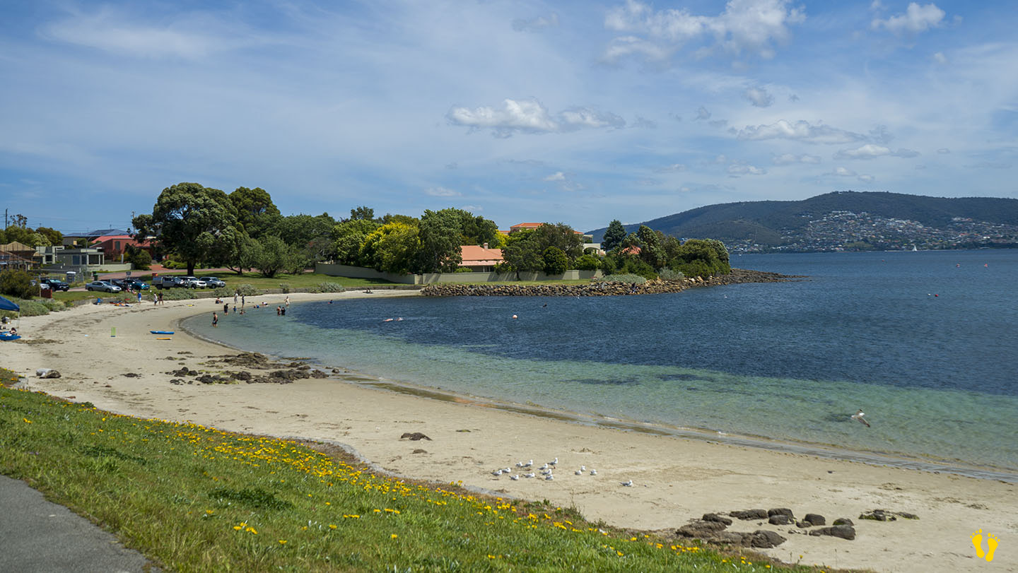
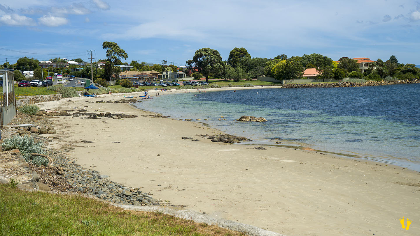
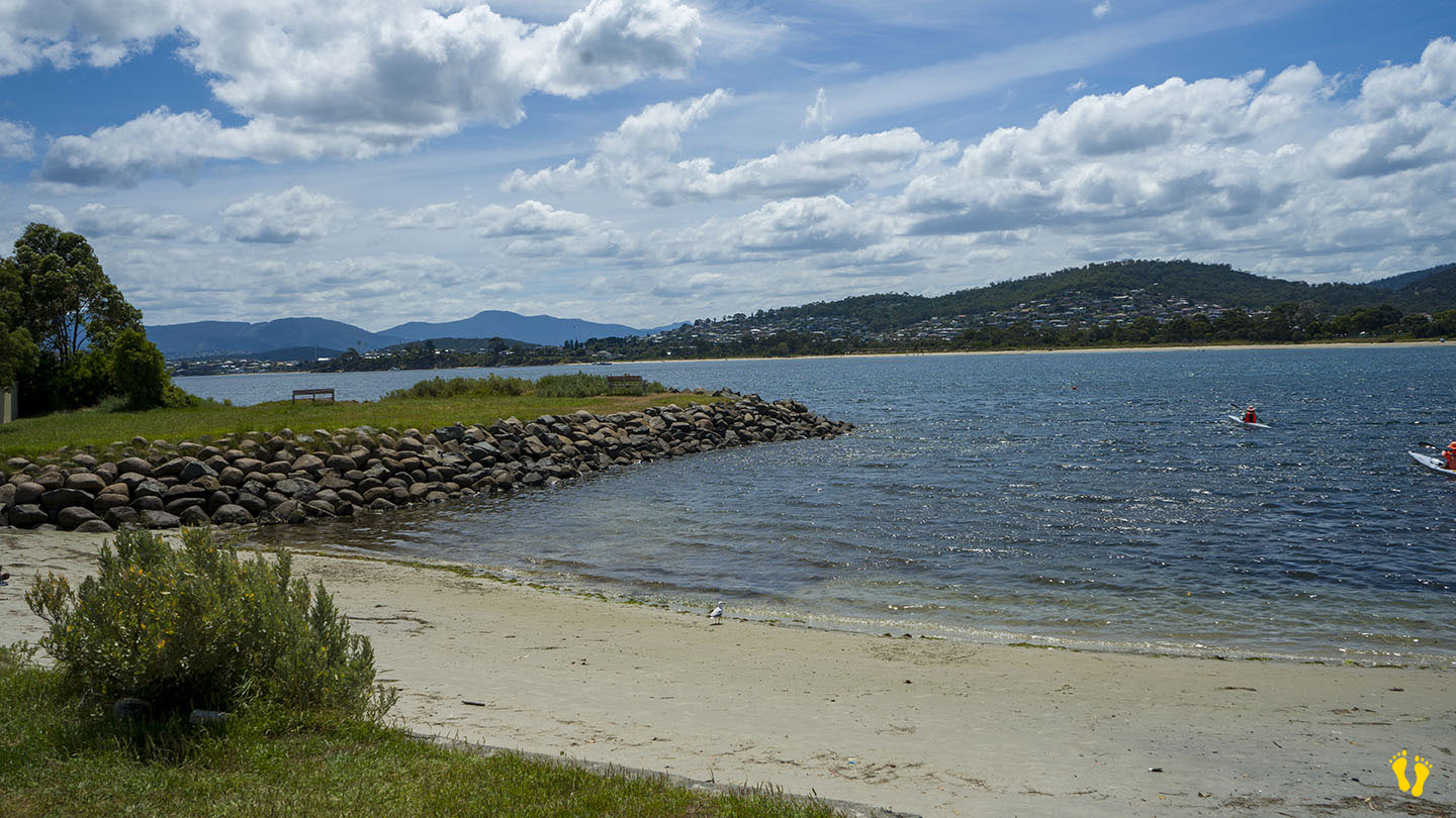
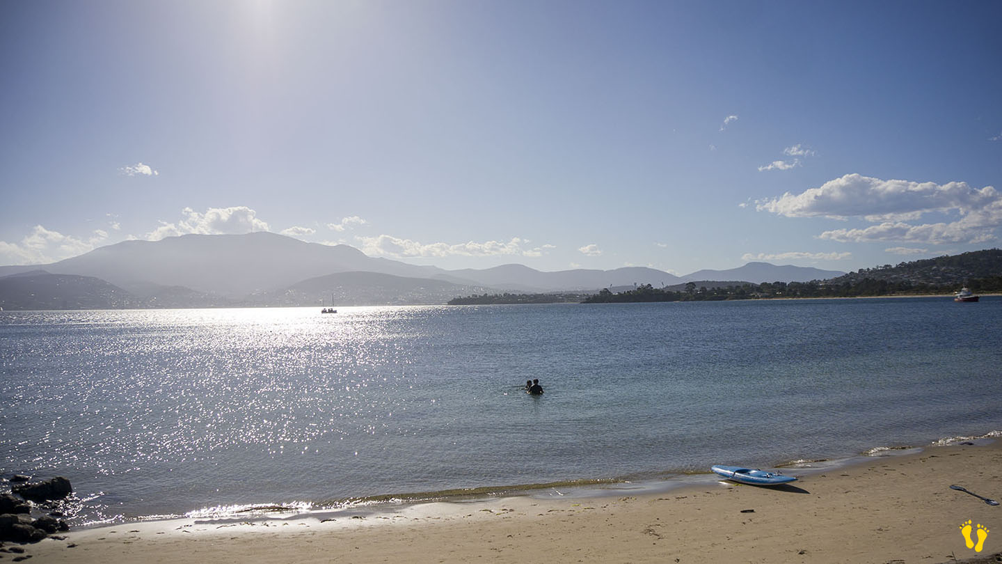
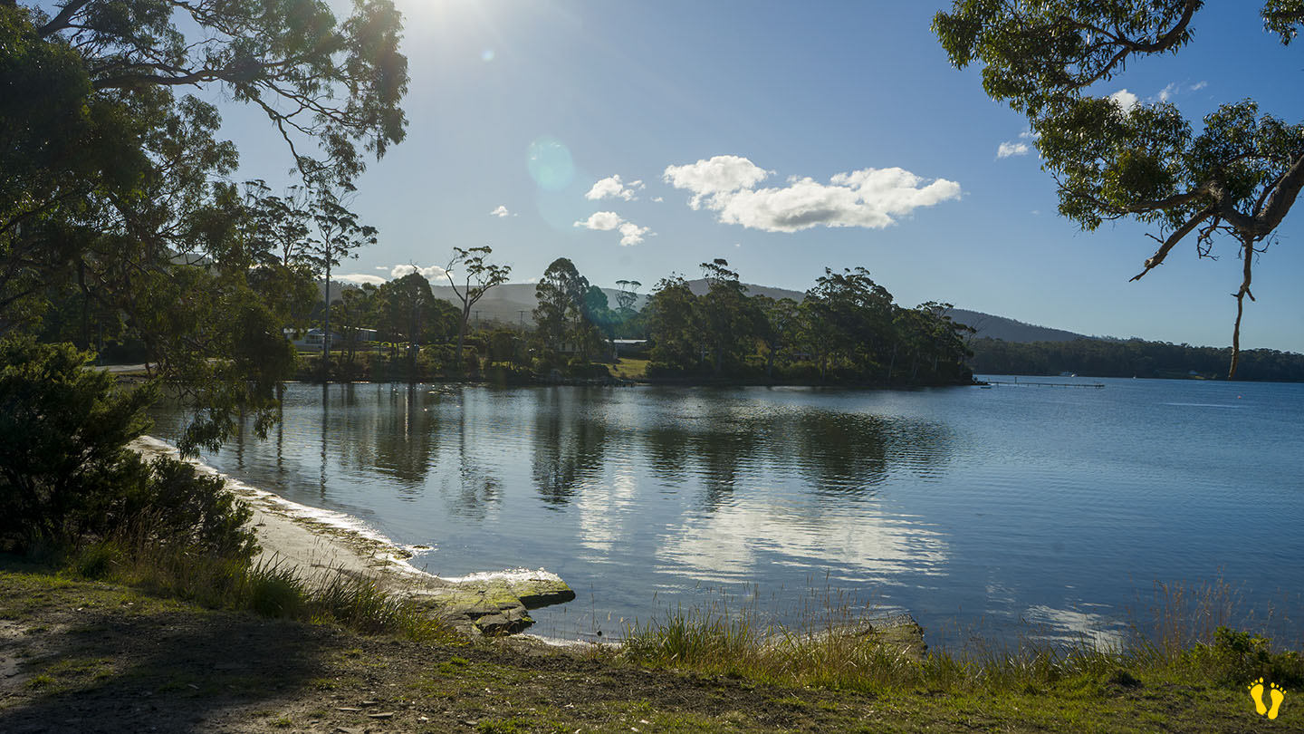
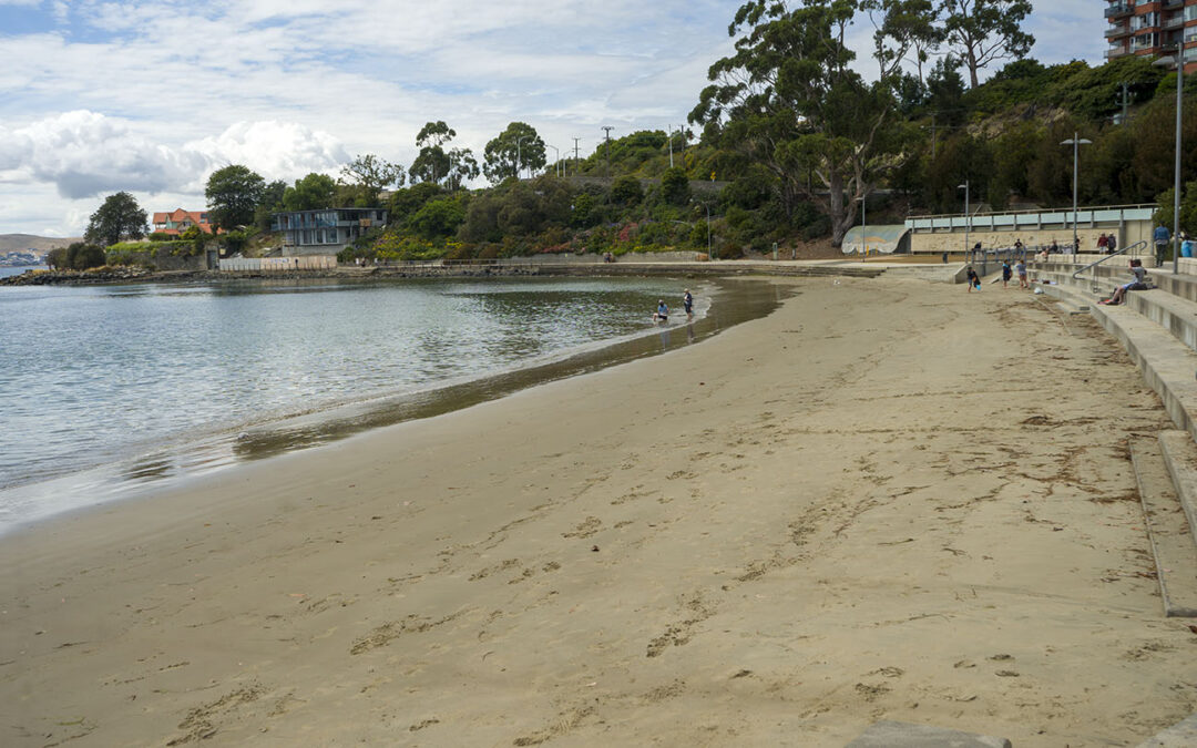
Eastern Shore near Hobart |
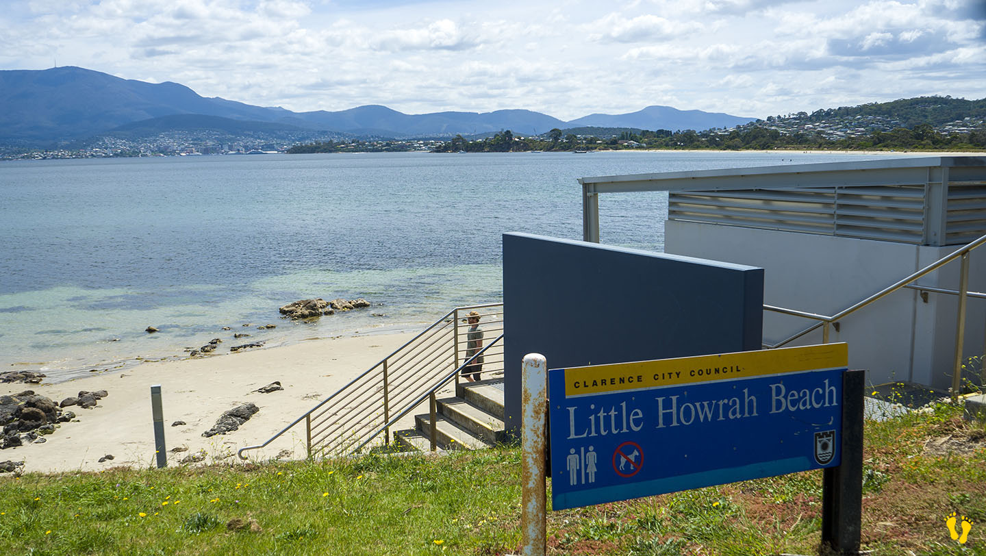
Hazard Rating: Low | Parking: Good + close | from Hobart: 14 km | Faces: West into the Derwent River | Length: 200 m
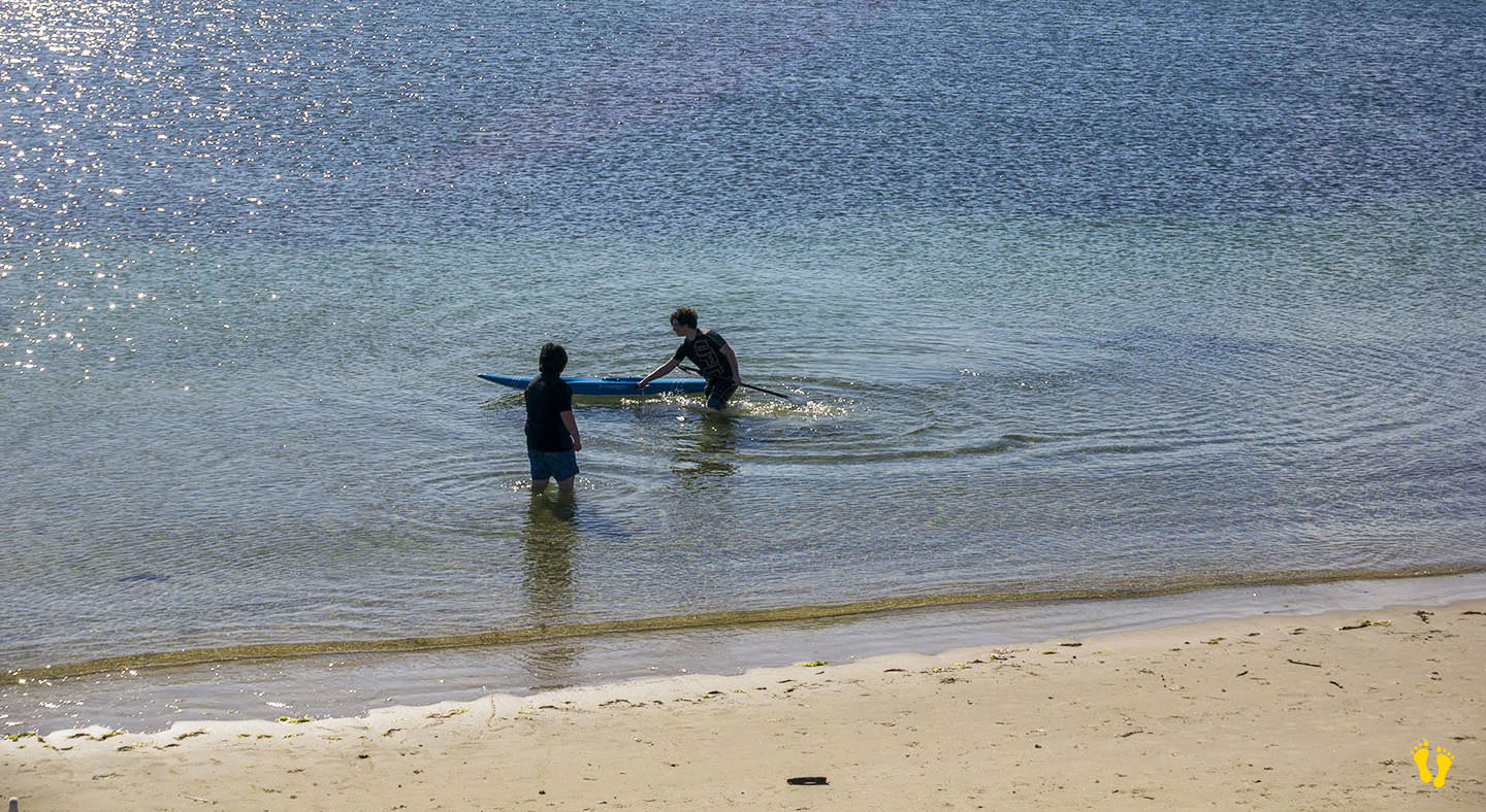
Little Howrah Beach just south of Howrah Beach is a protected beach ideal for families with young children. Great for learning to paddle board or kayak. Sand and grassy areas to relax. Shops nearby, good parking and toilets. Guess what – it’s small – but I highly recommend it. Good amenities and great views of Kunanyi. No dogs.
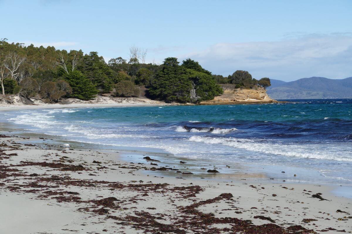
by Mickey Jarvis | May 7, 2024 | Low Hazard, South East, Tasman Peninsula
Near Port Arthur |
Hazard Rating: 1/10 | Parking: Roadside | from Hobart: 93 km | Faces: NE into Carnarvon Bay | Length: 150 km
Original Name: Turrakana, the homeland of the Pydairrerme (Tasman Peninsula’s Aboriginal people)
Little Possum Beach is about 2 km south of Port Arthur and the little cousin of Big Possum Beach a bit north. It is a beach but only just!
A small roadside beach ideal for a walk and paddle along the beach while enjoying the views. A classic old wooden jetty at the bottom end to wander onto and take in the whole experience of the bay and its surroundings.
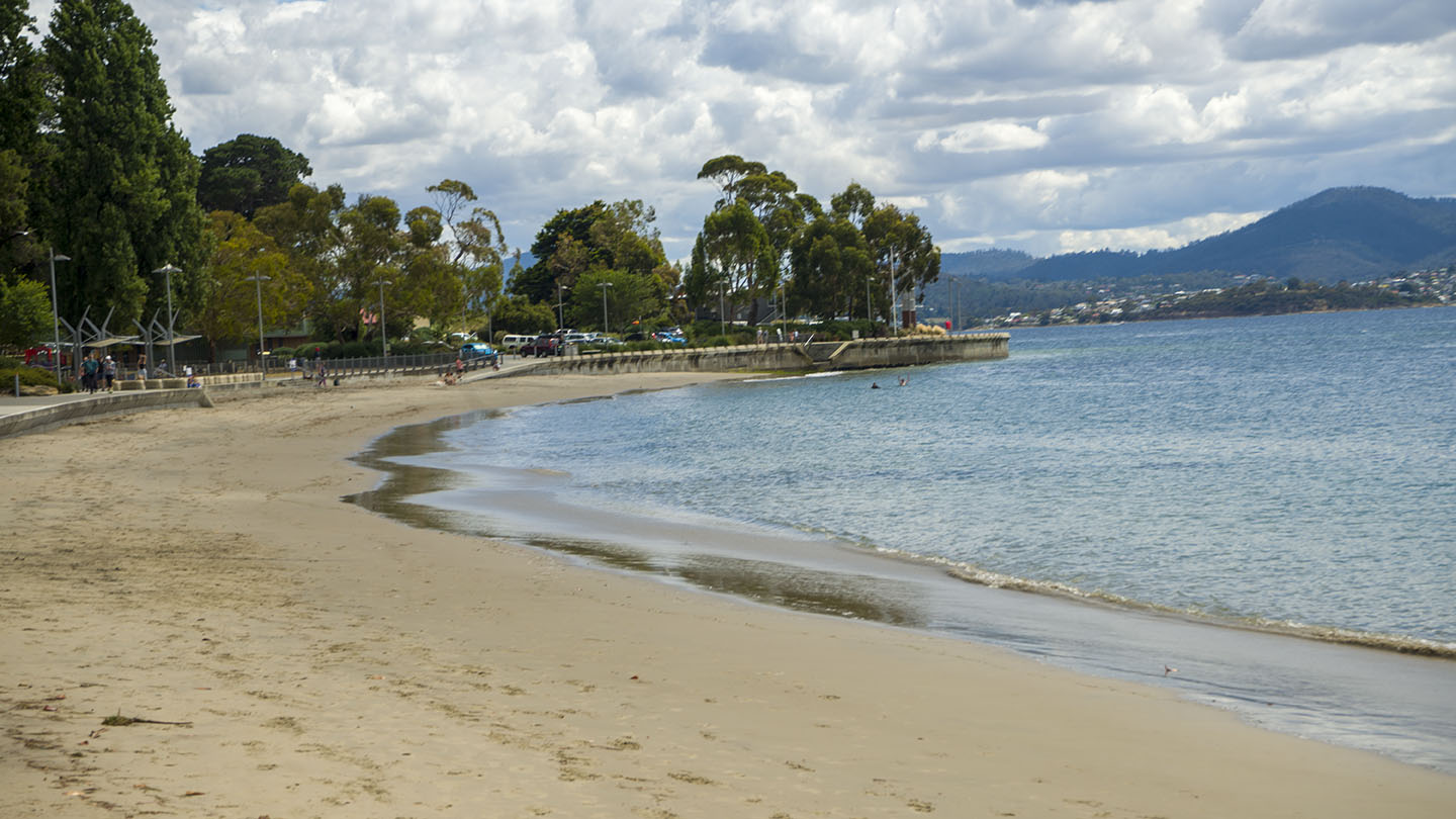
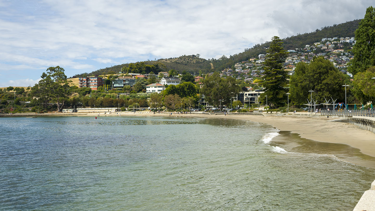
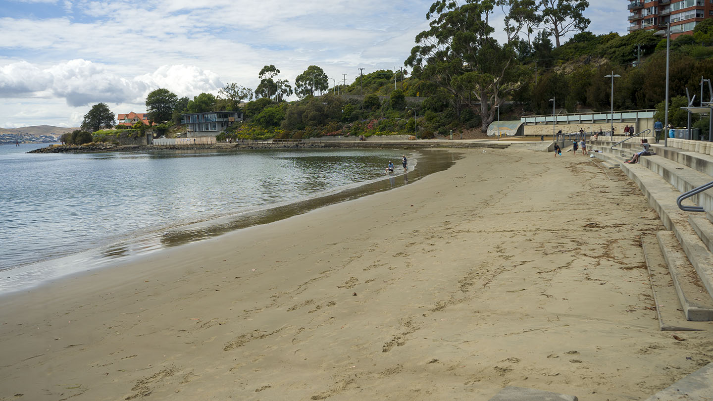
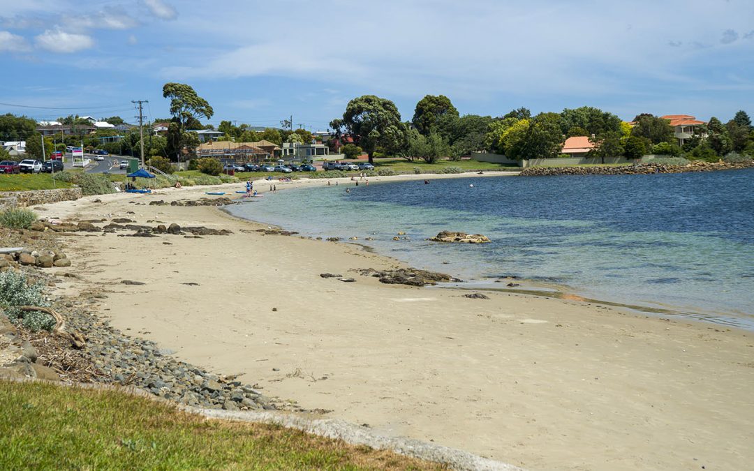
by Mickey Jarvis | Jan 21, 2023 | Greater Hobart, Low Hazard, Patrolled, Wheelchair Friendly
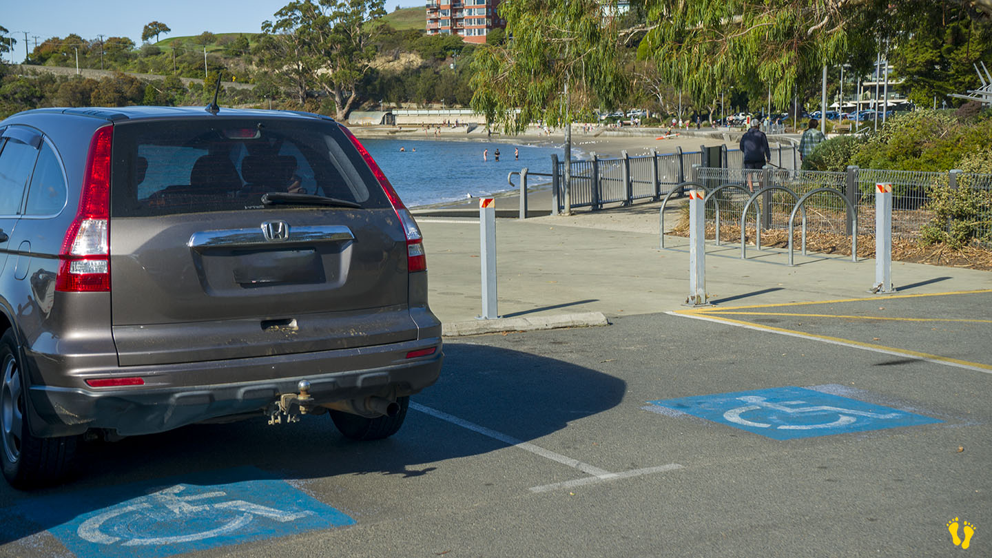
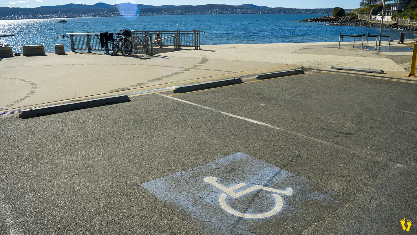
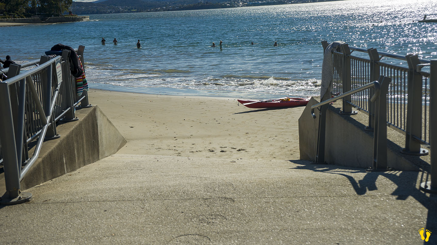
Little Sandy Bay |
Hazard Rating: 2/10 | Parking: Good + close | from Hobart: 5 km | Faces: West into the Derwent River and Little Sandy Bay | Length: 400 m
Original People: Originally named Kreewer and occupied for 35,000 years by the semi-nomadic Mouheneener people, a sub-group of the Nuennone.
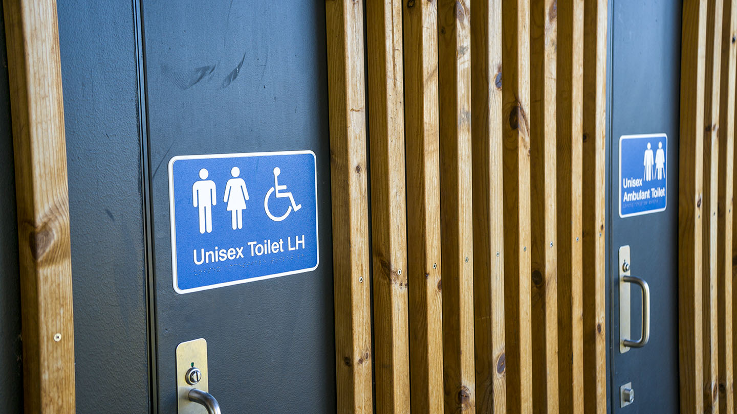
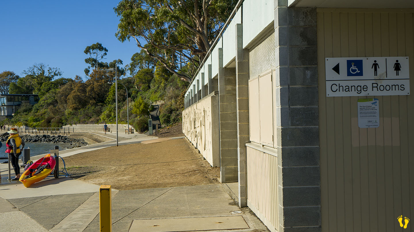
Wheel Chair Access: 2 ramps onto an often packed sand beach. Disabled toilets and parking on the north and south ends.
In Sandy Bay south of Hobart. Excellent amenities include a playground, BBQs, toilets and a large park area. It is a great family beach and park.
Accessible from 3 different main road turnoffs. The north end via Long Point Road provides access to the park and beach and is the best option for disabled access. The middle is accessed via Beach Road, near food outlets and a good general access point. The south end is good for kayak and board access.
Originally a single continuous beach, a basalt seawall was built to prevent coastal erosion in the 1970’s creating Nutgrove Beach to the north. So technically it’s now not a very long beach, but hey the name stuck.
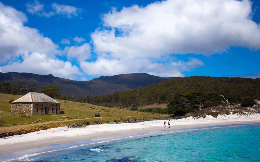
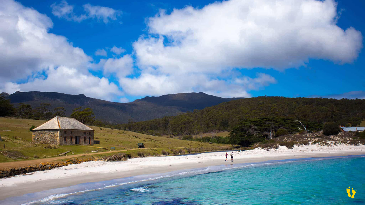
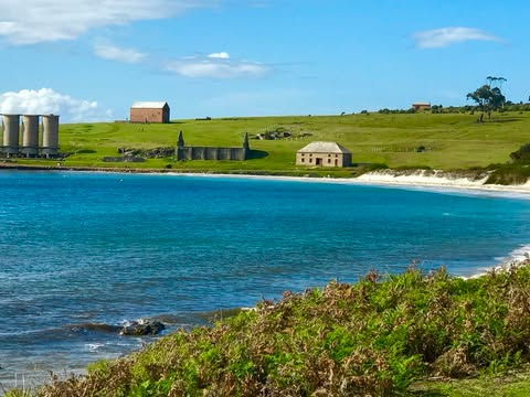
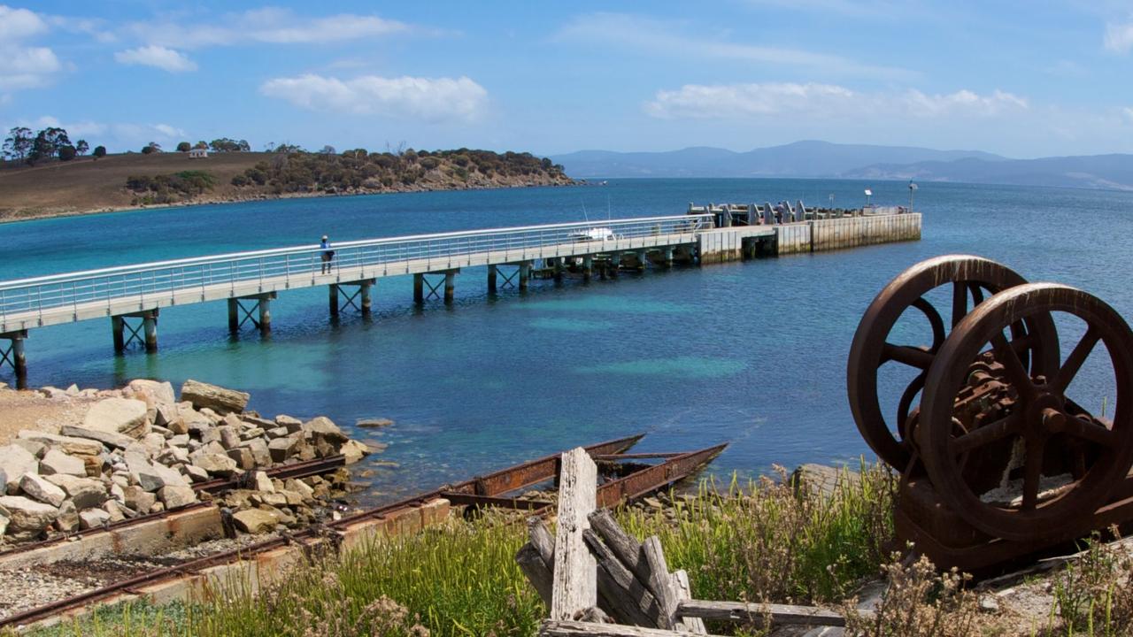
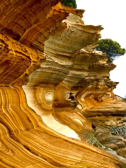
by Mickey Jarvis | Mar 7, 2026 | East Coast
Maria Island is accessed by ferry from Triabunna. The ferry lands at Hopground Beach on the northern end of Maria Island.
A picturesque beach with white sand and views of Mt Bishop & Clerk. The beach was named after the hop fields cultivated there during the first convict settlement period in the early 19th century.
A place of great beauty with no hotels, shops, or internet access. The whole of Maria Island is steeped in history and remains largely unchanged. Interesting bird life and fauna exist all over the island.
Not far from the jetty is penitentiary accommodation and a campground. Basic bunk accommodation is available in the old penitentiary at Darlington, as well as free camping at several sites around the island.
Maria Island has a long and rich history, going back well before the colonial era. Remnants from the Aboriginal people of the Tyreddeme clan of the Oyster Bay tribe can still be seen today. In 1642, the island was named by Dutch explorer Abel Tasman after Maria van Diemen (née van Aelst), wife of Anthony van Diemen, the Governor-General of the Dutch East Indies in Batavia.
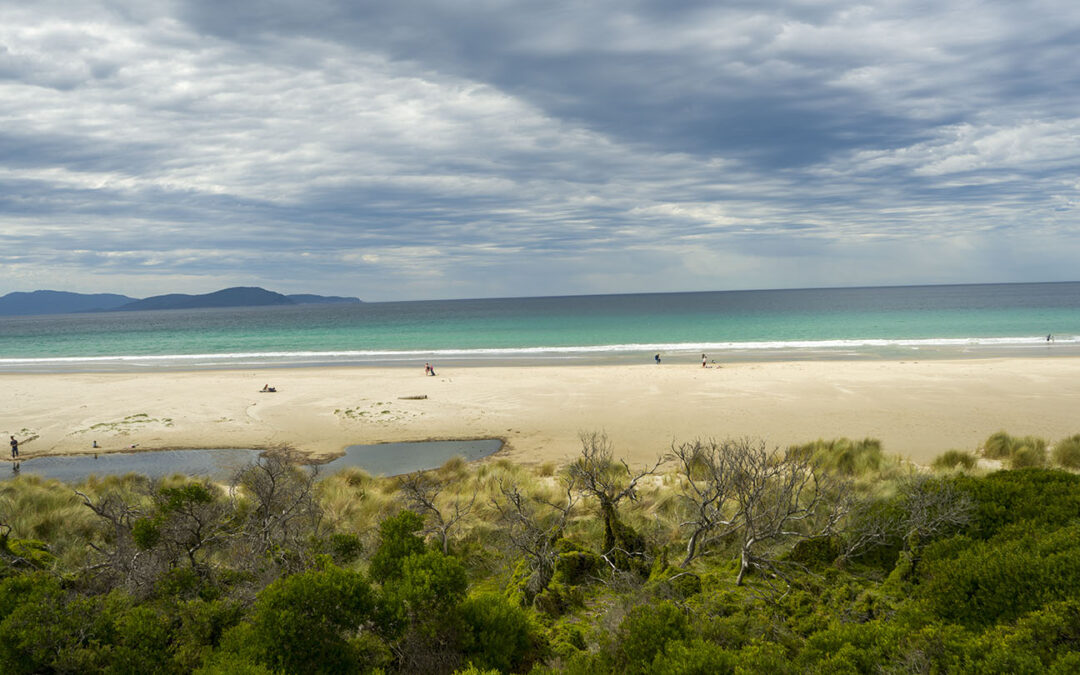
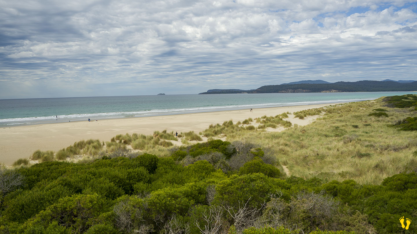
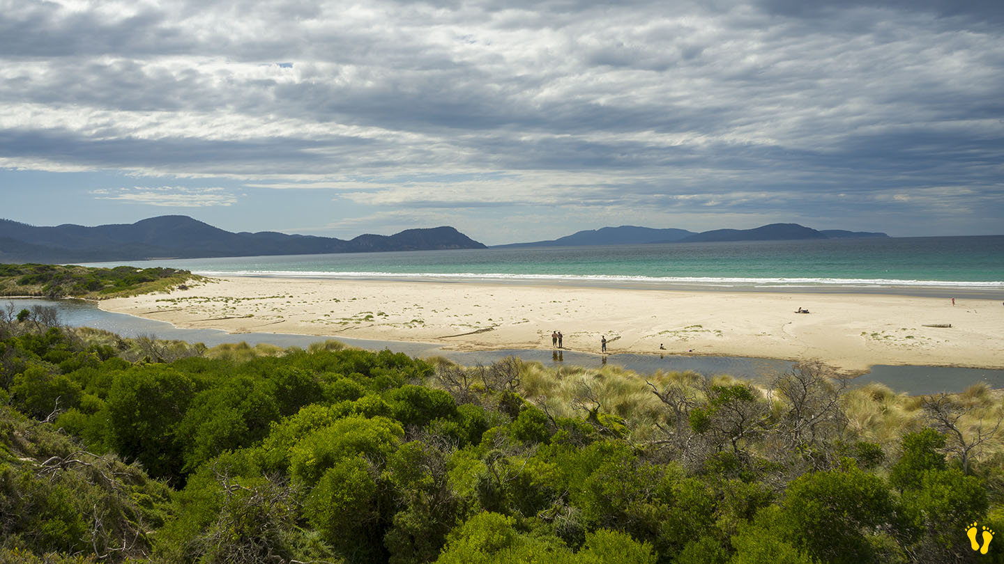
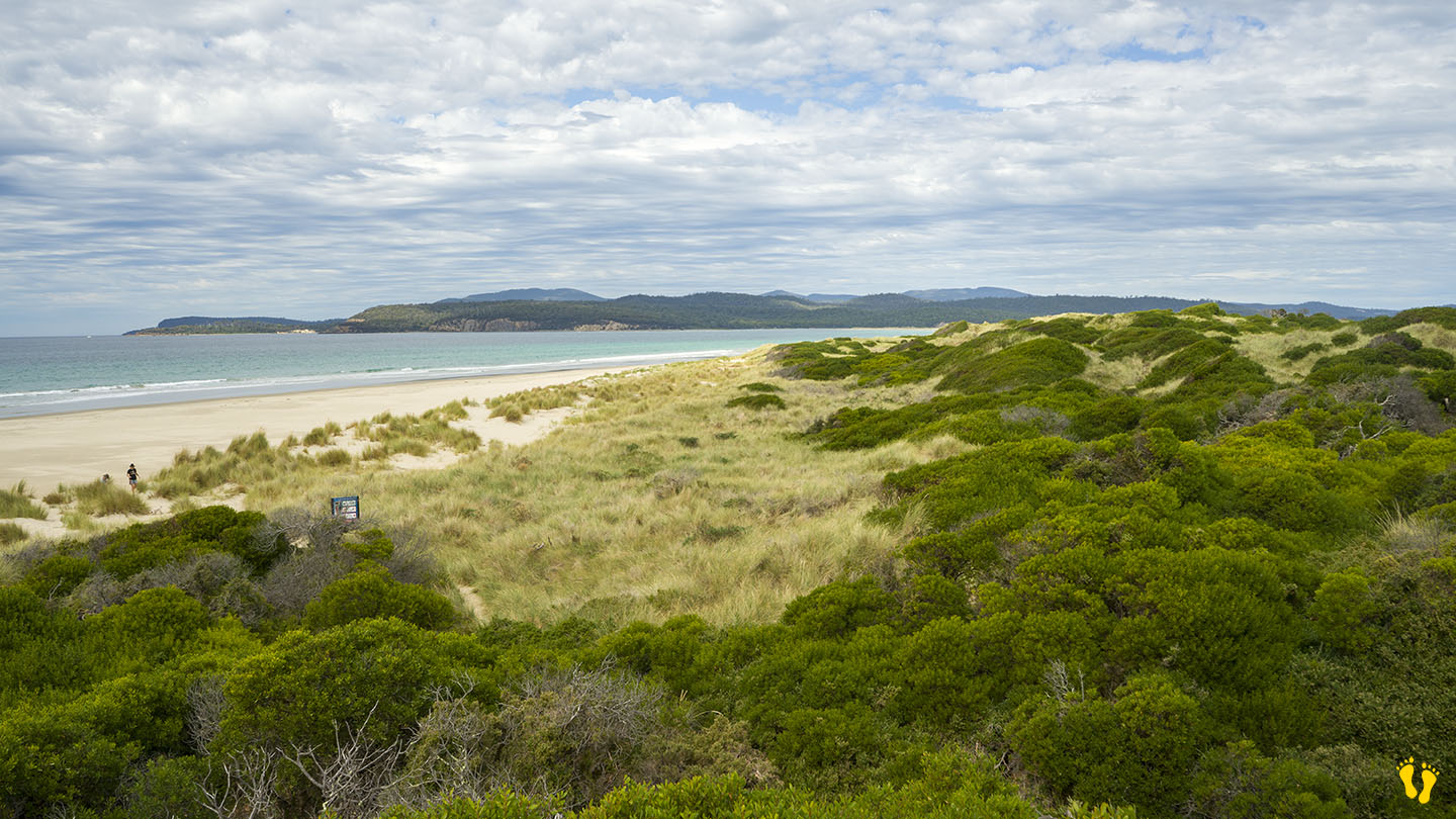
by Mickey Jarvis | Mar 18, 2023 | East Coast, Surf
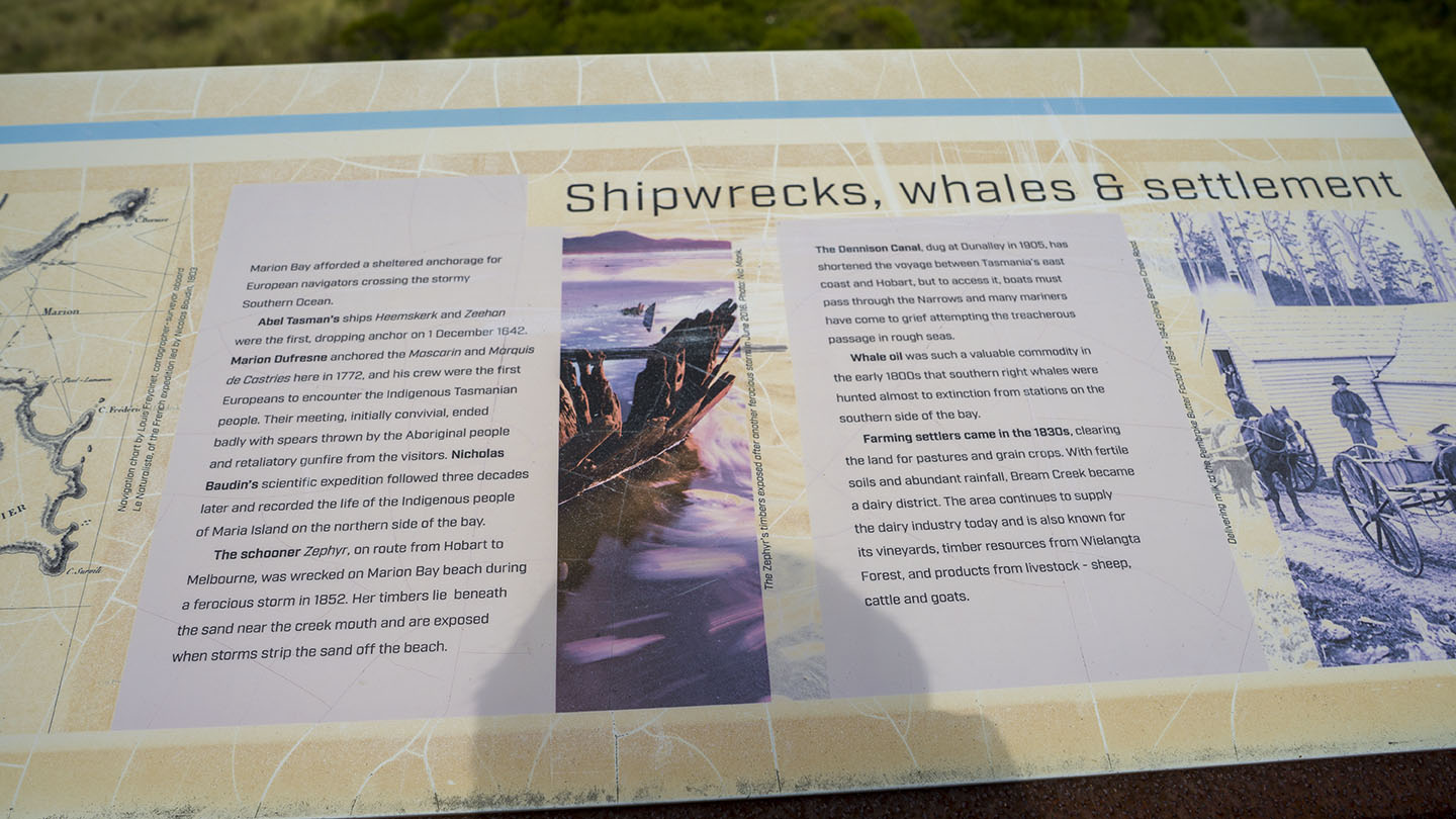
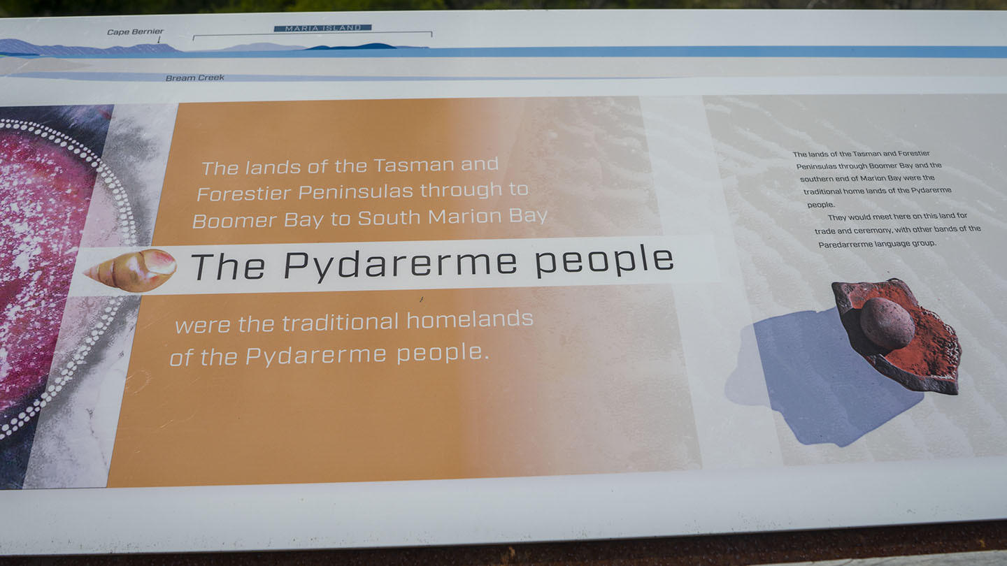
Marion Bay past Sorell |
Hazard Rating: 5/10 | Parking: OK | from Hobart: 52 km | Length: 8 km | Faces: East into Marion Bay / Tasman Sea
Original People: Pydarerme / Paredarerme
A long secluded beach in a beautiful area on the east coast of Tasmania.
The beach is accessed via Marion Bay Road. Access to the beach is a 100 – 200 m walk from the car park. Basic amenities include toilets.
The north end has 5 more beaches – Woody, Eagles, Shelly, Pine Creek and Bluff beaches – all have limited access mainly from tracks.
Bream Creek is parallel to the beach, which sometimes joins up with the sea. Fishing is good from the beach or creek behind.
Named after a French explorer Marion du Fresne, a ship captain who explored in 1772. Views of Maria Island to the northeast and a small island called Visscher Island to the southeast.
The beach sometimes has minor surf but a well-known surf break on the southern end called ‘Boneyard’ is considered one of Australia’s best right-handers when working.