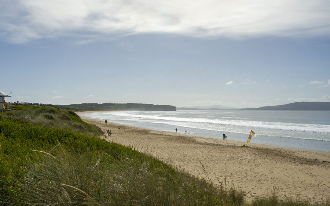
by Mickey Jarvis | Feb 5, 2023 | Dodges / Carlton, Patrolled, South East, Surf
South of Sorell |
Hazard Rating: 5/10 | Parking: Good + close | from Hobart: 40 km | Faces: South-ish into Tiger Head Bay | Length: 2.8 km
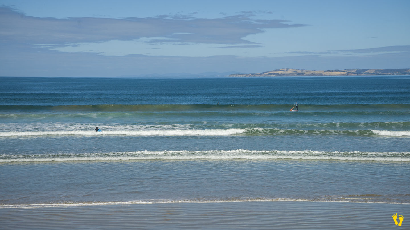
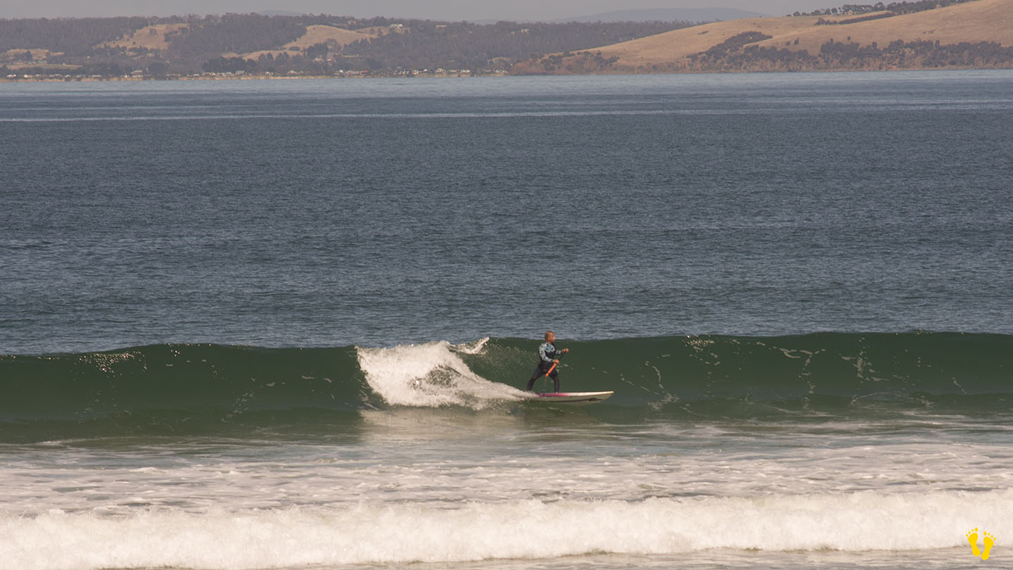
The east end is Carlton Beach (the west end is referred to as Park Beach). Close parking but may become limited on good days (sun or surf). Can be accessed along it’s length by means of walkways from Carlton Beach Road (100-200m).
The east has has amenities and is patrolled. A good beach to learn surfing and boarding when patrolled.
At the far east end of the beach is the Carlton Rivermouth which is known for its surf break but not recommended for swimming due to strong currents.
Named by a whaler in 1806 the word Carlton means ‘free peasant settlement’.

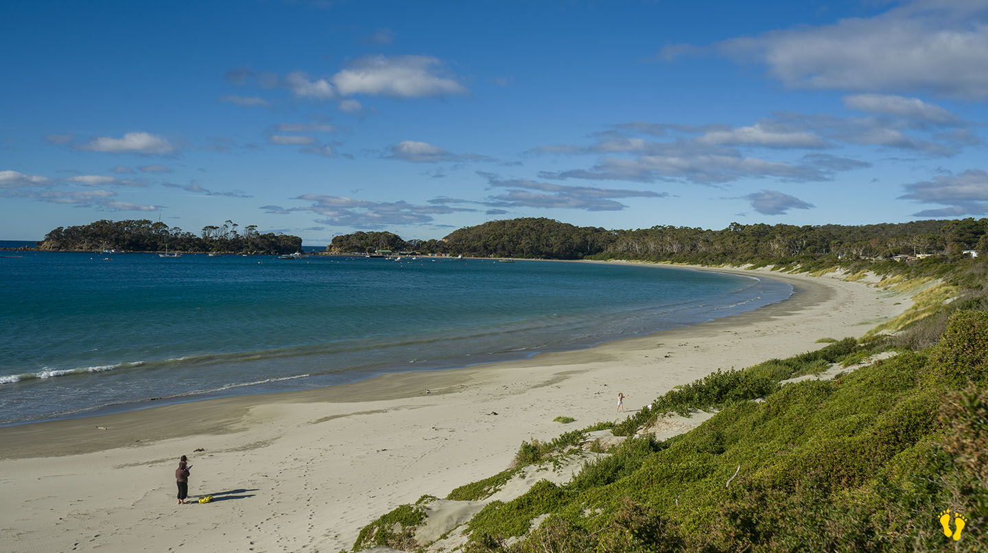
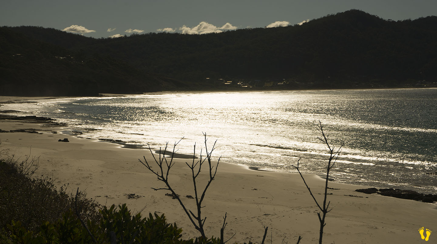
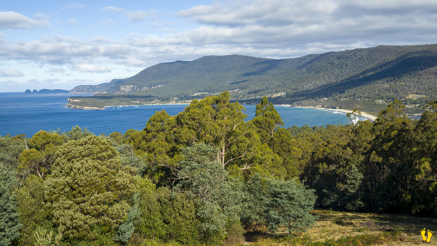
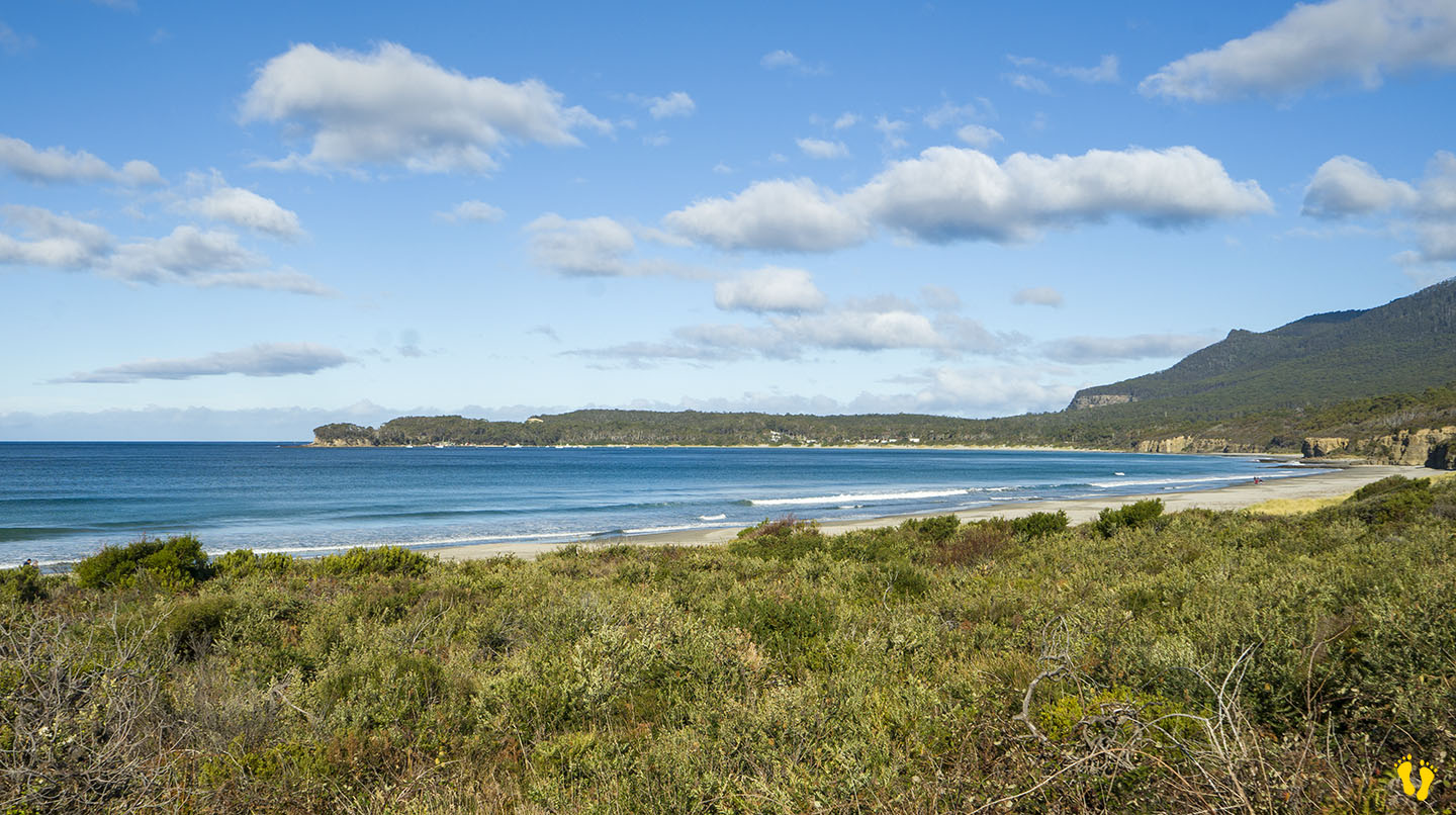
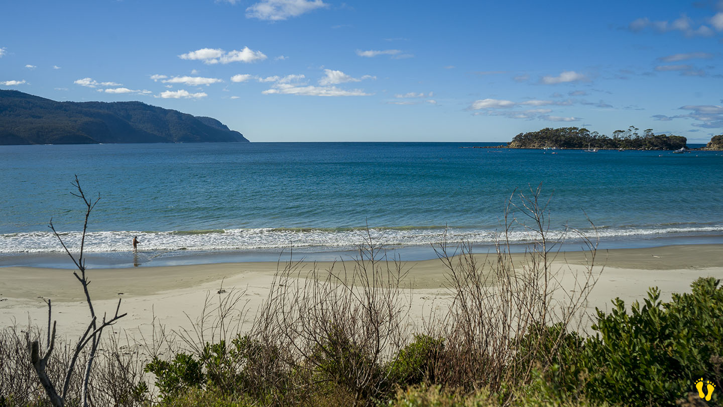
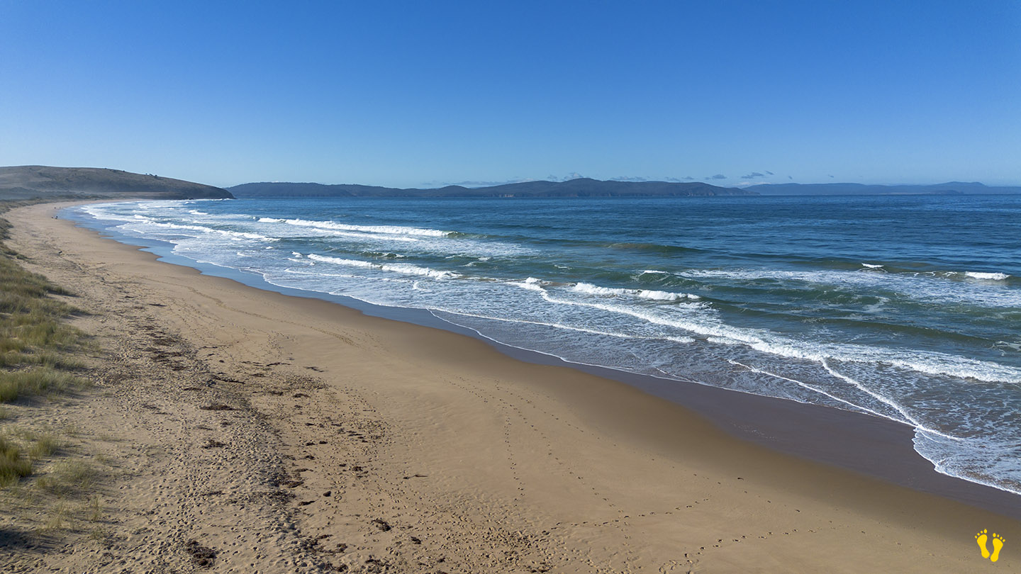
by Mickey Jarvis | Nov 11, 2024 | Bruny Island, Surf
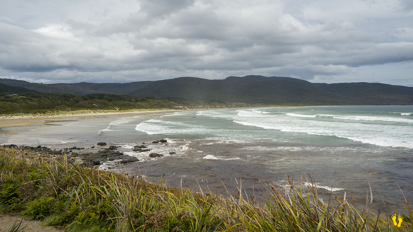
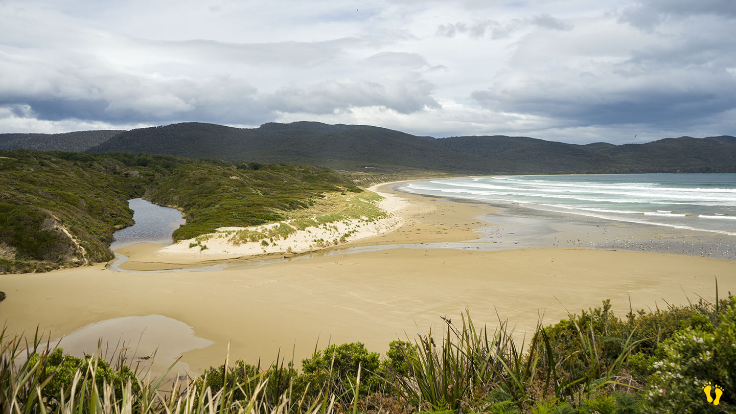
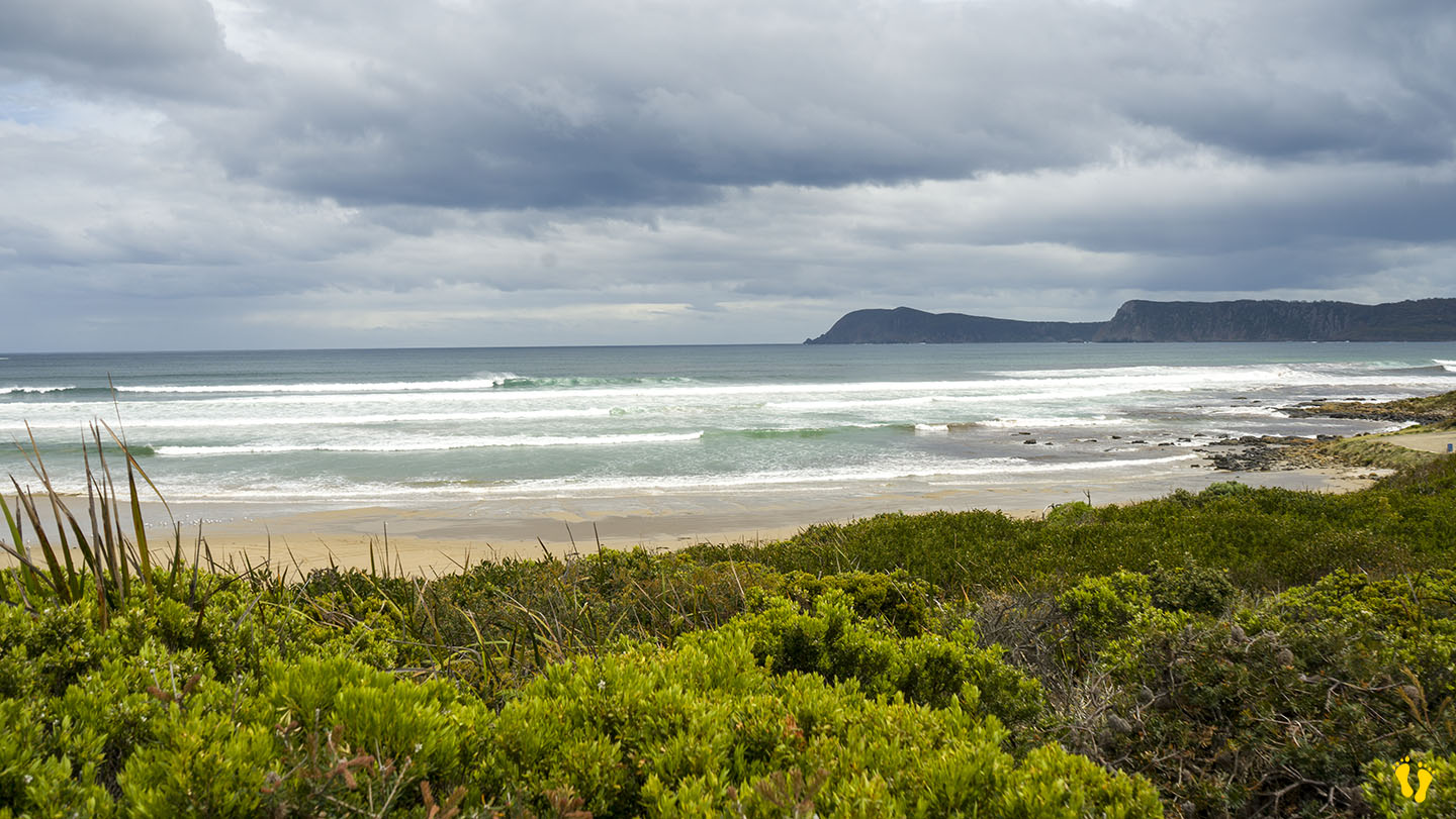
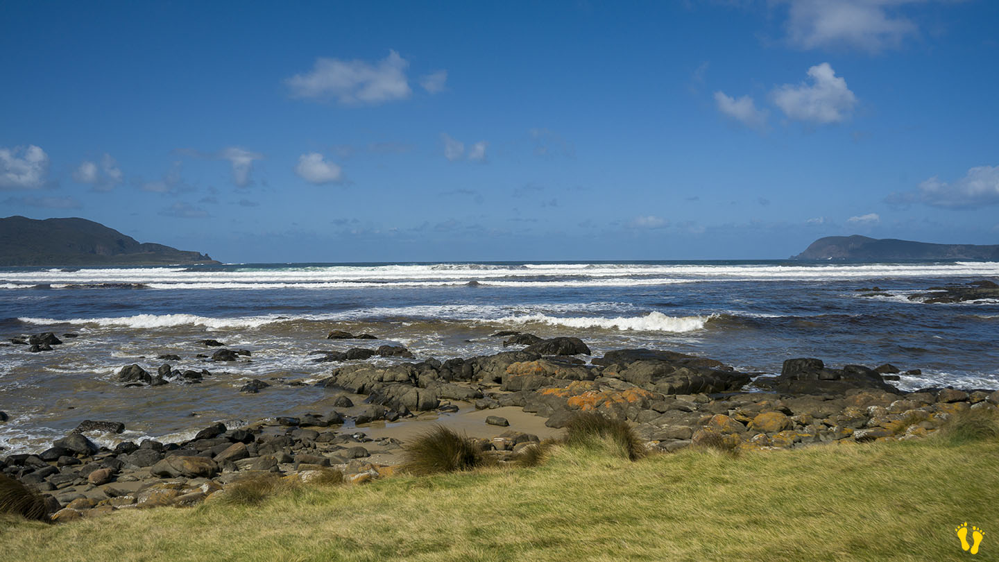
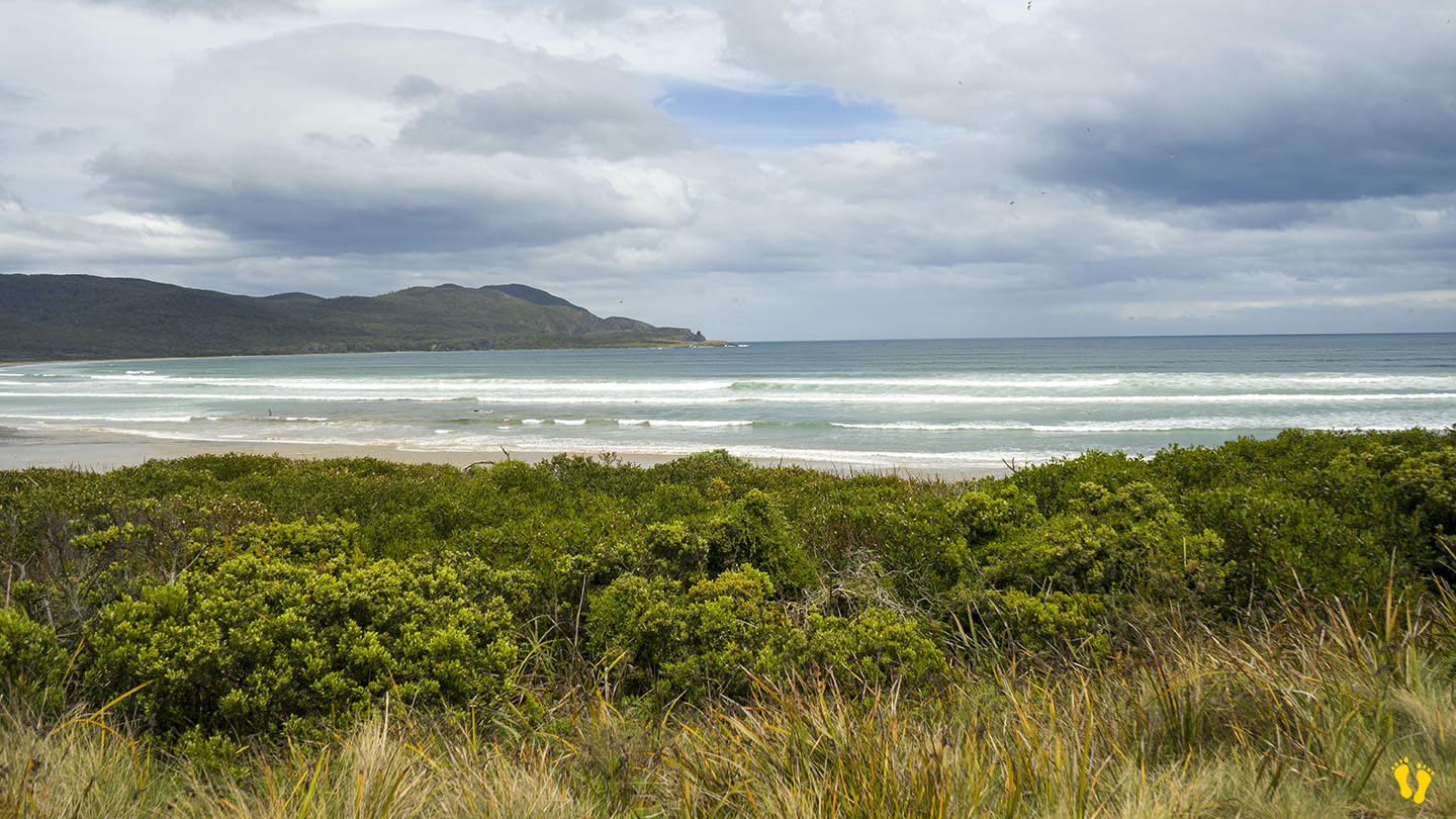
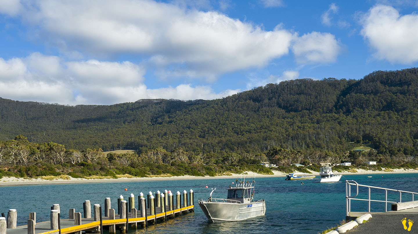
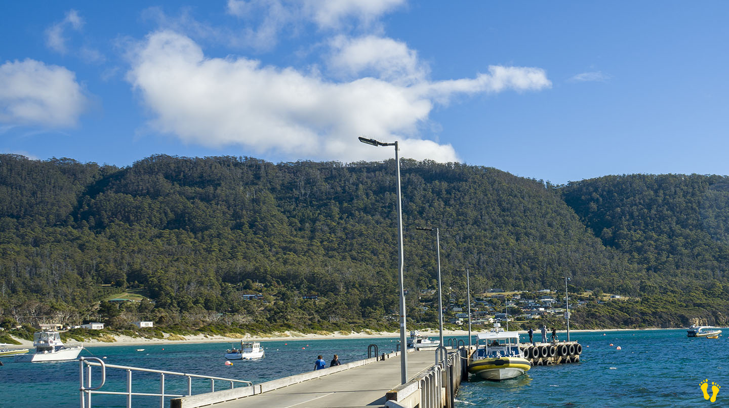
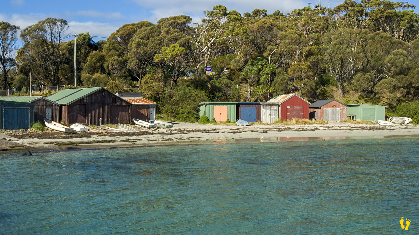
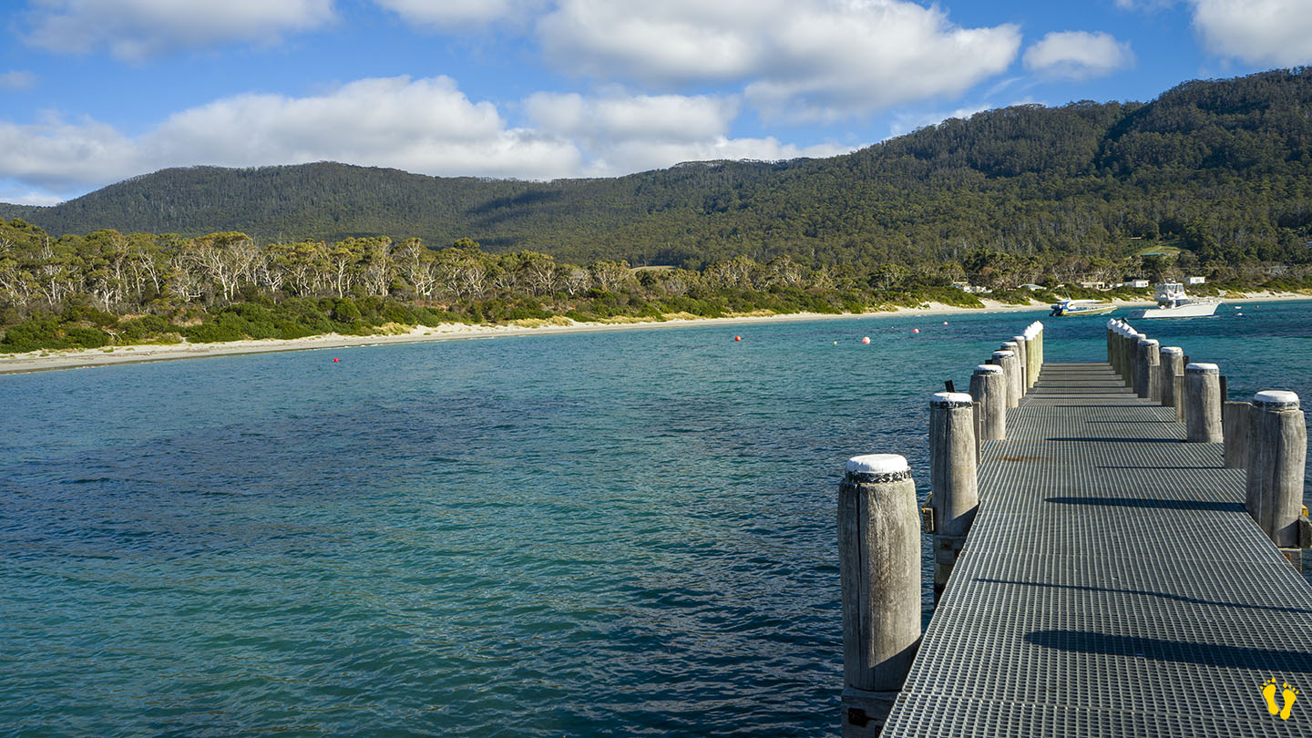
Bruny Island | Hazard Rating: 7/10 | Parking: Good + close | Location: South Bruny Island | Faces: South | Length: 9 km (ish)
Original People: Nuenonne | Original Name: lunawannalonna (Bruny Island)
Information and review
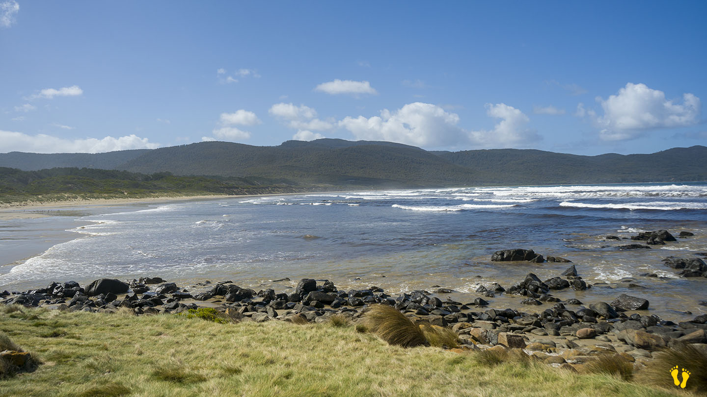
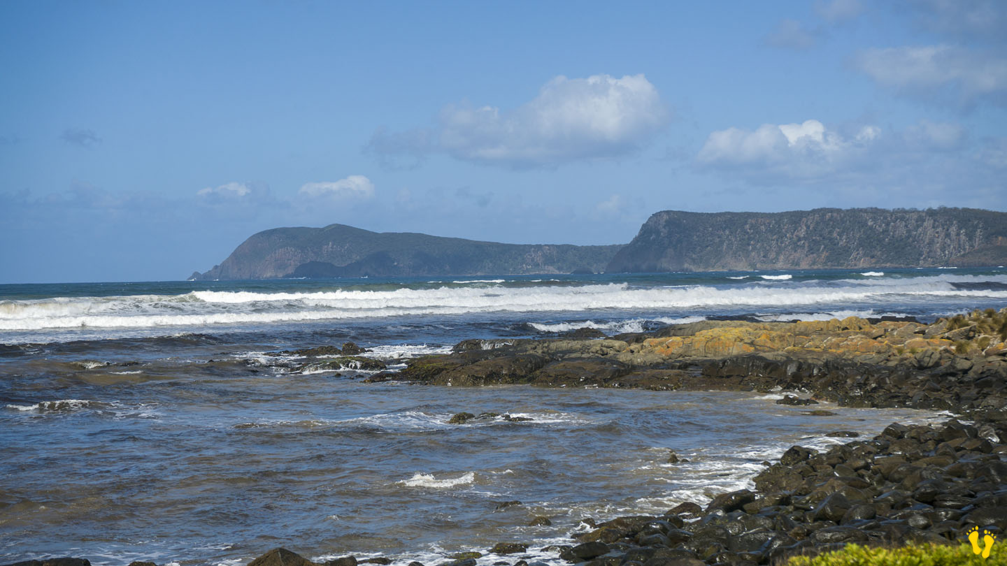
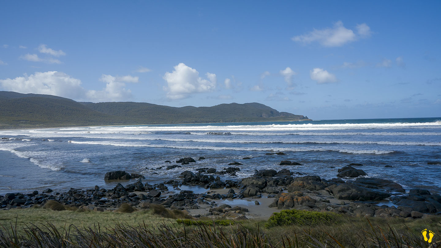
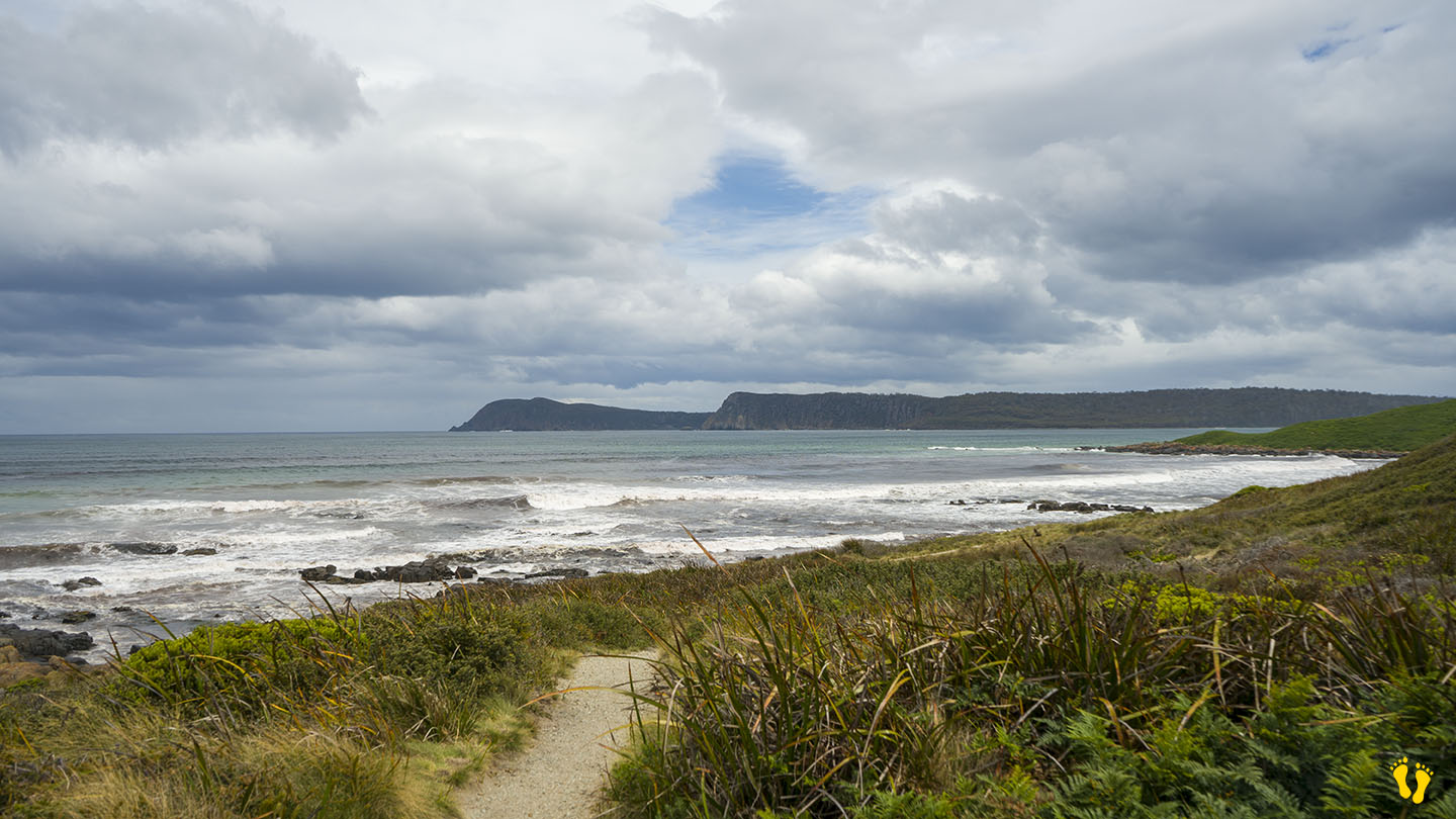
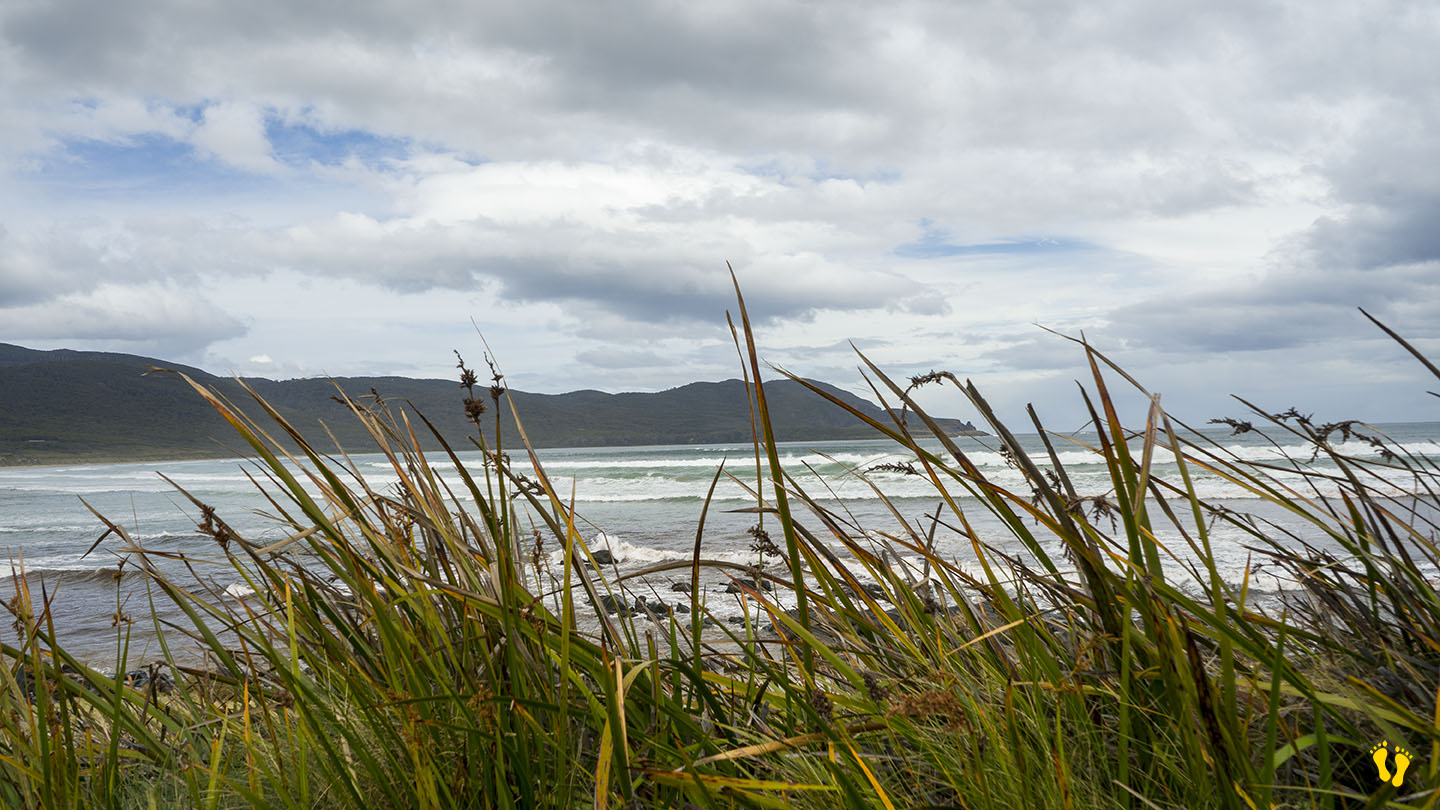
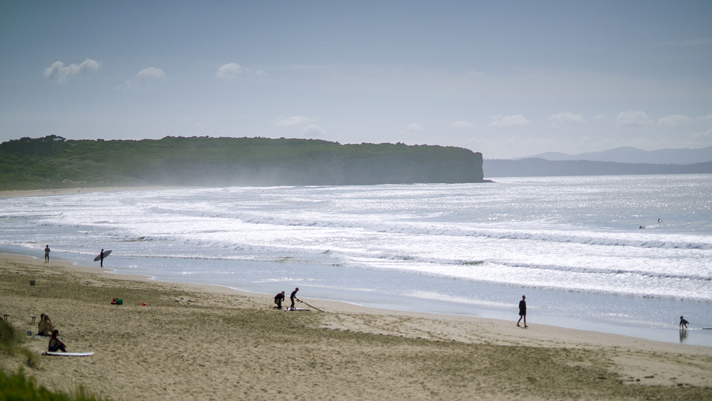
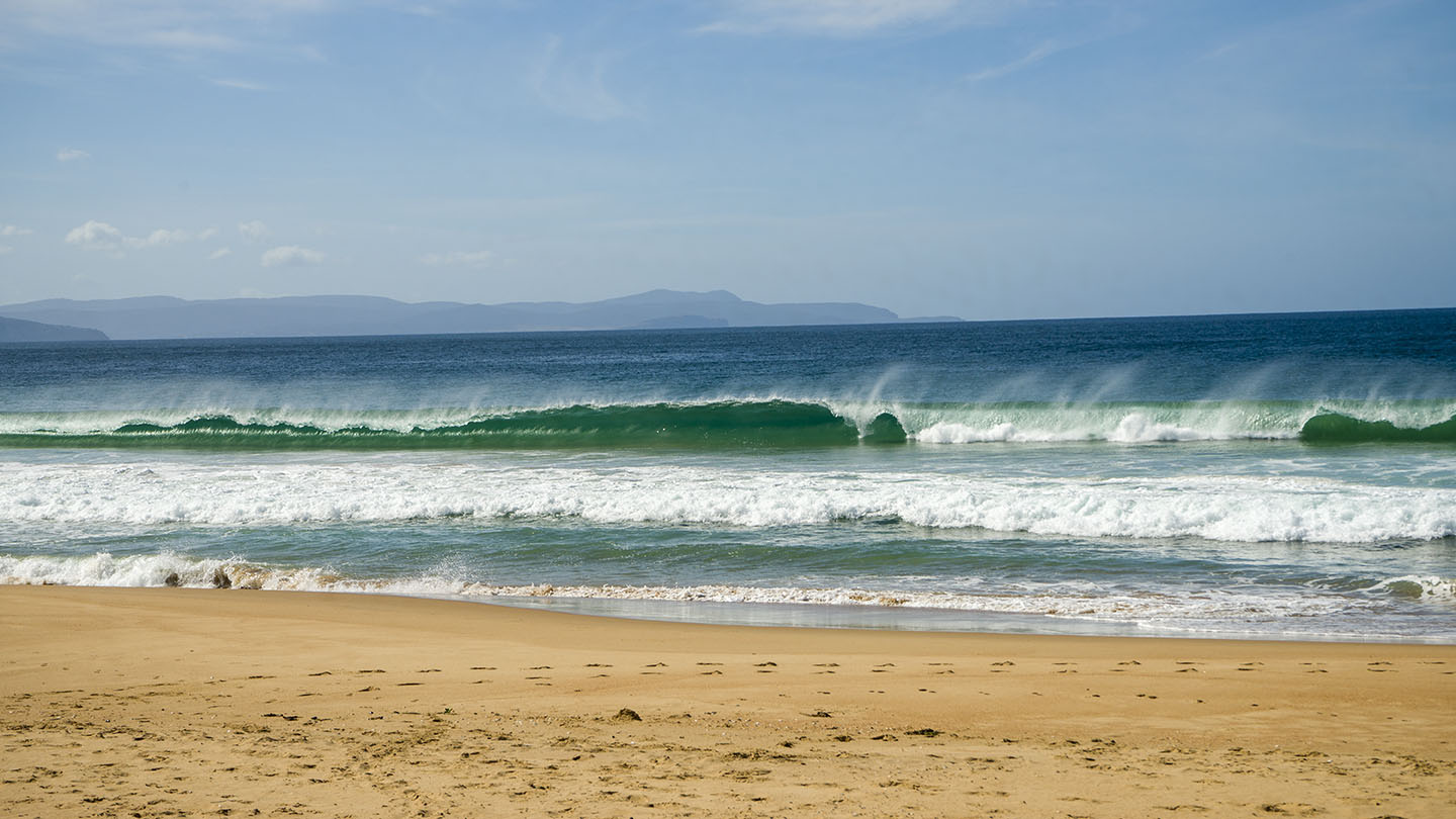
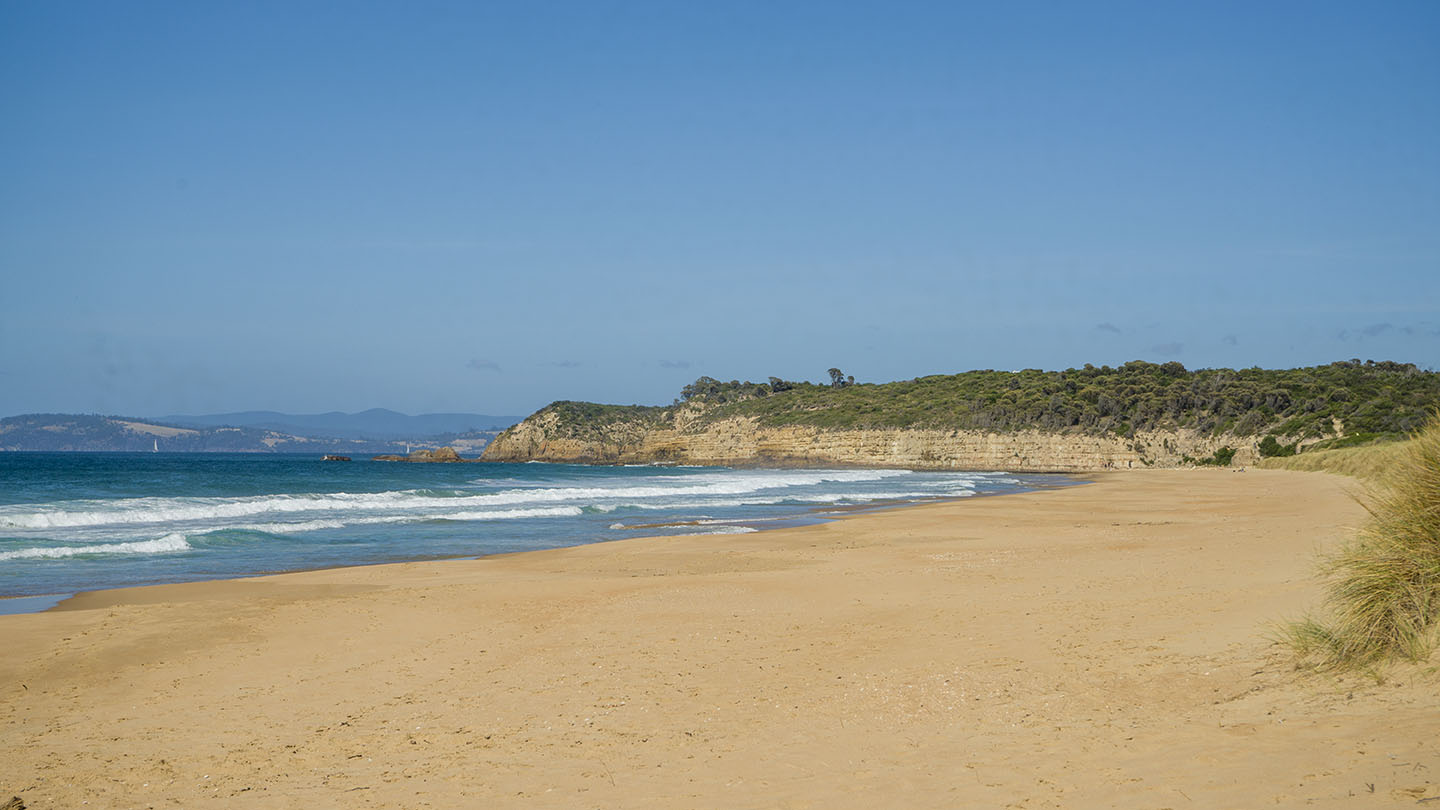
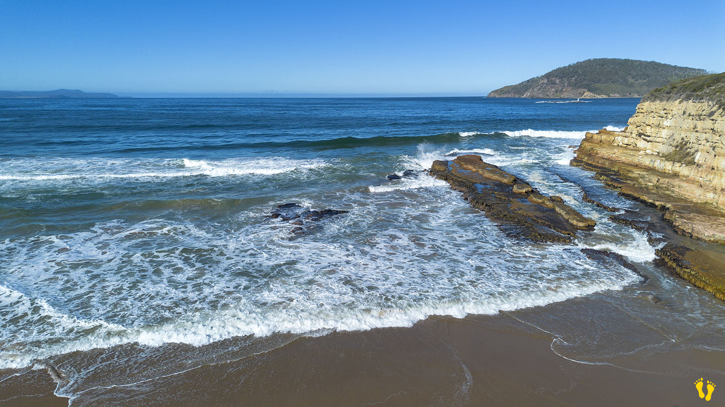
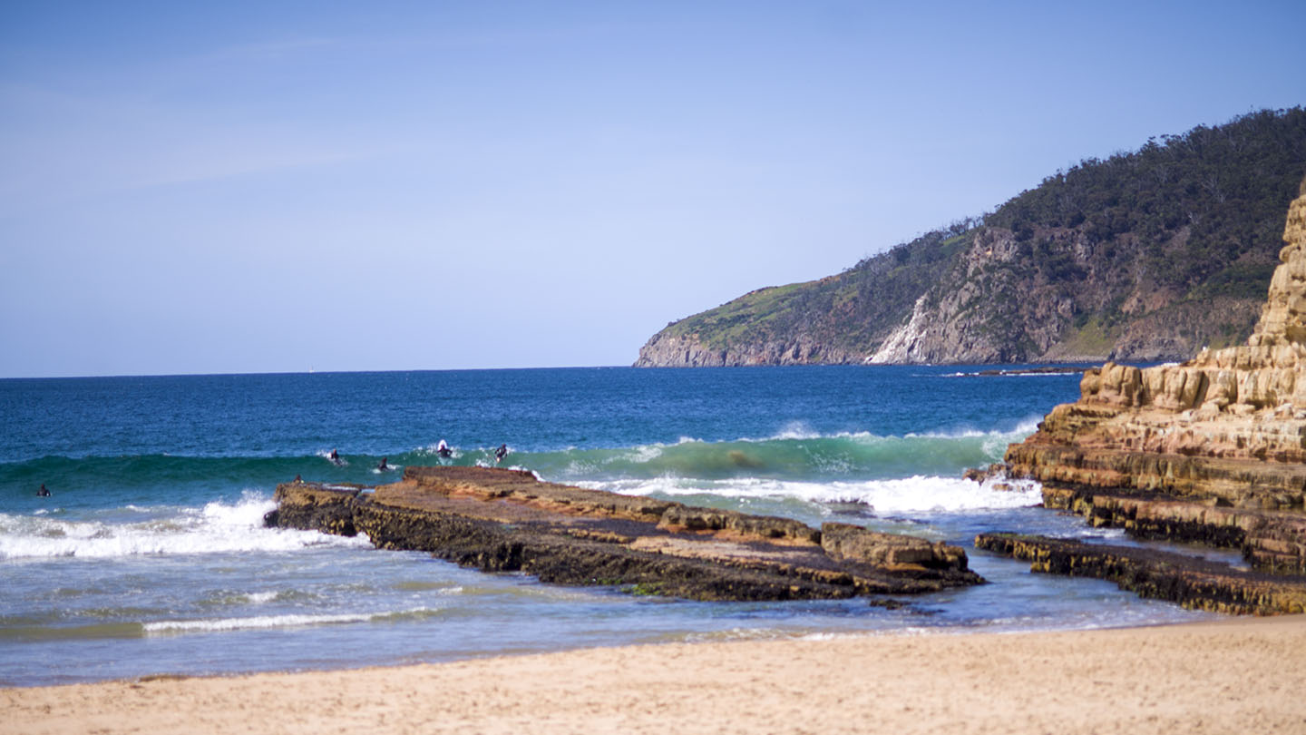
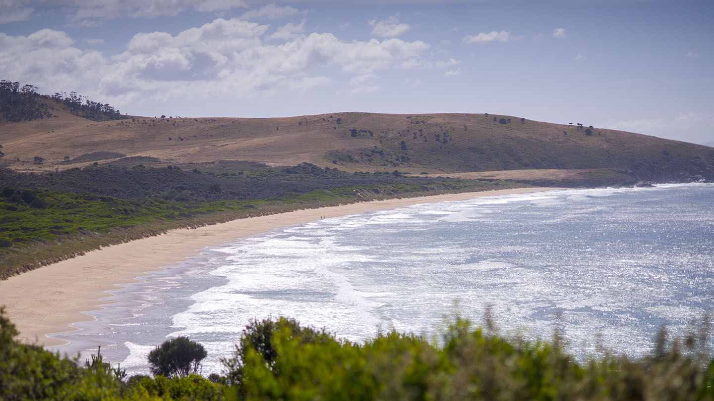
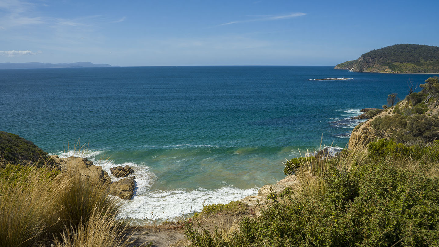
Cloudy Bay is a spectacular beach and bay at the south end of Bruny Island. A long beach with a headland in the middle and an inland lagoon (Cloudy Bay Lagoon) that feeds into the sea via Inlet Beach. To get there turn left at Lunawanna – about 10 Km to Cloudy, view some of the unique flora on the way.
This is a wild beach in a remote area of South Bruny with great surf. Although dangerous to swim, it is worth visiting to explore, view and enjoy.
Cloudy is a renowned surf beach, particularly the west end, a 500+ metre walk west from the carpark. Looking south the next stop is Antarctica.
The bay was originally named l’baie Mauvaise (Bad Bay) by French explorer Bruni D’Entrecasteaux in 1792. After 1822, it was marked on maps as Bad Bay, and after 1859, it became known as Cloudy Bay.
Cloudy has one the best bush ‘loos’ with a view I have seen – sit and enjoy the fantastic view!
I cannot express how much I think anyone visiting Bruny Island should visit this beach – in terms of great beaches it is a wonder of the world.
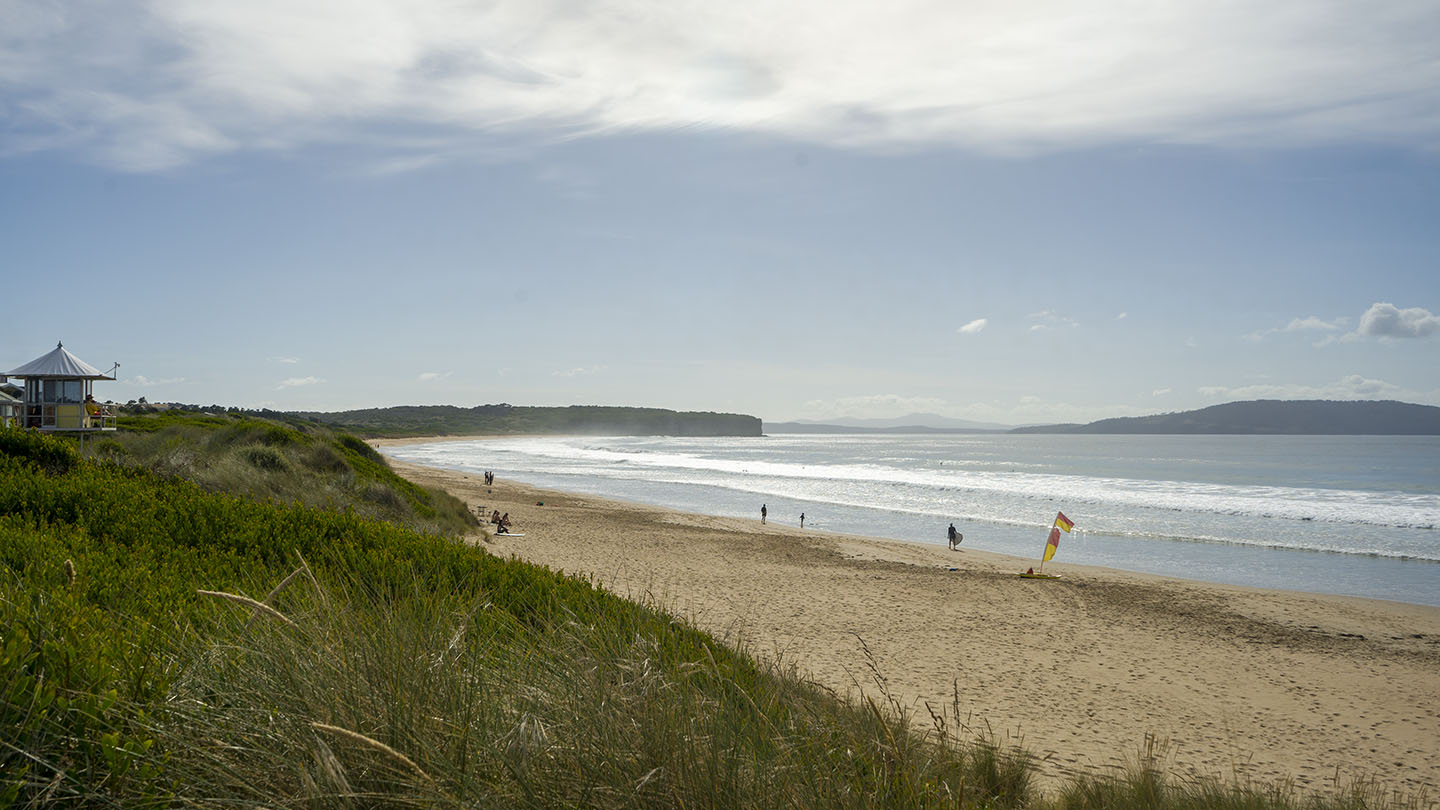
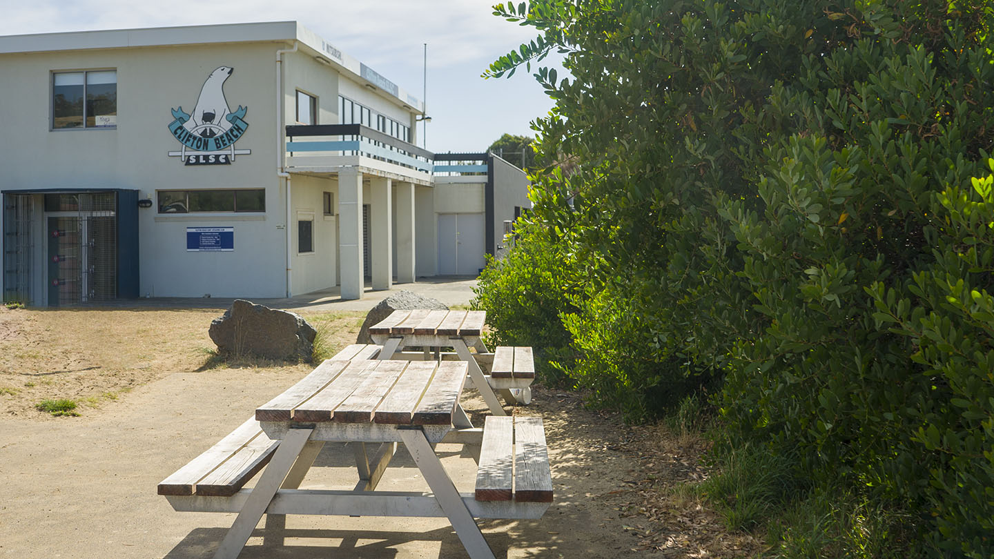
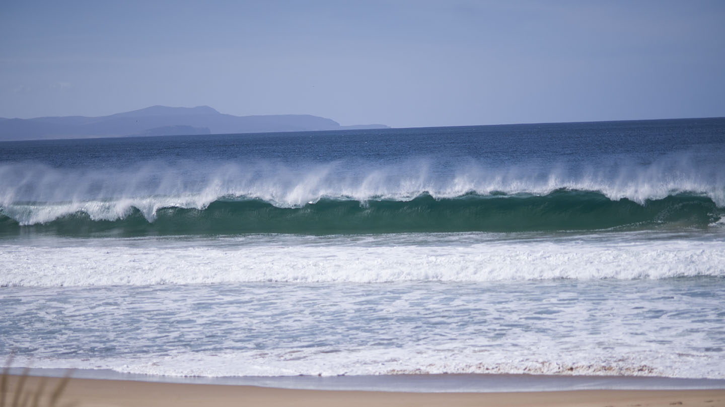
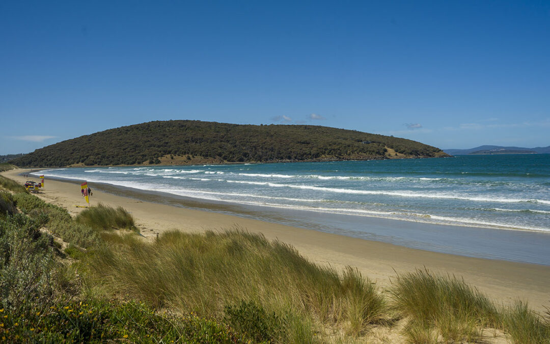
by Mickey Jarvis | Jan 27, 2023 | Patrolled, South Arm Road, Surf
South Arm Road |
Hazard Rating: 6/10 | Parking: Good + close | from Hobart: 30 km | Faces: South into Storm Bay | Length: 2.1 km
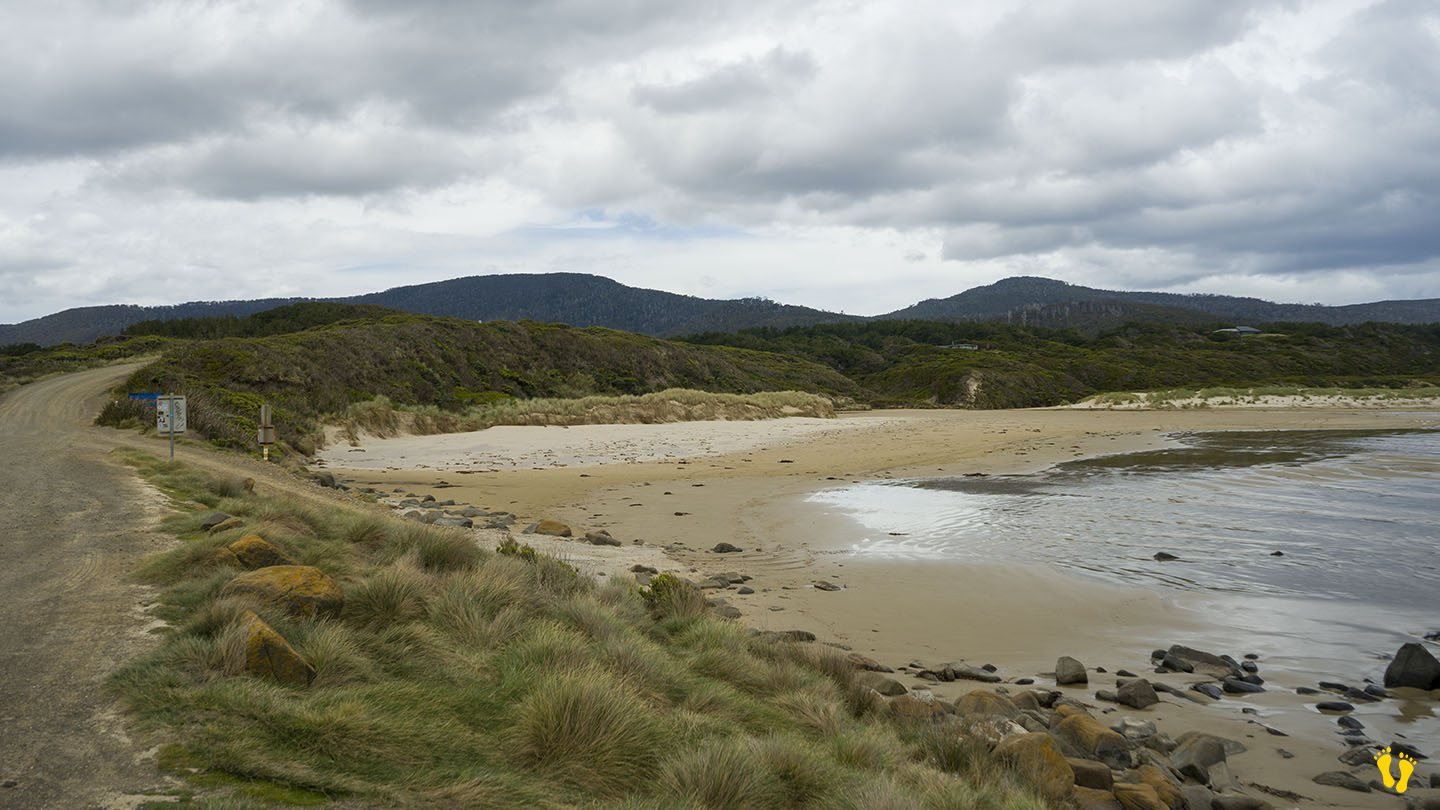
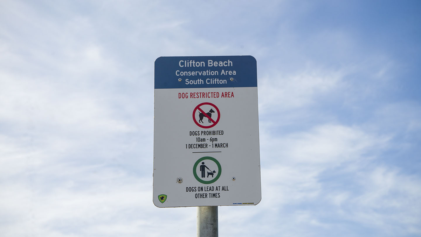
Located off South Arm Road, Clifton Beach is a popular surf beach. The west end is generally referred to as South Clifton and the east end as North Clifton?
South has close parking but may become busy on good days. Good amenities and is often patrolled.
North is accessed via Cape Deslacs Track and a 300m walk and has no amenities. Often has better surf than the south end.
South is a good beach to learn surfing and boarding as it has consistent surf and is often patrolled.
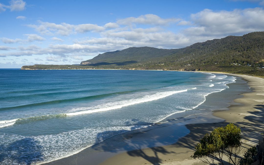
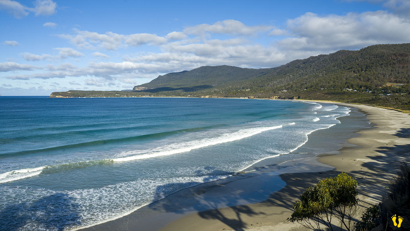
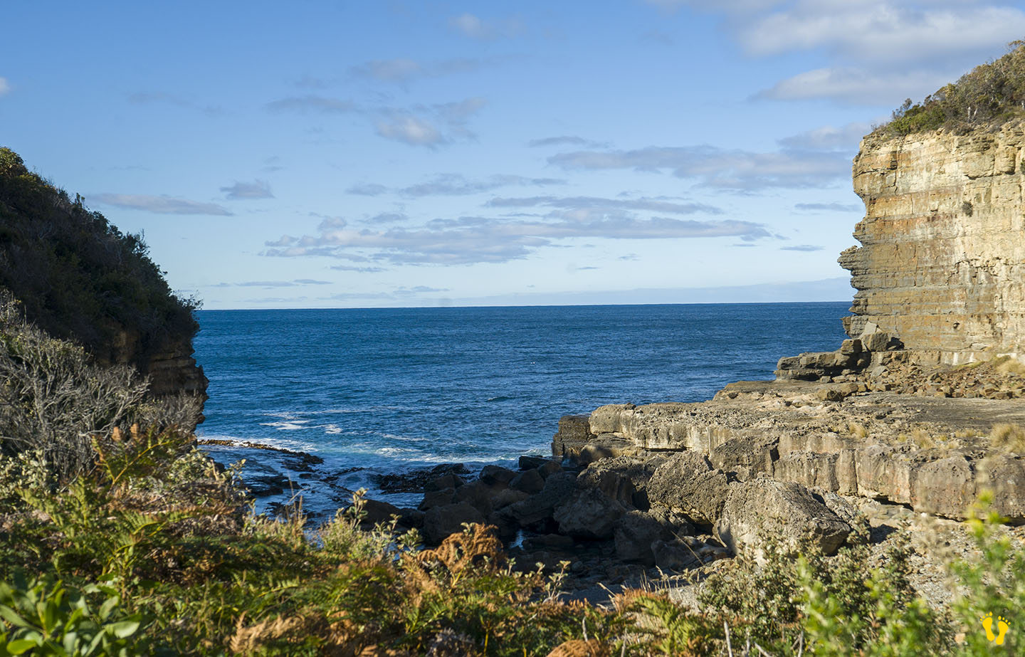
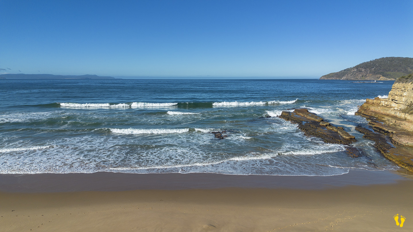
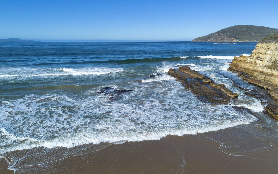
by Mickey Jarvis | Mar 31, 2024 | South East, Surf, Tasman Peninsula
Hazard Rating: 6/10 | Parking: Varied | from Hobart: 75 km | Faces: East into Pirates Bay | Length: ~ 4 km
Original name: Teralina | Original people: Nuenonne |
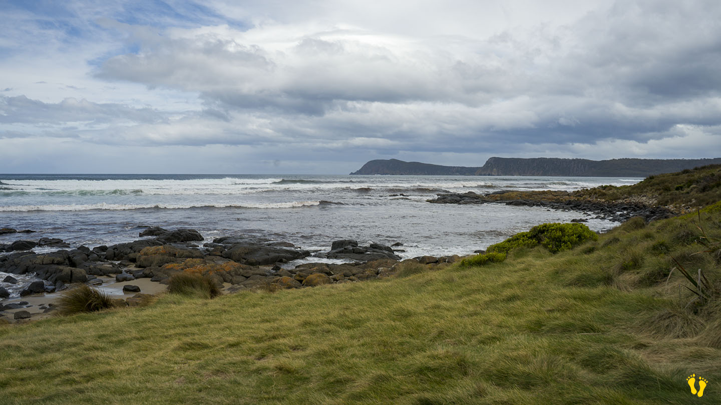
Eaglehawk Neck is an isthmus (neck) on the way to Port Arthur. Eaglehawk Bay is on the neck’s west side, and Pirates Bay is on the east side.
The east side has a wonderful sweeping beach with white sand facing out into Pirates Bay – the Tasman Sea and the next stop – New Zealand. Various access points and parking along its length. Toilets are at each end and an excellent boat ramp on the south end.
The beach has several headlands creating overlapping beach names, including;
- Eaglehawk Neck Beach | Pirates Bay Beach | Egg Beach | Quarry Beach | Descent Beach
The beach often has surf, generally better on the north end and more protected on the south end near the Blowhole. The north end has the Tesselated Pavement area, a geographical marvel worth a look. Views of Fossil Island on the south end, a whole new mystery!
The name Eaglehawk Neck combines Eaglehawks (Wedge-tailed Eagles) found in the area and its geographical Neck. ‘Teralina’ was the aboriginal name for Eaglehawk Neck. Pirates Bay was originally named Monge Bay by French explorer Baudin but was later renamed around 1822 when escaped convicts took possession of a transport ship called the Seaflower and thus became pirates!
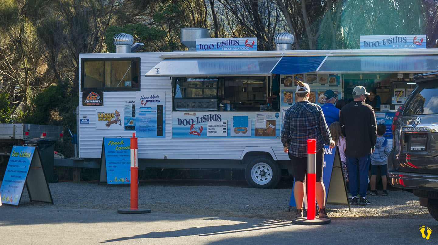
The south end has a quirky town named Doo Town after properties each with a name called Doo-Something. In 1935, Hobart architect Eric Round started a tradition when he named his shack Doo I. The idea soon caught on with most of the town’s shacks now having “Doo” names – the likes of Doo Nix, Make Doo, Much-a-Doo, Doo-Me, Doo-Us, Just Doo It, Doo Drop Inn, Dr Doolittle, Make Doo, Gunnadoo, etc… you get the drift!
Great seafood takeaways at Doo-lishus near the blowhole on the south end (closed in winter). Food and accommodation can be found at the Lufra Hotel.
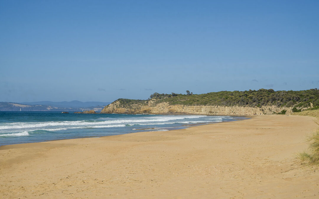
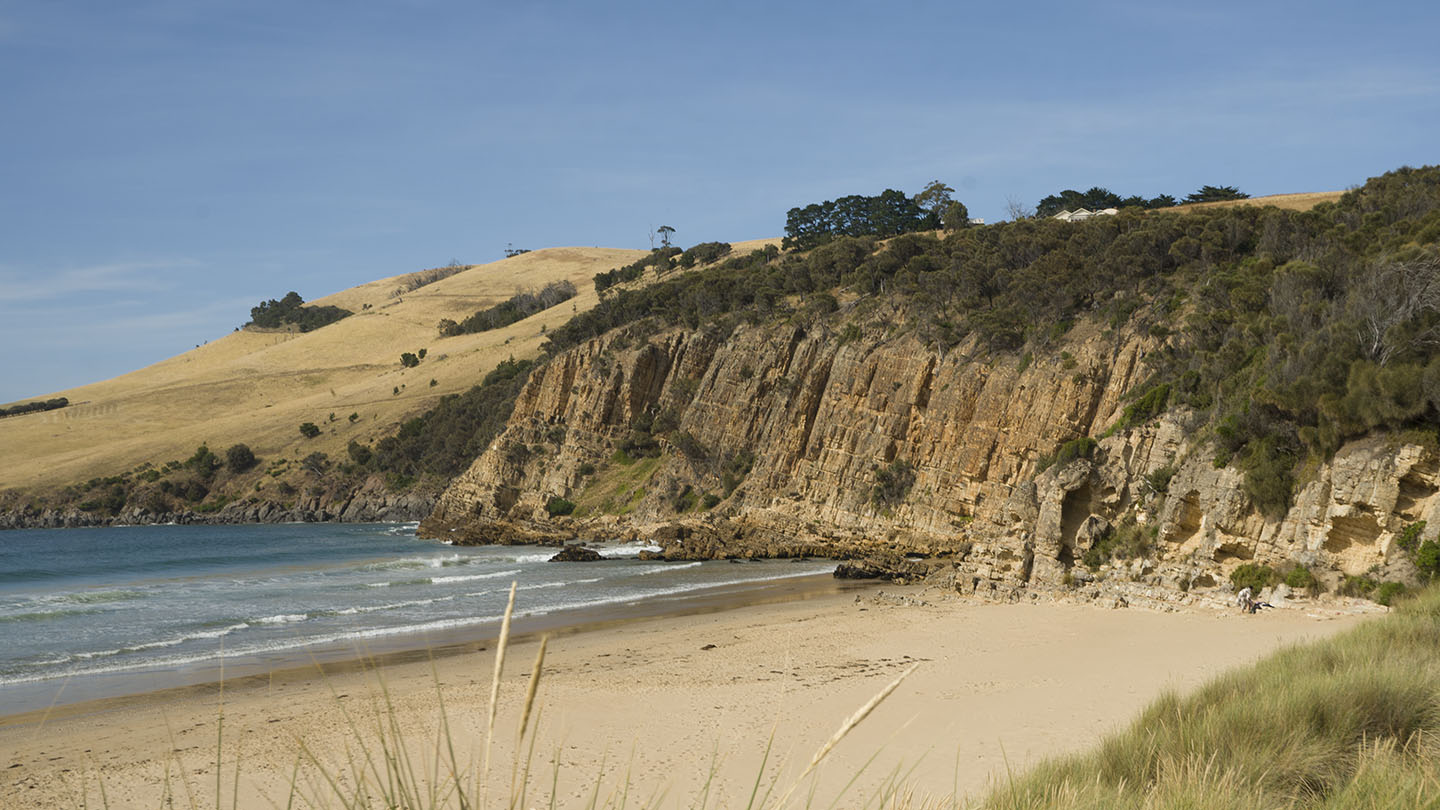
by Mickey Jarvis | Jan 28, 2023 | South Arm Road, Surf
Hazard rating: 6/10 | Parking: Varied | from Hobart: 34 km | Faces: South-ish into Storm Bay | Length: 2.4 km
Located off South Arm Road past Clifton Beach. There are three access points, two mid beach with parking about 50 – 100m from the beach and one at the west bluff end that has close parking and is a popular surf spot (Goats Bluff).
A highly recommended pristine and secluded beach that often has surf.
by Mickey Jarvis | Jan 28, 2023 | South Arm Road, Surf
Goat Bluff is a headland on South Arm Road midway between Goat (Calverts) Beach to the east and Hope Beach to the west. A high bluff that gives you great views of Black Jack Rocks and Betsey Island to the south.
Two popular surf locations are located east and west of the bluff. Goats to the east is accessible by road and has parking, Wedge to the west is a walk down from the bluff (about 400m).