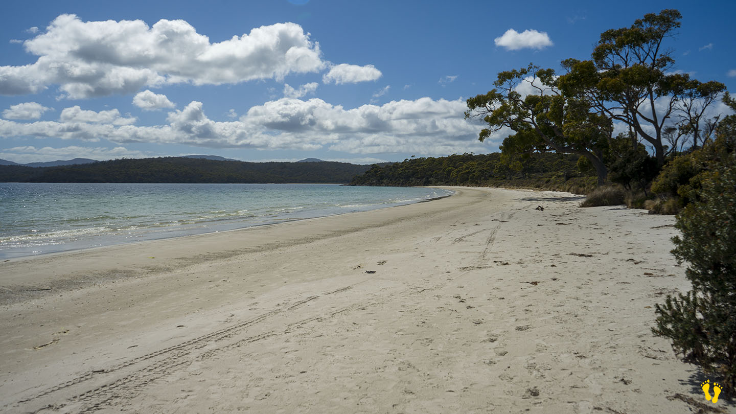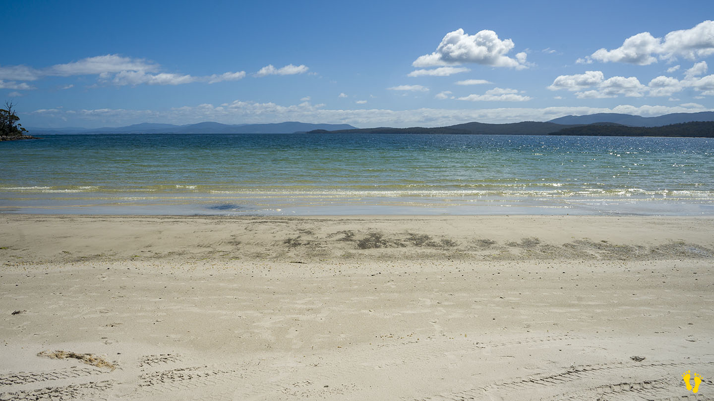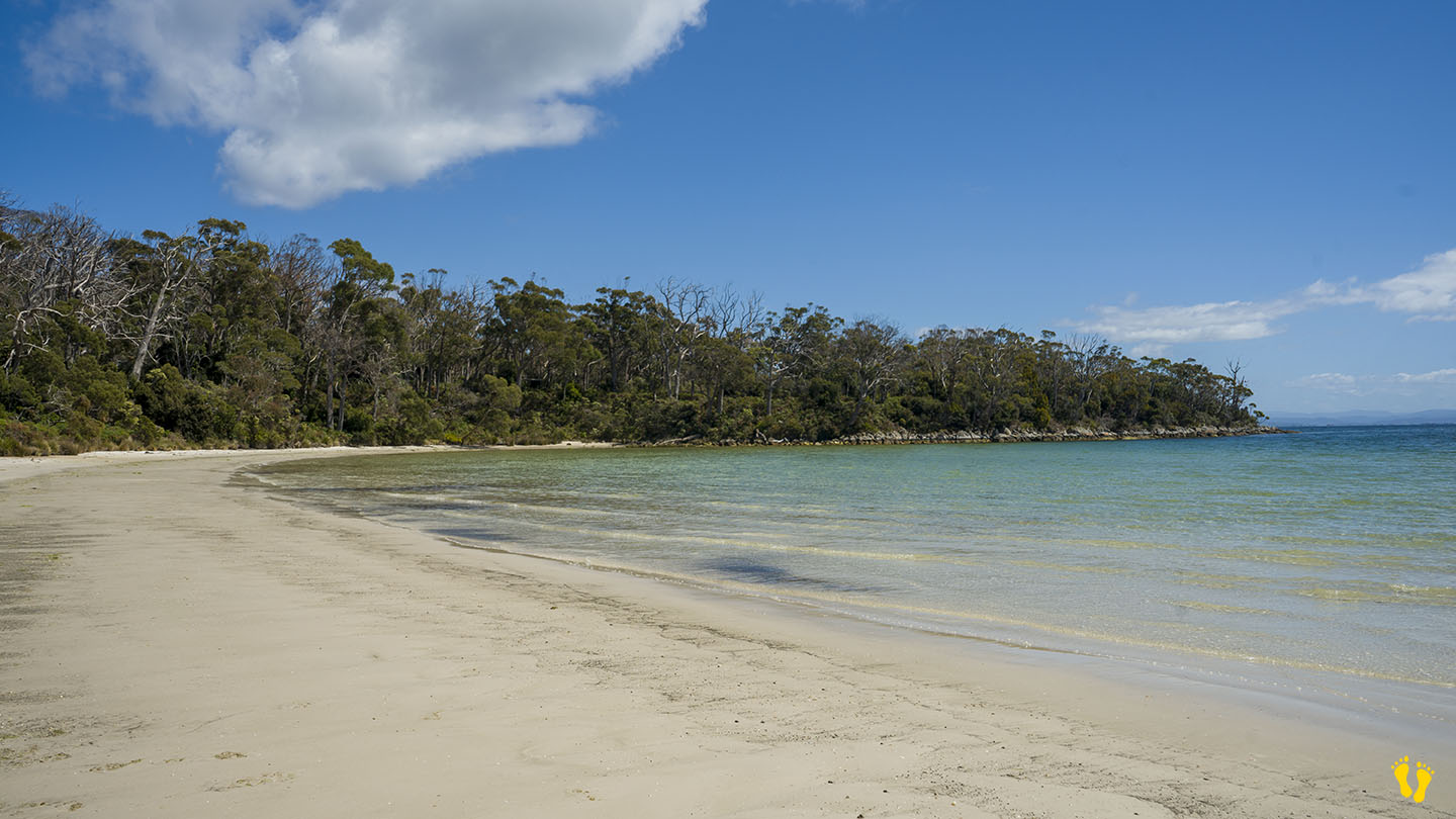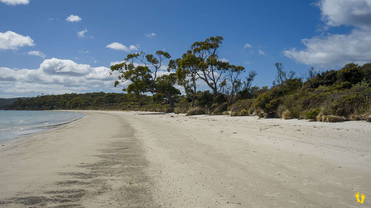
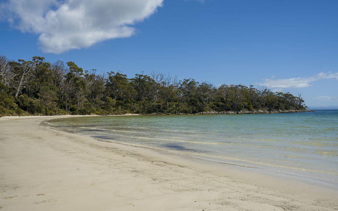
by Mickey Jarvis | Dec 28, 2023 | Low Hazard, South Arm Road, South East
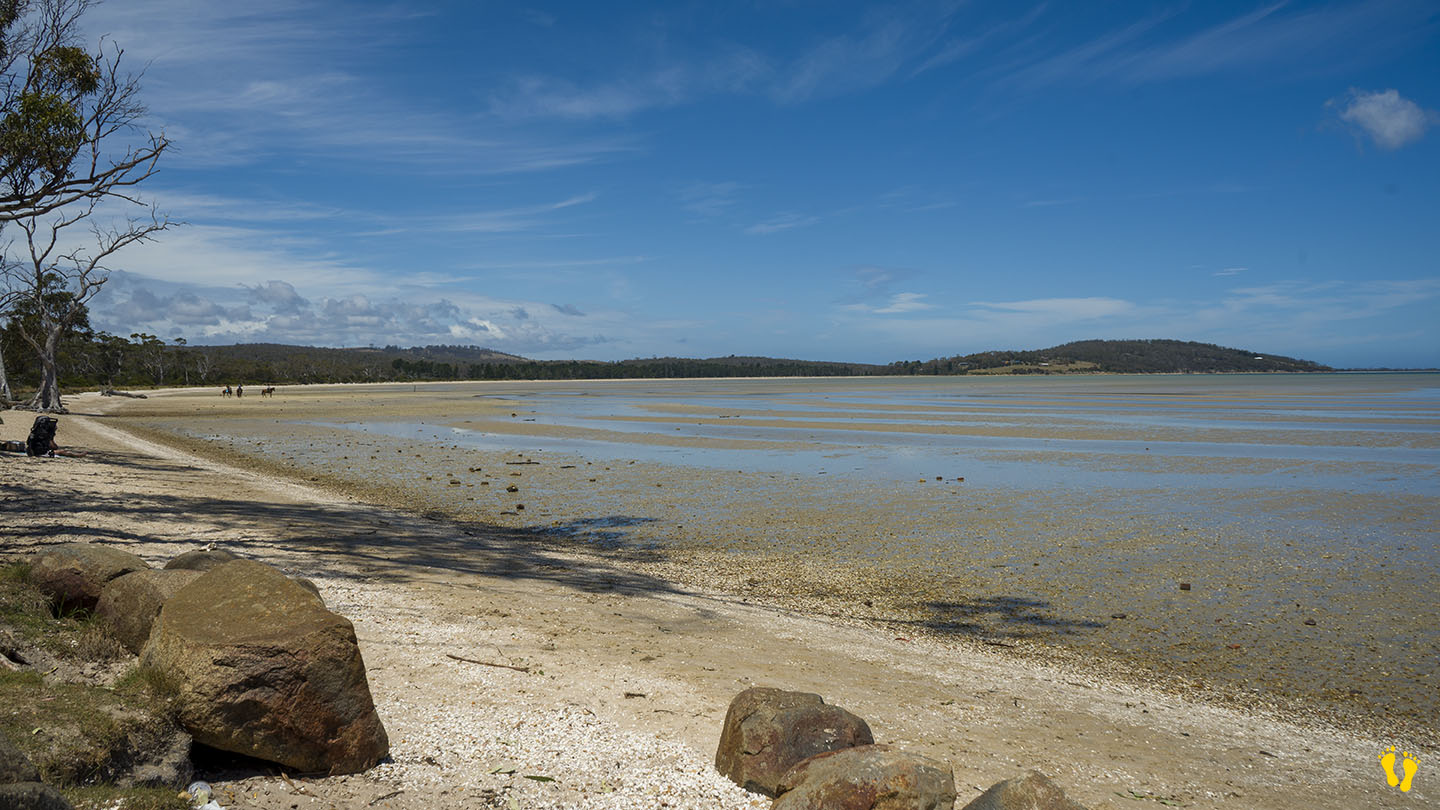
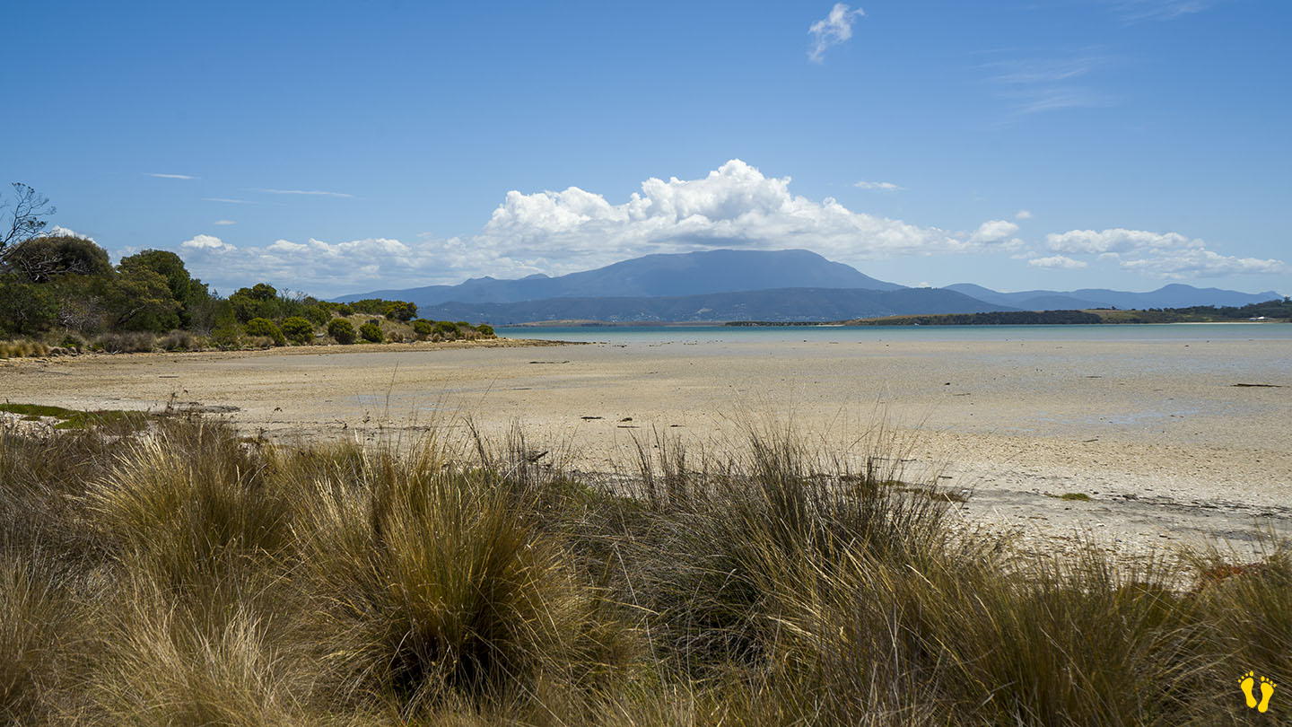
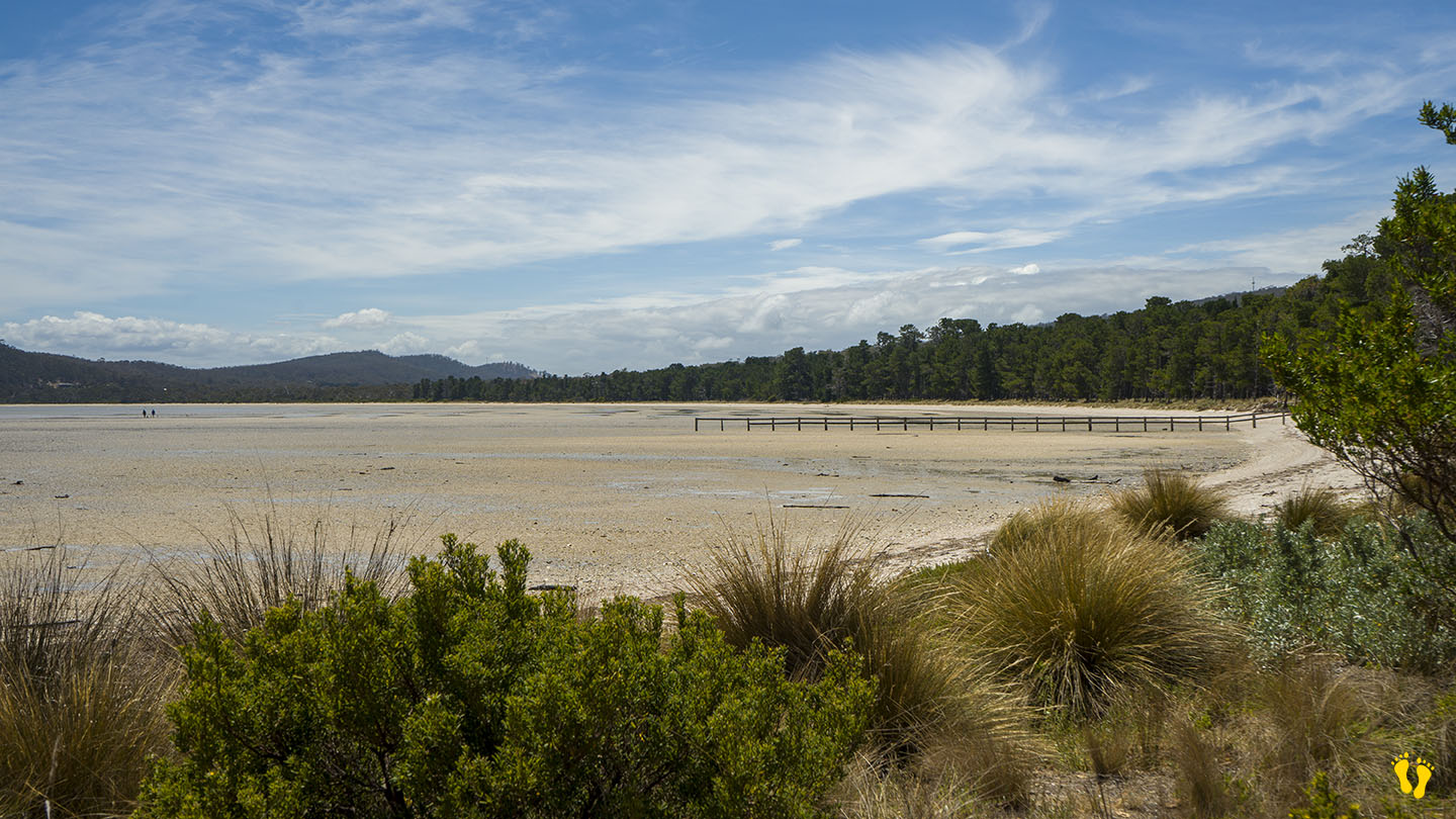
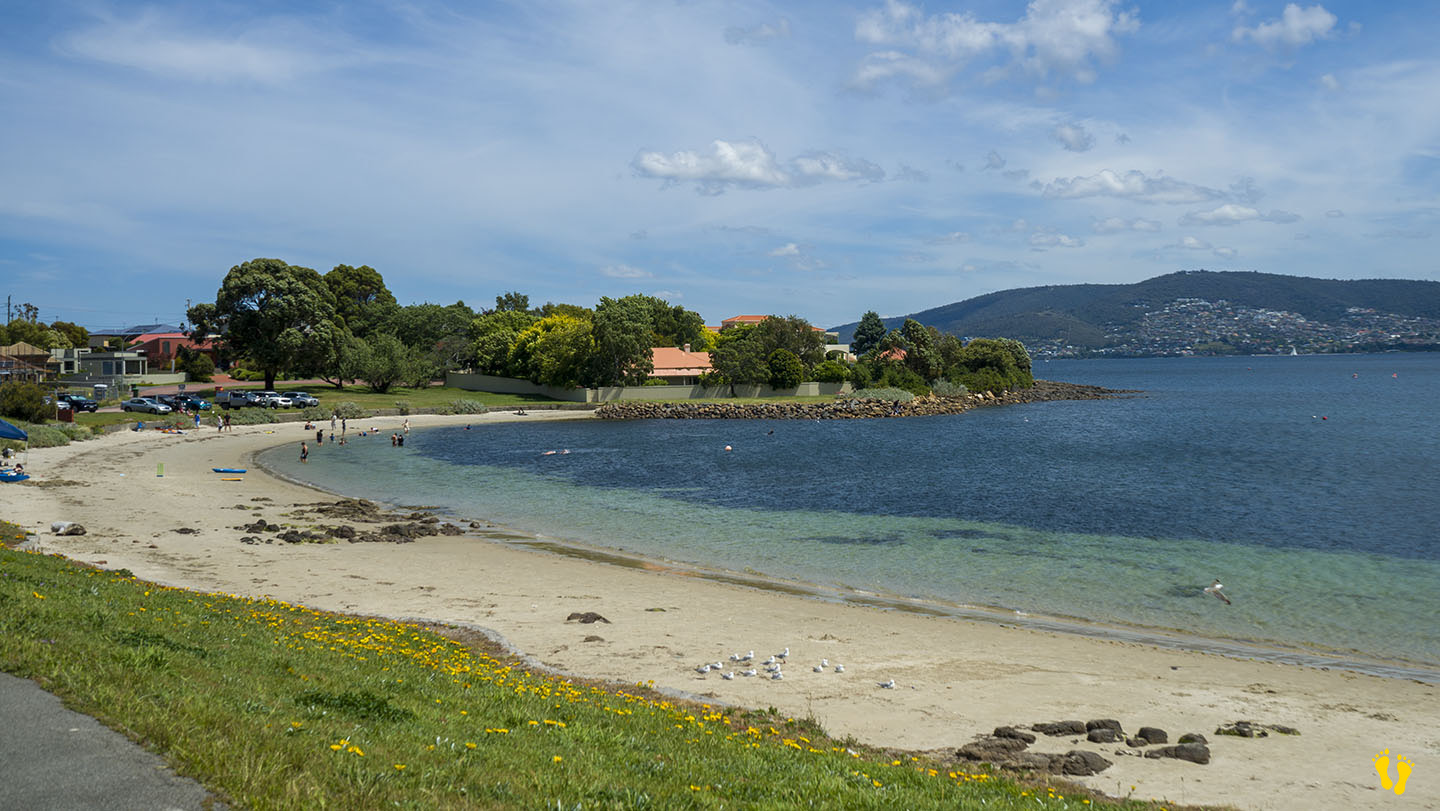
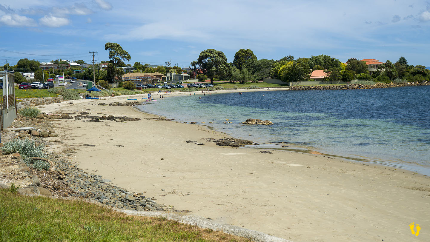
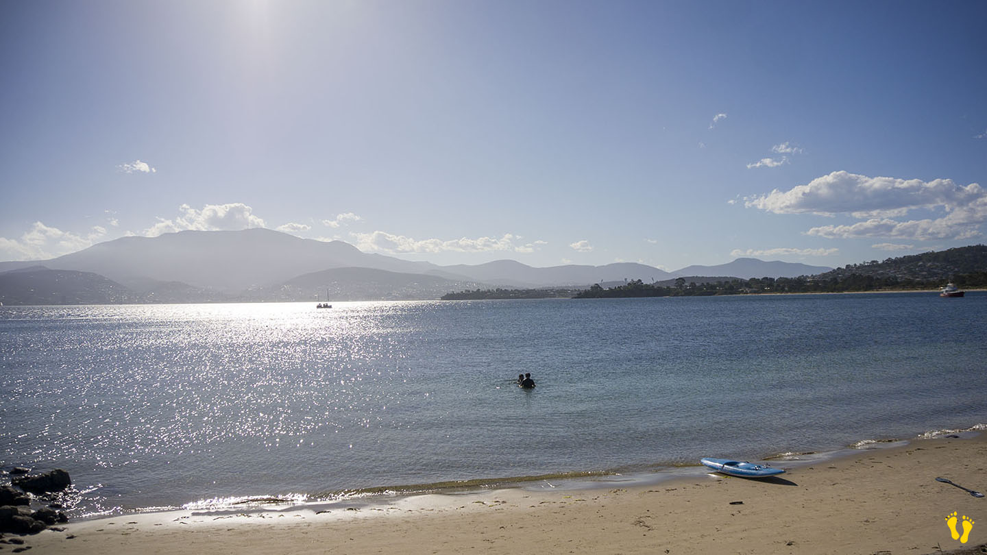
Hazard Rating: 1/10 | Parking: Good + close | from Hobart: 26 km | Faces: West into Mortimer Bay | Length: 2.7 km
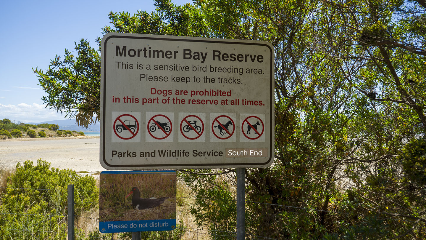
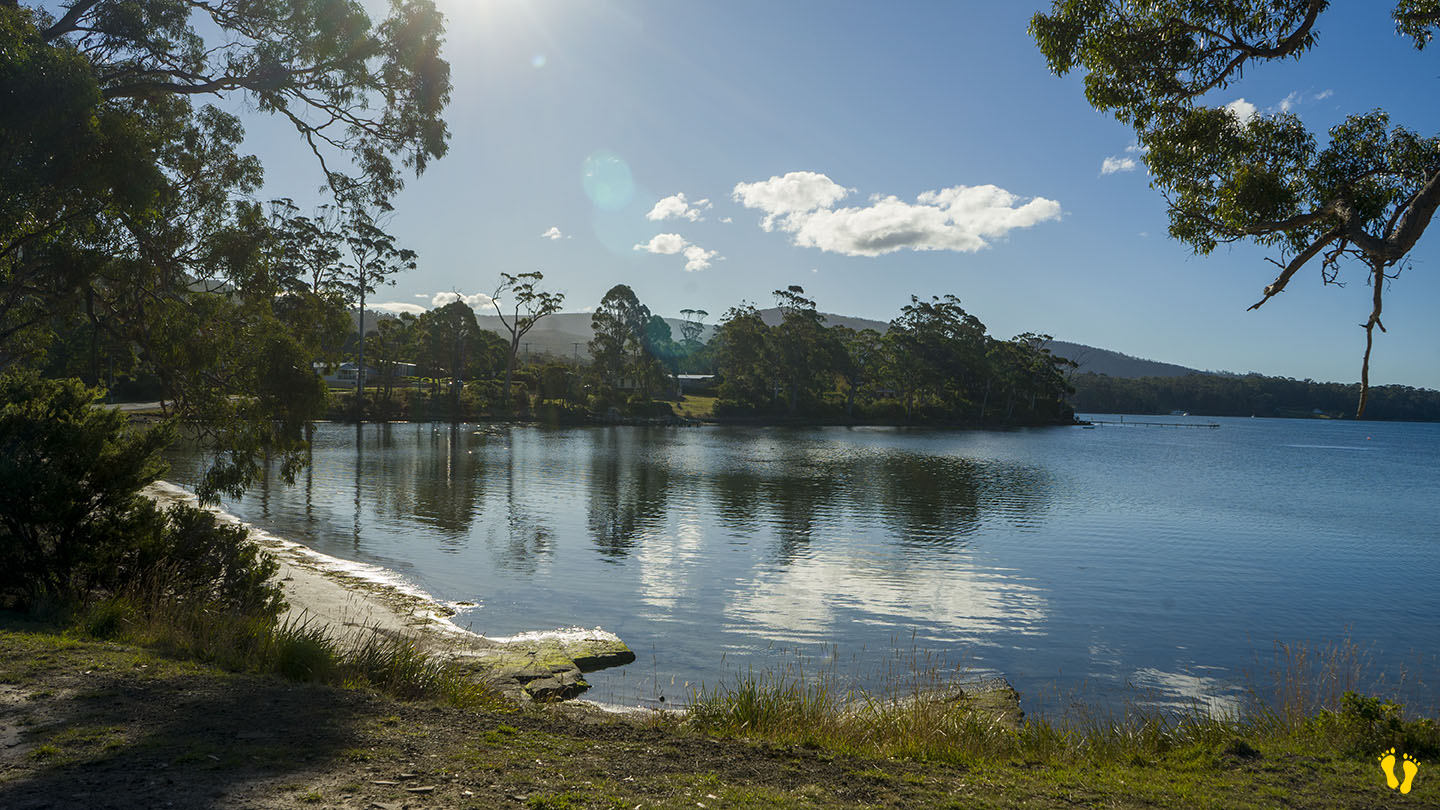
Gorringes Beach is part of the Mortimer Bay reserve in a protected area of South Arm. Access via Rifle Range Road just past Lauderdale. The north end is at the end of Rifle Range Road and the south end is further down Gellibrand Drive which forks off Rifle Range Road. No dogs on the south end.
A gradual tidal beach that is more suited for wading than swimming. Interesting birdlife and other things to explore and a wonderful beach to walk and explore with views of the east side of South Arm.
Gorringes Beach was named after Charles Francis Gorringe Senior (born 1809) who occupied the area in 1867. Mortimer Bay was named after landowner and whaler Henry William Mortimer who lived there between 1825-39.

by Mickey Jarvis | Jan 1, 2023 | Greater Hobart, Low Hazard
Eastern Shore near Hobart |
Hazard Rating: Low | Parking: Varied | from Hobart: 12 km | Faces: South into the River Derwent | Length: 1.2 km
Howrah Beach is on the Eastern Shore near Hobart and is backed by Wentworth Park. The west end has interesting rock formations and is ideal for beginner snorkeling and kids to explore. This is one of my favourite Hobart beaches near Hobart. Take the cliff-top walk to Bellerive Beach west along Second Bluff track or even better the rocky shoreline walk to uncover interesting rock formations & caves. Exploring the foreshore gives you access to interesting geology formations, hidden caves, and glimpses into history.
There is limited parking on each end of the beach plus access via Wentworth Park in the middle. Mid beach via Wentworth Park are toilets, BBQ area and a playground area about 100m from the beach.
Howrah-Bellerive beaches are part of the foreshore trail. Wentworth Park was once a wetland filled in to create the park area. Named after ‘Howrah House’ a home built by an Indian Army officer in 1830, Howrah is near Calcutta in India and means swampy lake! Little Howrah Beach is a short distance to the south.
East end
Middle – via Wentworth Park – the beach is about 50m from the park
West end
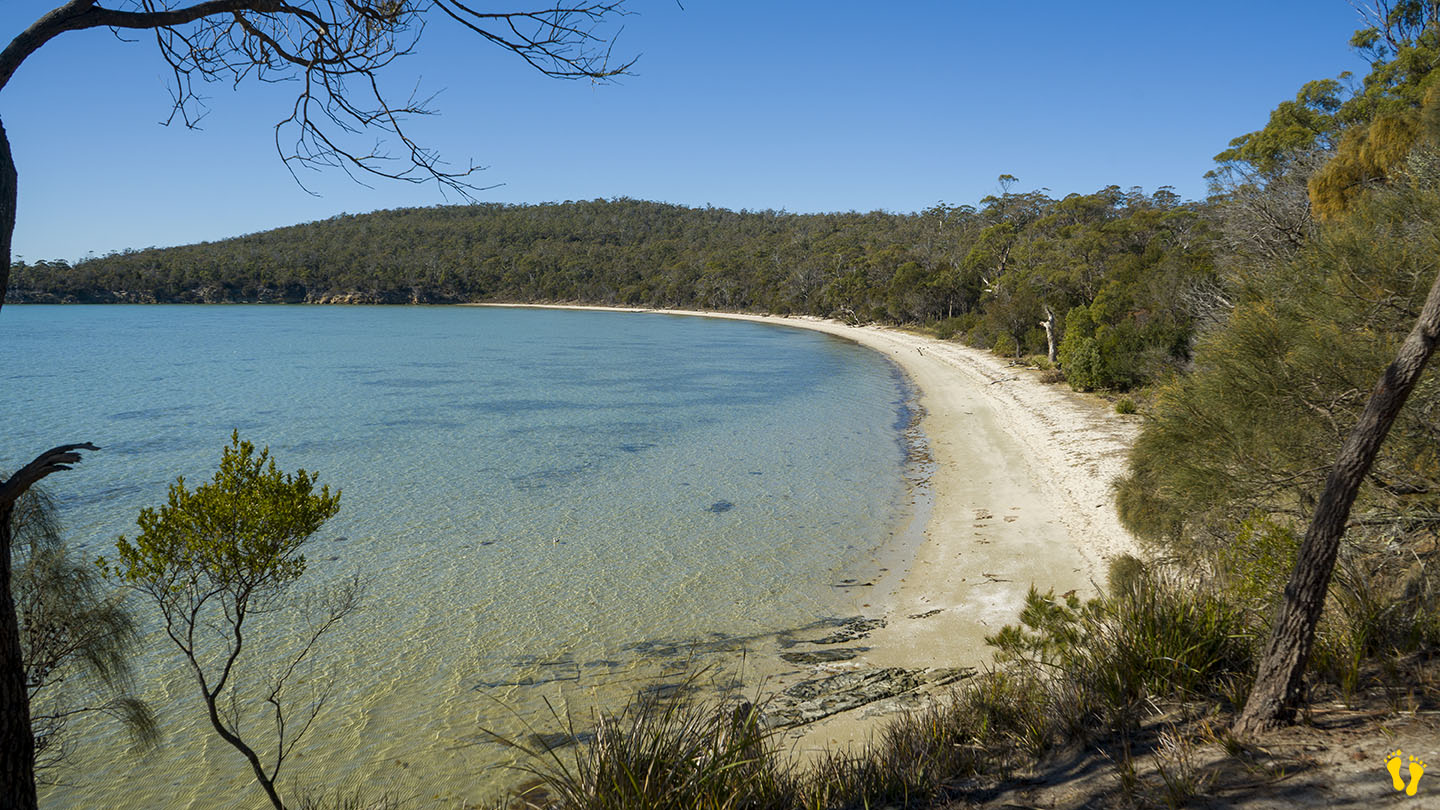
by Mickey Jarvis | Nov 23, 2024 | Bruny Island, Low Hazard
Bruny Island | Hazard Rating: 1/10 | Parking: Good + close | Faces: Nor-West into Great Taylors Bay | Length: 700 m
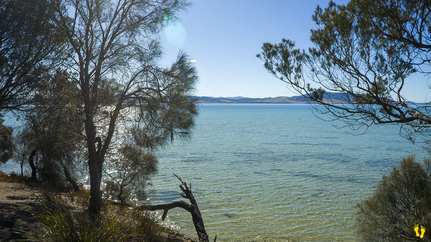
Lighthouse Jetty Beach (or Jetty Beach) is on south Bruny Island on the way to the Lighthouse (far south). Turn right about 2km before the Lighthouse and head down Old Jetty Road about 4km on a well signposted good dirt road.
The beach is in a sheltered part of Great Taylors Bay that has safe swimming, snorkeling and fishing with basic boat access.
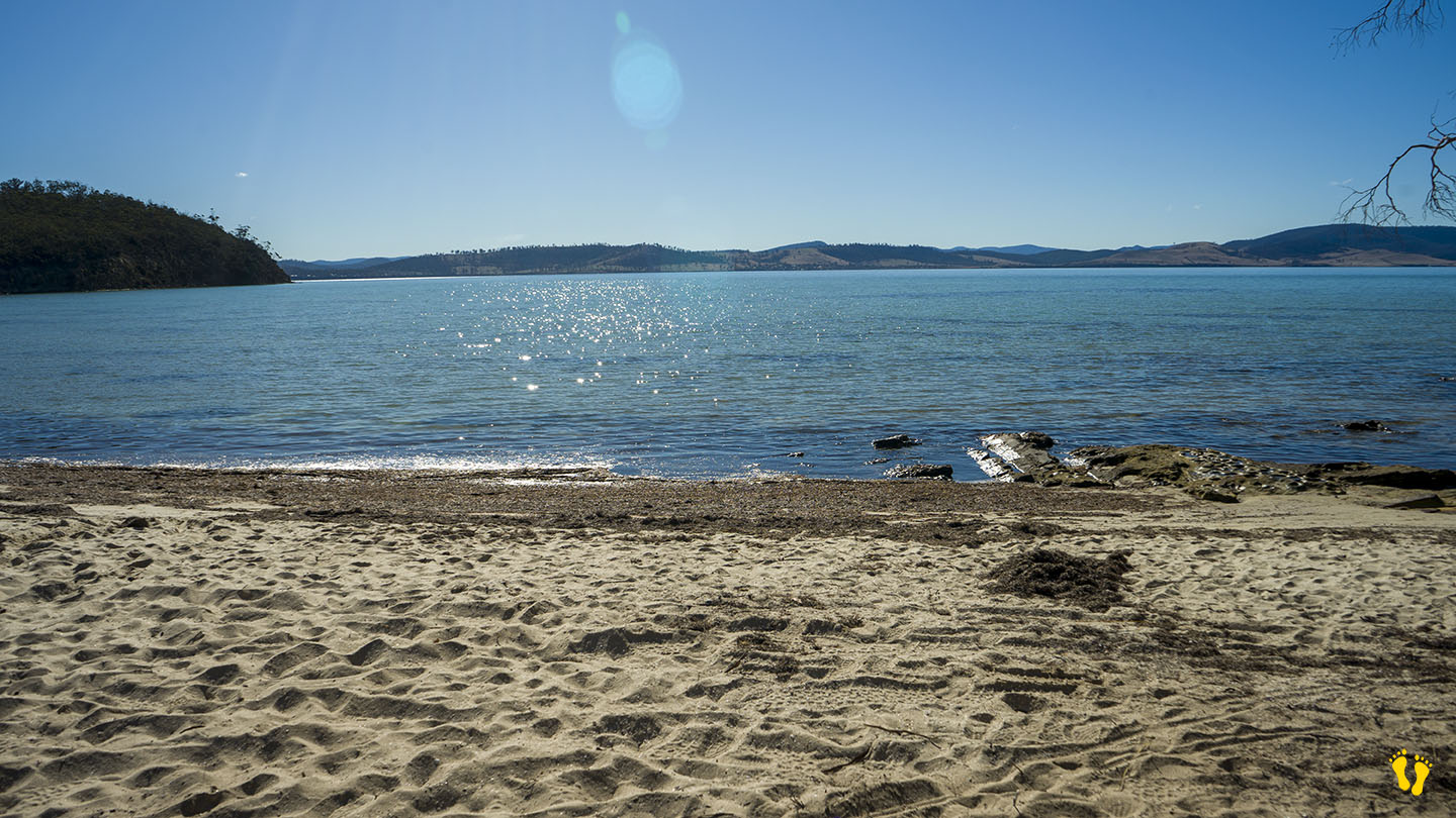
The Jetty Beach Campground is next to the beach and has parking for access to the beach.
The campground is situated in a beautiful natural environment surrounded with trees and wildlife. Pit toilets and water (which you should boil). For camping at a safe beach at a relatively unknown beach, this is a great choice. Small kids will love it! Managed by Parks and Wildlife the self booking fees are very reasonable.
Named after a jetty (now missing) that supplied the Lighthouse at Cape Bruny about five kilometres away.
Google Maps has confused Lighthouse Jetty Beach, Jetty Beach and Kingfisher Beach locations. Also not to be confused with Jetty Beach at Dennes Point at the north end of Bruny.
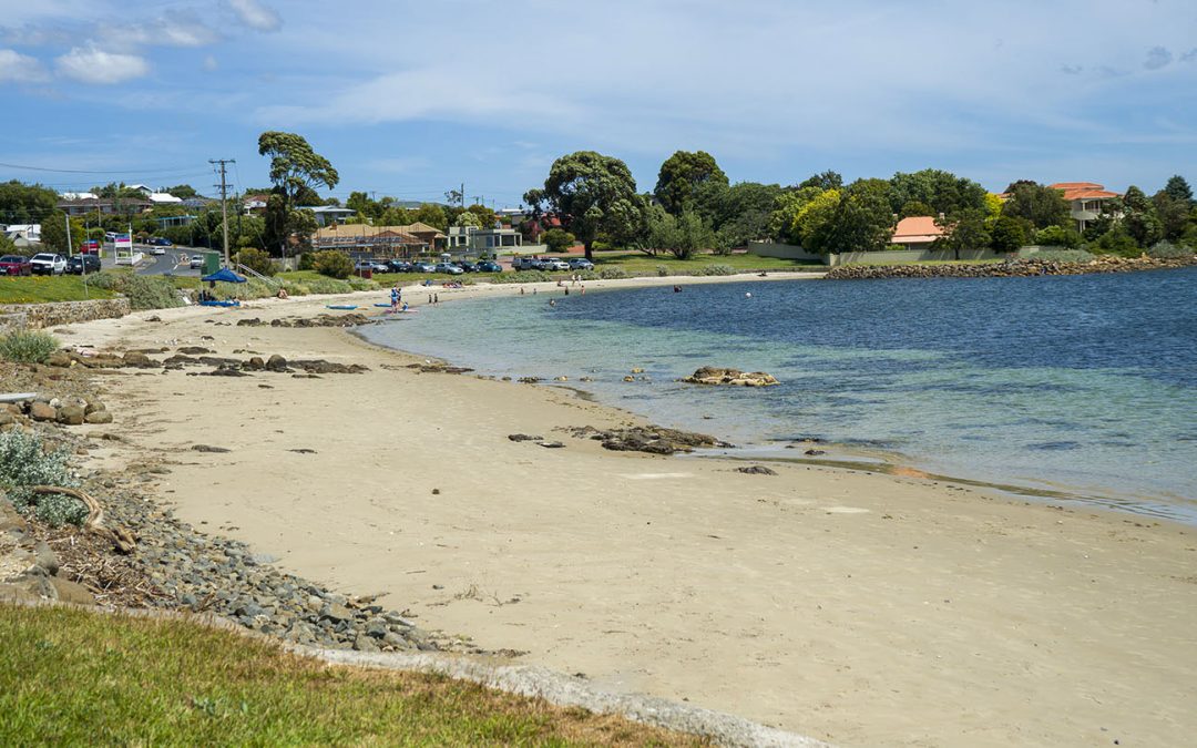
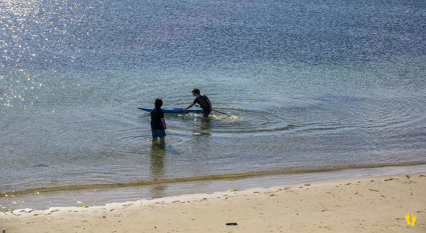
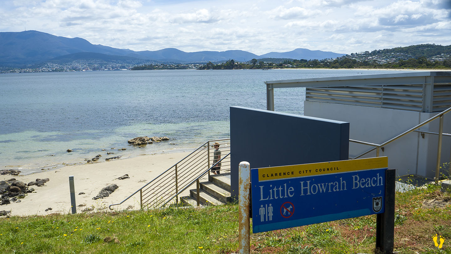
by Mickey Jarvis | Dec 29, 2022 | Greater Hobart, Low Hazard
Eastern Shore near Hobart |
Hazard Rating: Low | Parking: Good + close | from Hobart: 14 km | Faces: West into the Derwent River | Length: 200 m
Little Howrah Beach just south of Howrah Beach is a protected beach ideal for families with young children. Great for learning to paddle board or kayak. Sand and grassy areas to relax. Shops nearby, good parking and toilets. Guess what – it’s small – but I highly recommend it. Good amenities and great views of Kunanyi. No dogs.
by Mickey Jarvis | May 7, 2024 | Low Hazard, South East, Tasman Peninsula
Near Port Arthur |
Hazard Rating: 1/10 | Parking: Roadside | from Hobart: 93 km | Faces: NE into Carnarvon Bay | Length: 150 km
Original Name: Turrakana, the homeland of the Pydairrerme (Tasman Peninsula’s Aboriginal people)
Little Possum Beach is about 2 km south of Port Arthur and the little cousin of Big Possum Beach a bit north. It is a beach but only just!
A small roadside beach ideal for a walk and paddle along the beach while enjoying the views. A classic old wooden jetty at the bottom end to wander onto and take in the whole experience of the bay and its surroundings.
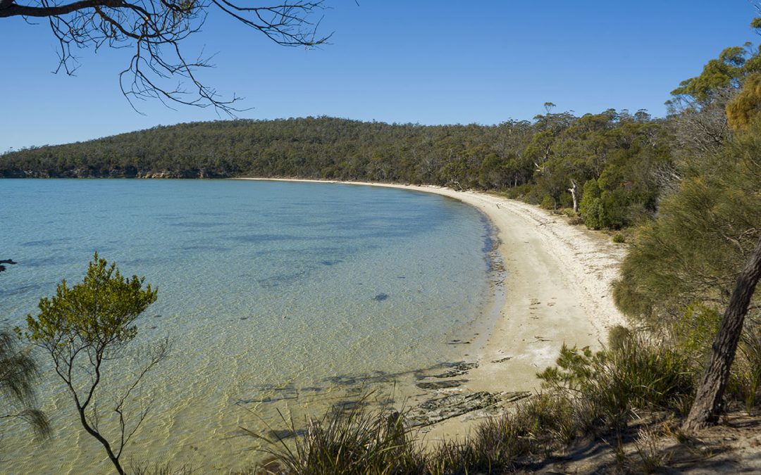
by Mickey Jarvis | Apr 2, 2024 | Low Hazard, Tasman Peninsula
Hazard Rating: 1/10 | Parking: Campground | from Hobart: 110 km | Faces: NE into Lime & Norfolk Bays| Length: 1.1 km
Original Name: Turrakana, the homeland of the Pydairrerme (Tasman Peninsula’s Aboriginal people)
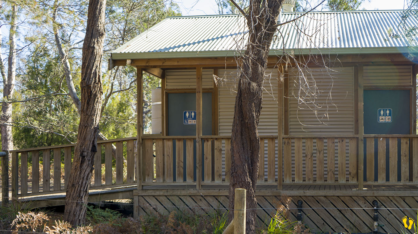
Wheelchair access: Disabled toilets and some access to the beach down a hard-packed dirt track to the left beach.
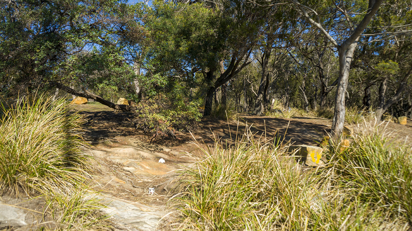
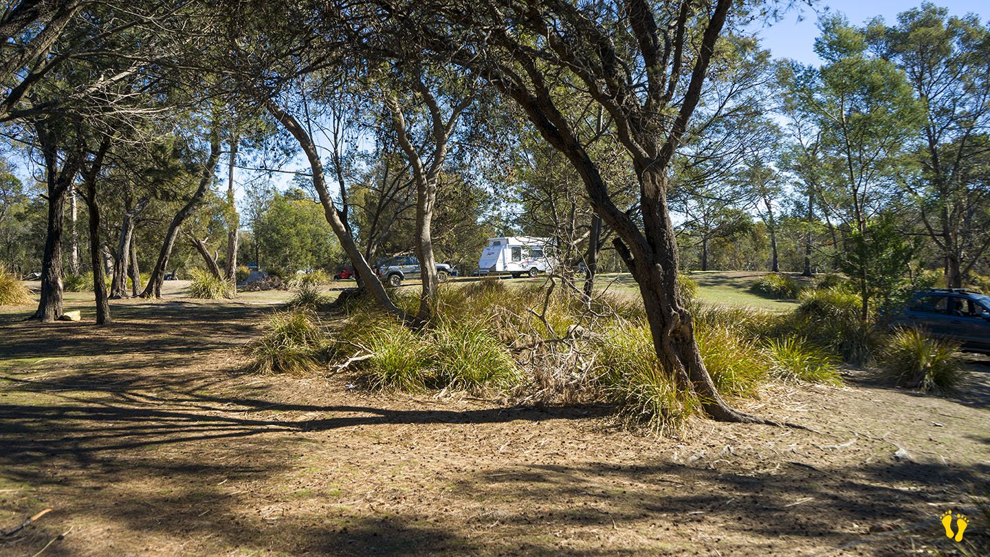
Lime Bay on the northwest side of the Tasman Peninsula consists of 2 beaches facing north-ish with a 150m headland between them.
The camp-ground is on the headland. No dogs allowed.
Each beach is a low-gradient beach with occasional minor wind waves. Access to the beaches is from the camp-ground, about 50m to each beach. The beaches are tranquil, well-protected and great for swimming, snorkeling and kids (and adults) to enjoy.
A great camping site ideal for kids that operates a no-booking, honesty box system. There are long-drop toilets, picnic tables and fireplaces. Campers must bring their own water and firewood but cooking is recommended on fuel stoves due to occasional fire bans. Camping is run by Parks and Wildlife Tasmania. Watch out for the headland cliffs which have no fencing. Lots of walking trails including a two-hour return walk to Lagoon beach.
You get to Lime Bay by taking Saltwater River Road at Premaydena and then Coal Mines Road, the last part is on a good dirt road. Many historic sites in the area date back to penal colony days and are worth a look. Lime Bay was named after the process of extracting lime from the remains of shellfish (oysters, abalone, mussels, cockles, etc.) from aboriginal middens in the area.
.