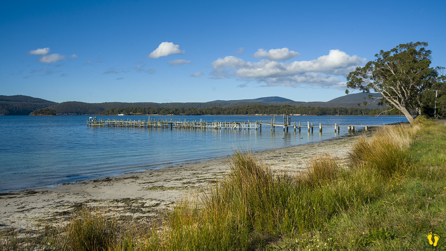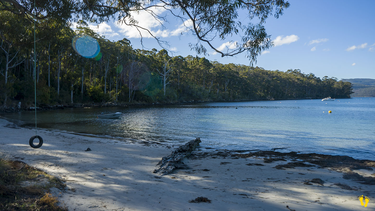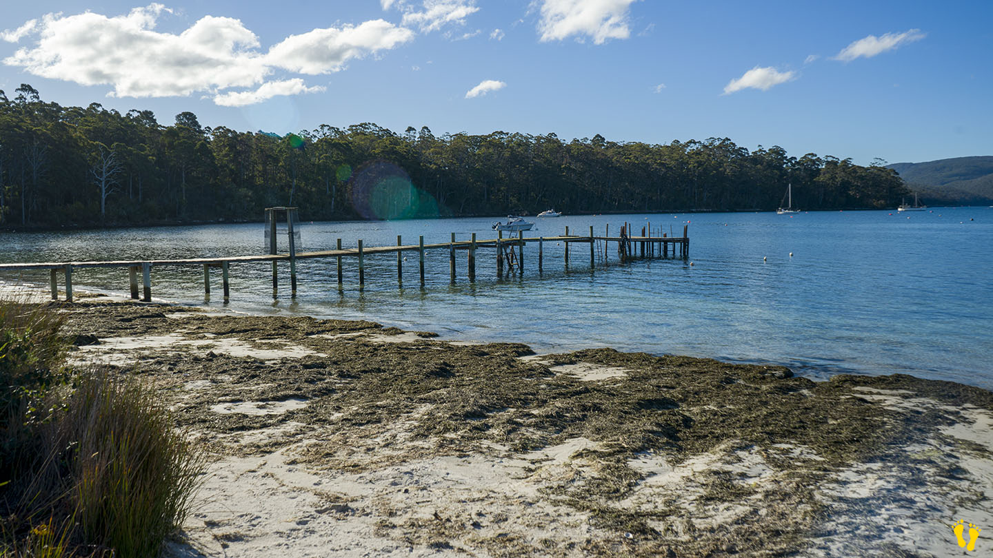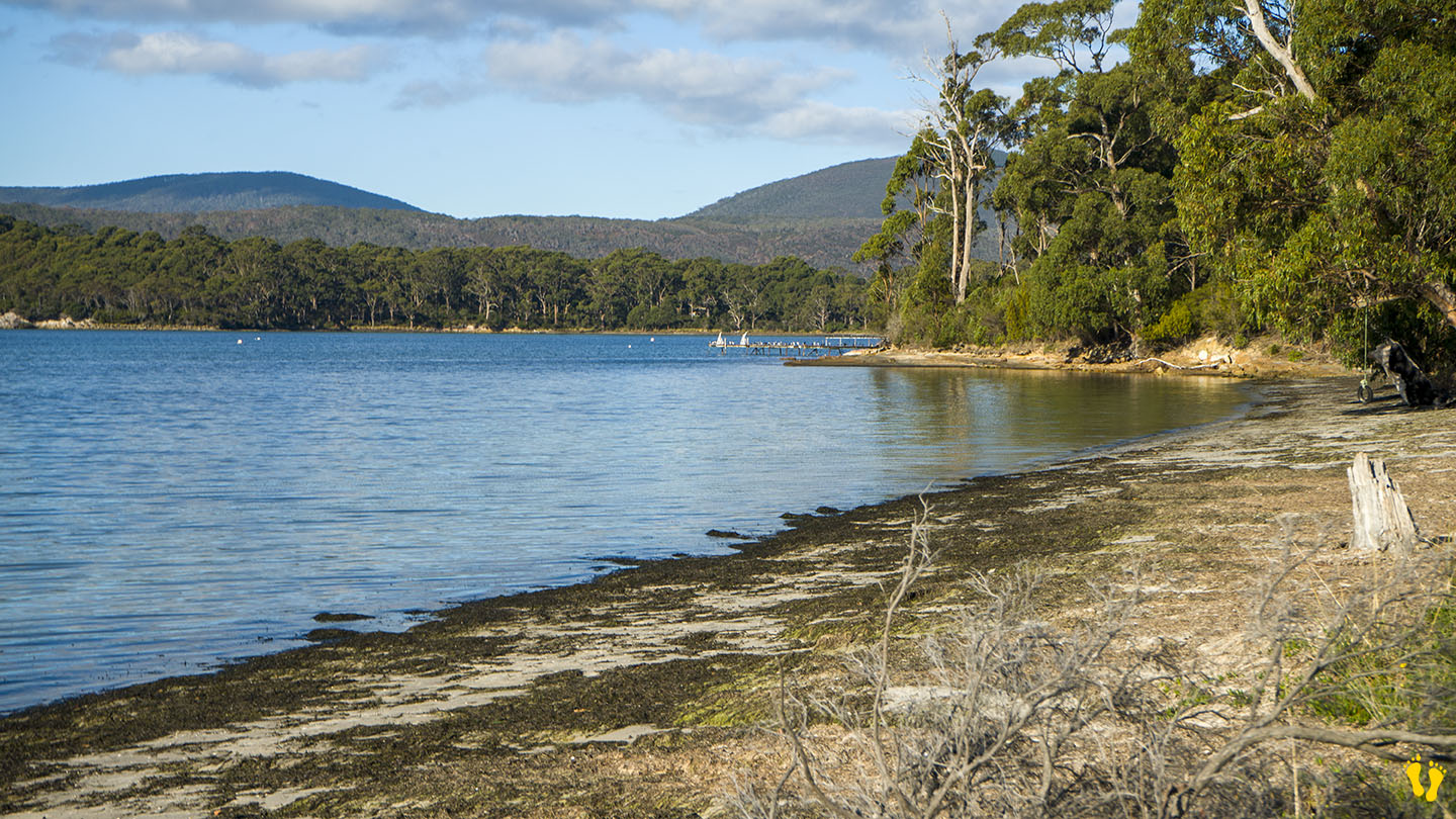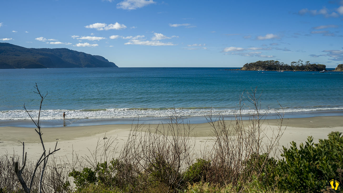
by Mickey Jarvis | May 7, 2024 | Low Hazard, South East, Tasman Peninsula
Near Port Arthur |
Hazard Rating: 1/10 | Parking: Roadside | from Hobart: 92 km | Faces: NE into Carnarvon Bay | Length: 1 km
Original Name: Turrakana, the homeland of the Pydairrerme (Tasman Peninsula’s Aboriginal people)
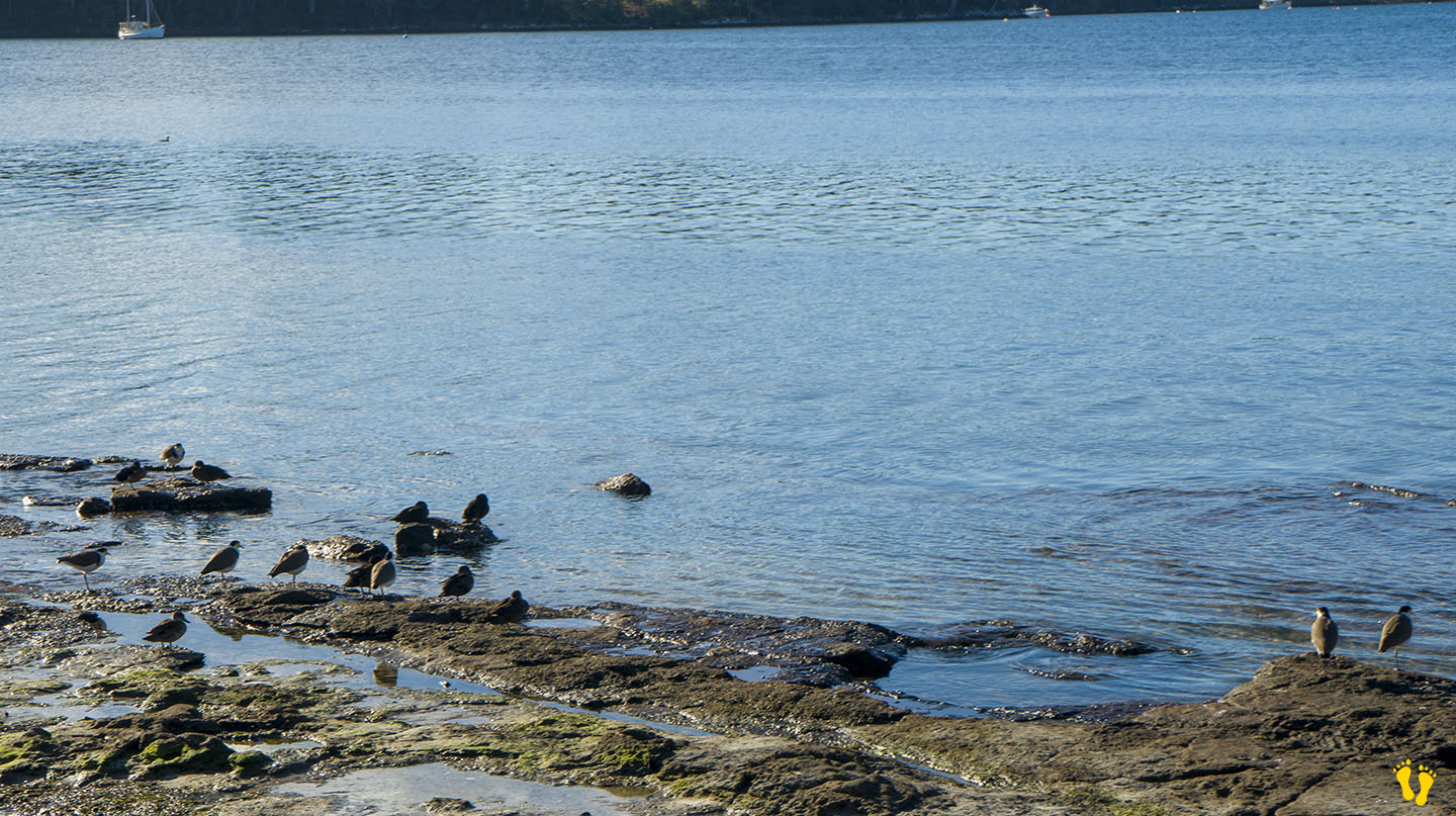
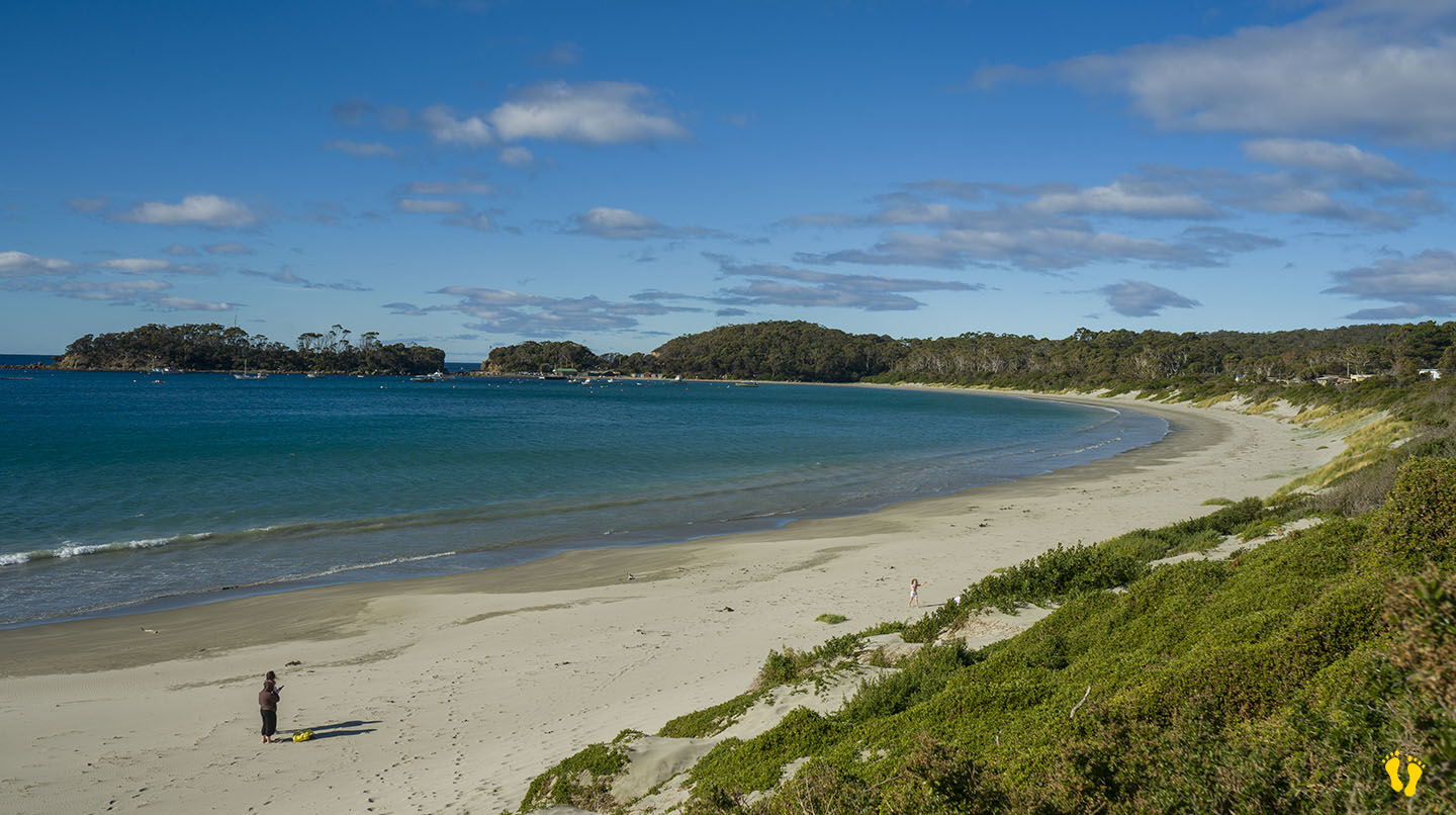
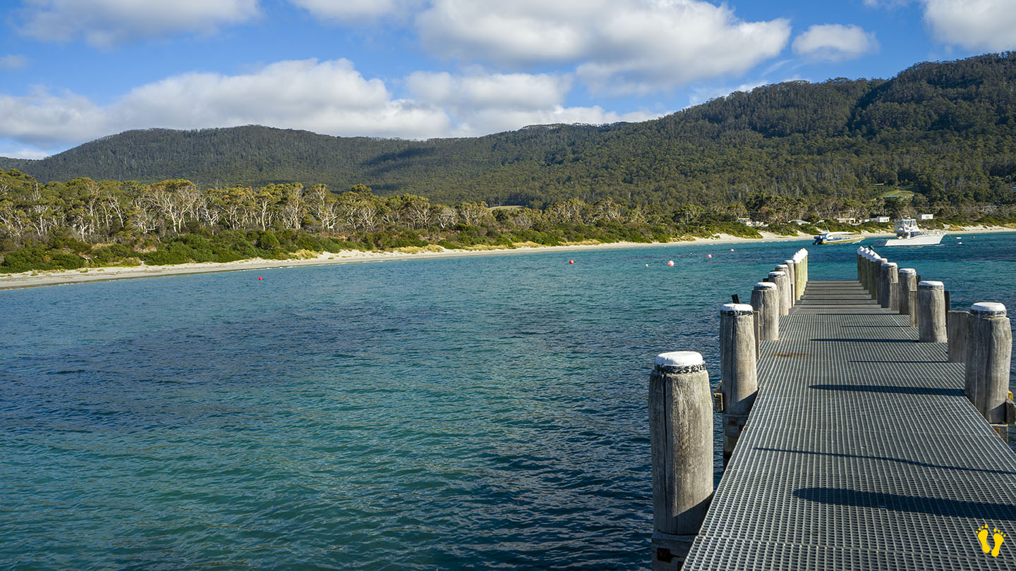
Big Possum Beach is on the Tasman Peninsula 1.5 km south of Port Arthur on Safety Cove Road on the way to Remarkable Cave.
A small quaint unknown roadside beach ideal for families and kids.
Walk, swim, paddle, swing on an old-style tire swing, walk out on a somewhat suspect jetty or watch bird life while taking in the stunning views across Carnarvon Bay.
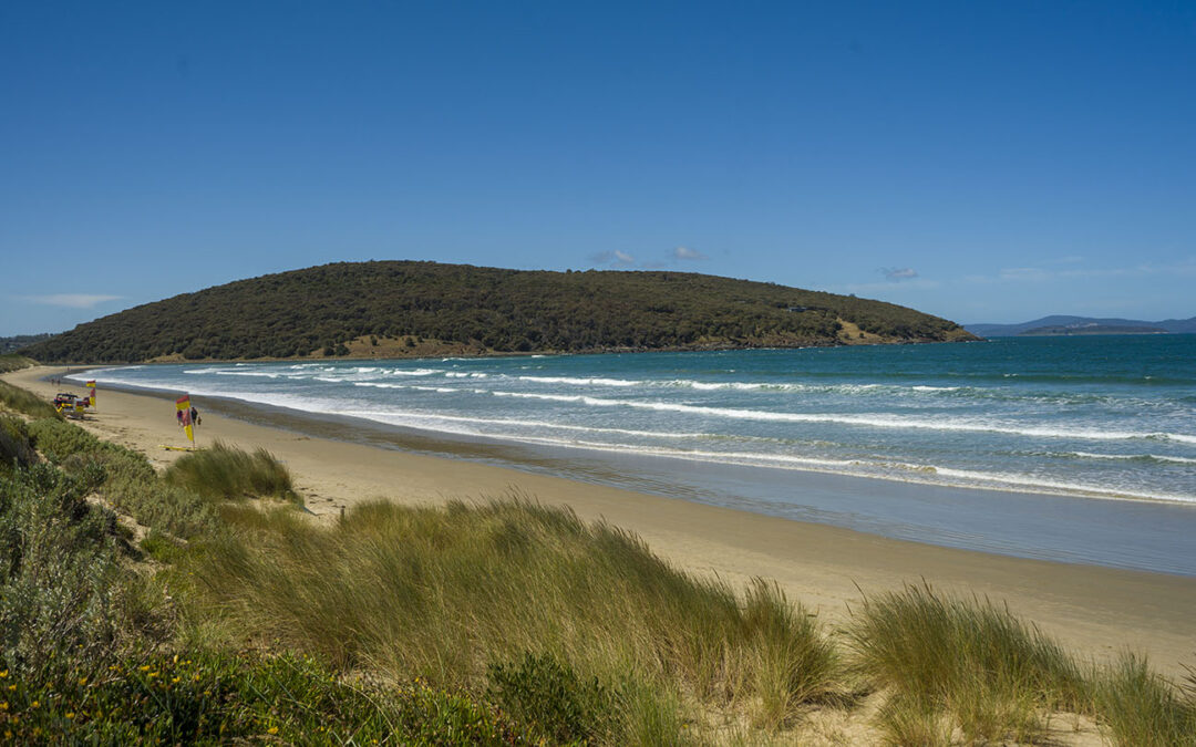
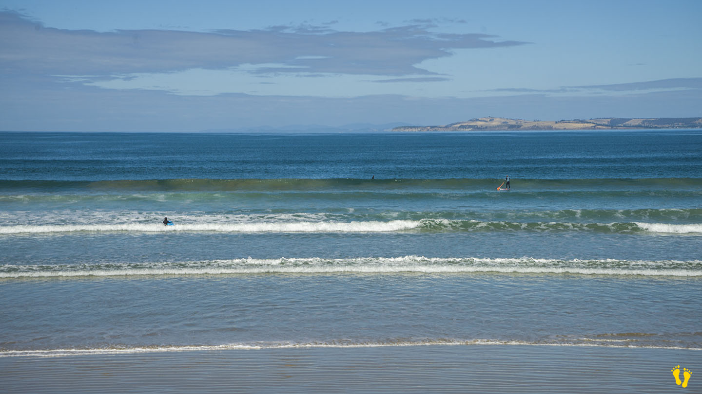
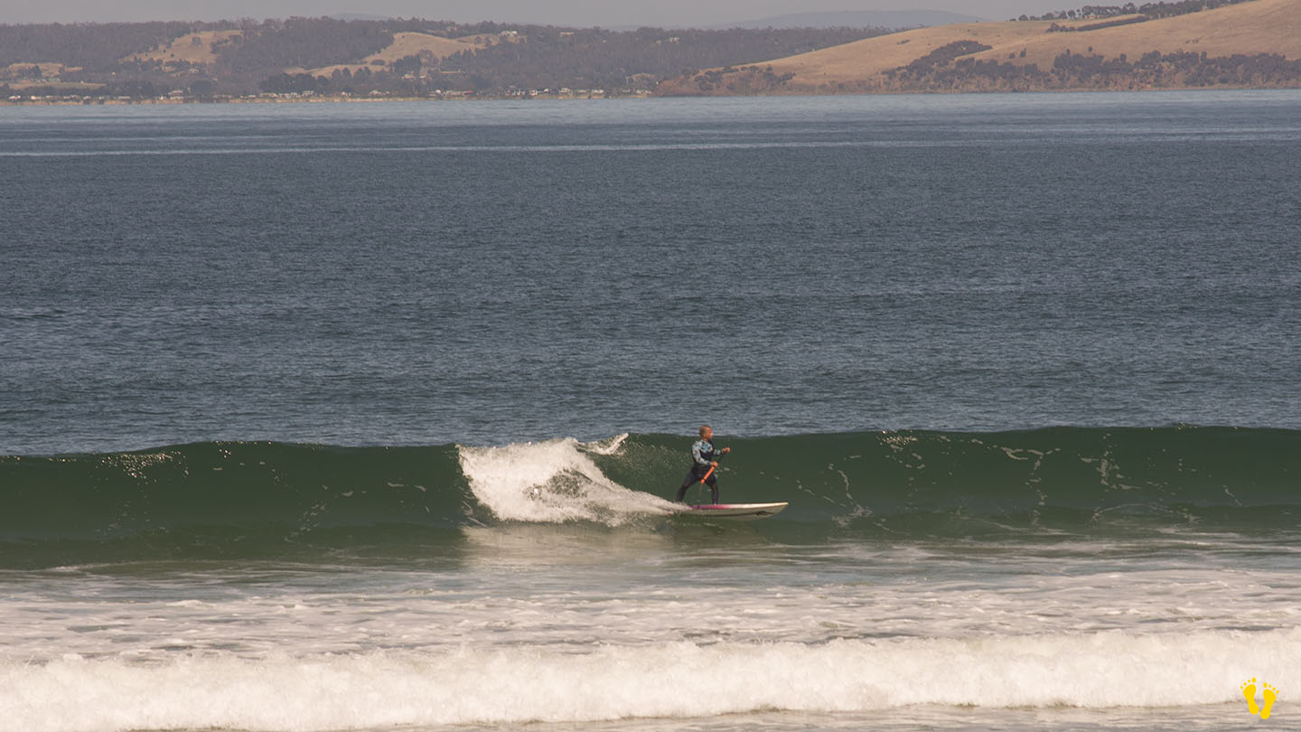
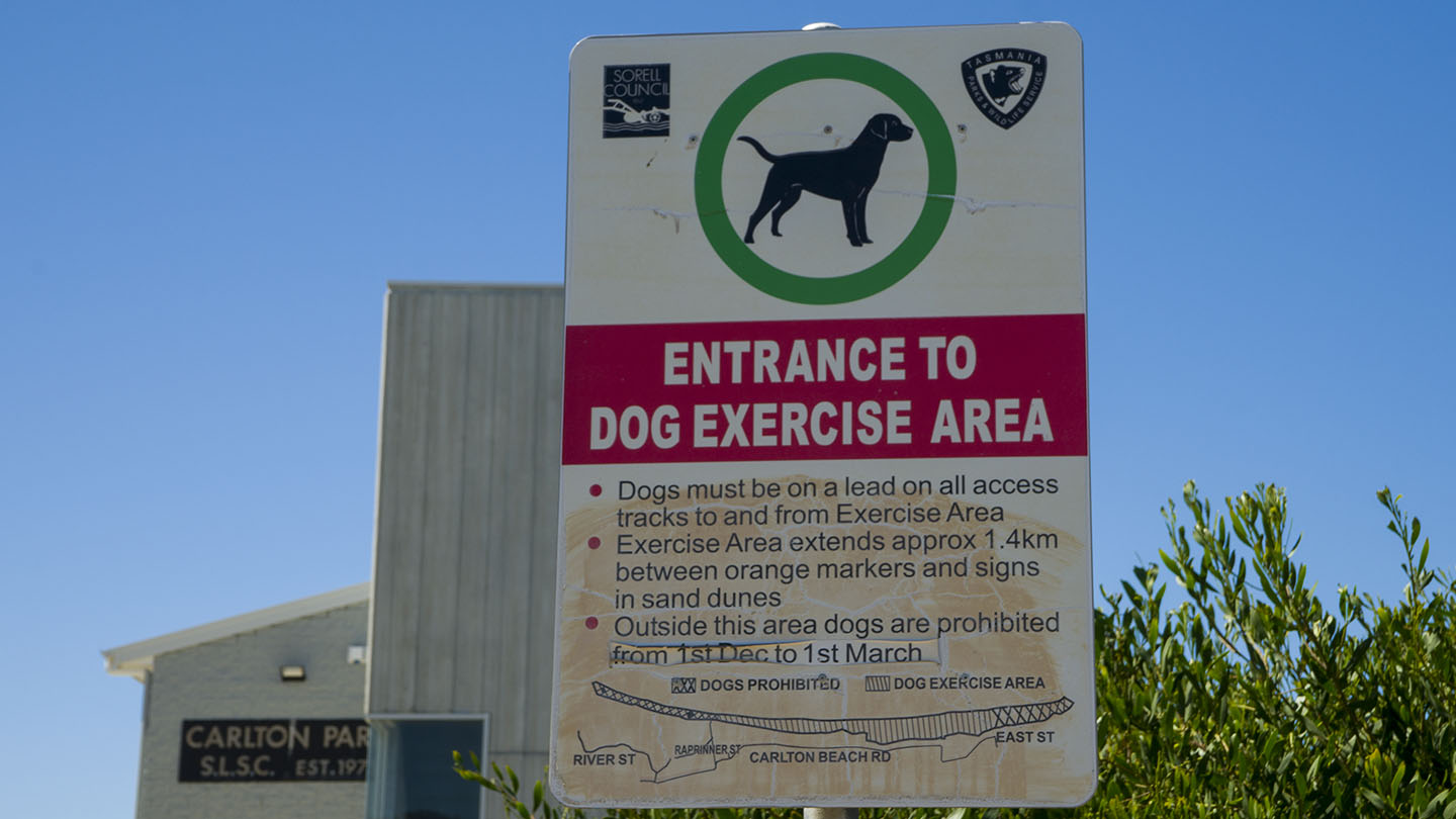
by Mickey Jarvis | Feb 5, 2023 | Dodges / Carlton, Patrolled, South East, Surf
South of Sorell |
Hazard Rating: 5/10 | Parking: Good + close | from Hobart: 40 km | Faces: South-ish into Tiger Head Bay | Length: 2.8 km
The east end is Carlton Beach (the west end is referred to as Park Beach). Close parking but may become limited on good days (sun or surf). Can be accessed along it’s length by means of walkways from Carlton Beach Road (100-200m).
The east has has amenities and is patrolled. A good beach to learn surfing and boarding when patrolled.
At the far east end of the beach is the Carlton Rivermouth which is known for its surf break but not recommended for swimming due to strong currents.
Named by a whaler in 1806 the word Carlton means ‘free peasant settlement’.
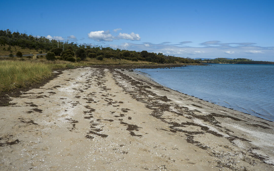
by Mickey Jarvis | Mar 16, 2023 | South East, Tasman Peninsula
Hazard Rating: 1/10 | Parking: Good + close | from Hobart: 60 km | Faces: SW into Norfolk Bay | Length: 2 km
1 km just past Dunalley is Dunalley beach (south end called Carlisle Beach). The beach has a gradual beach shore and is great to explore particularly on a low tide. Close to main road with parking at the south end. Grab a takeaway from one of the excellent food venues in Dunalley and sit on the beach to eat.
Originally named East Bay Neck, the small settlement was changed to Dunalley in 1839 by an early settler after Henry Prittie, the third Baron Dunalley – a title from County Tipperary in Ireland. Located on the Arthur Highway on a narrow isthmus which separates the Forestier and Tasman Peninsulas.
Overlooks Fulham Island to the north and Smooth Island to the south.
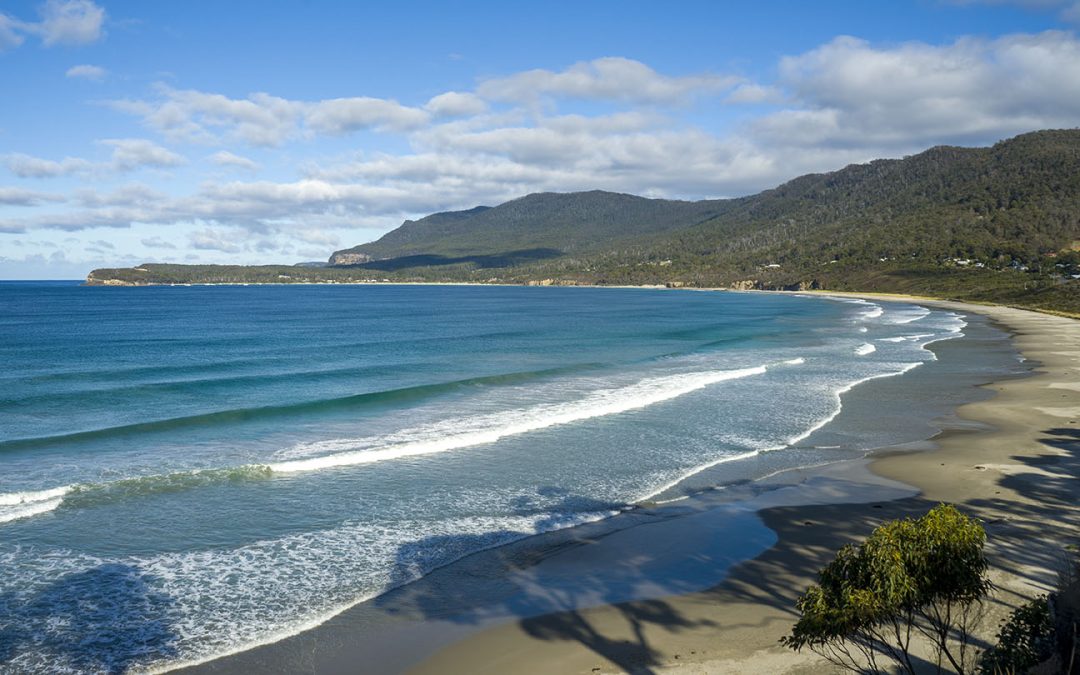
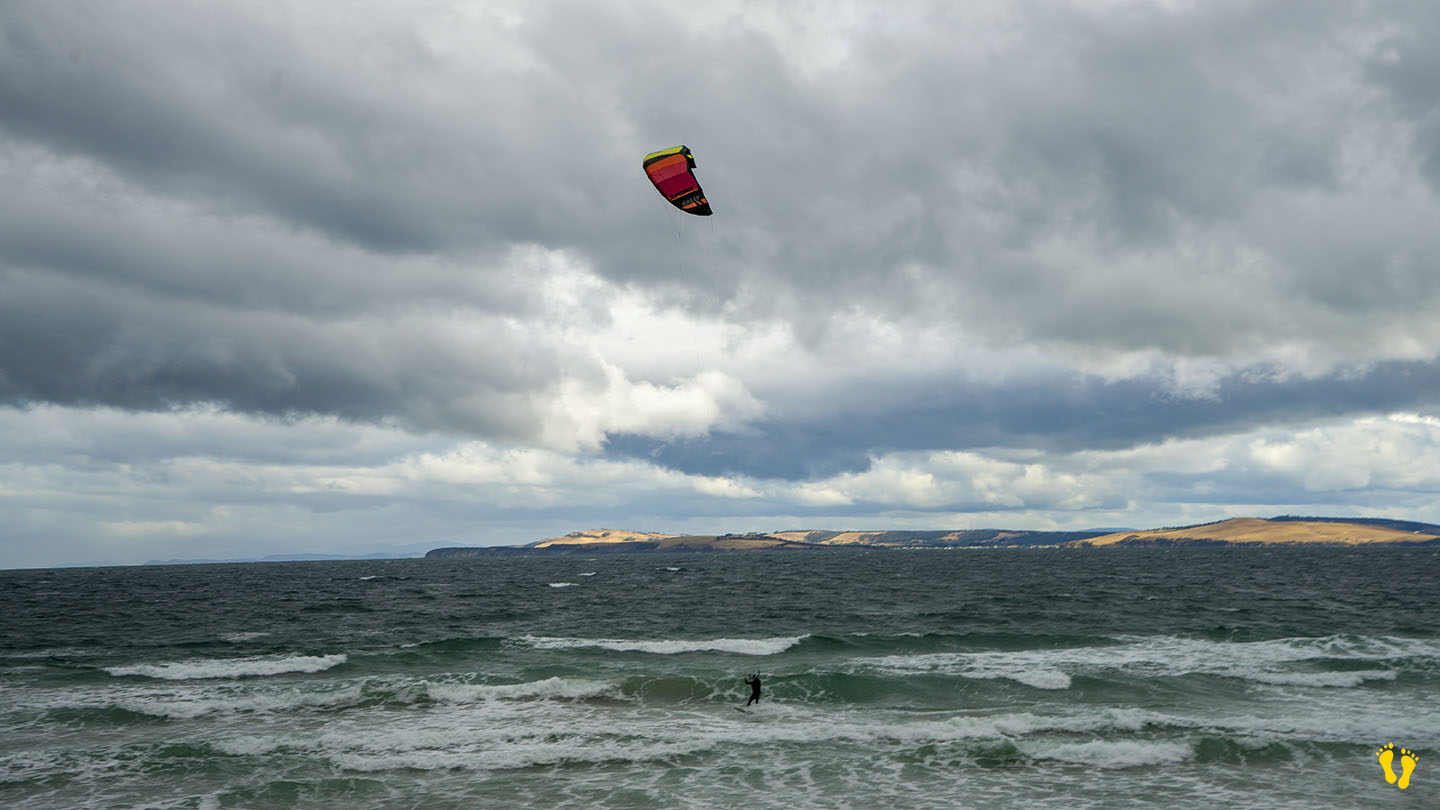
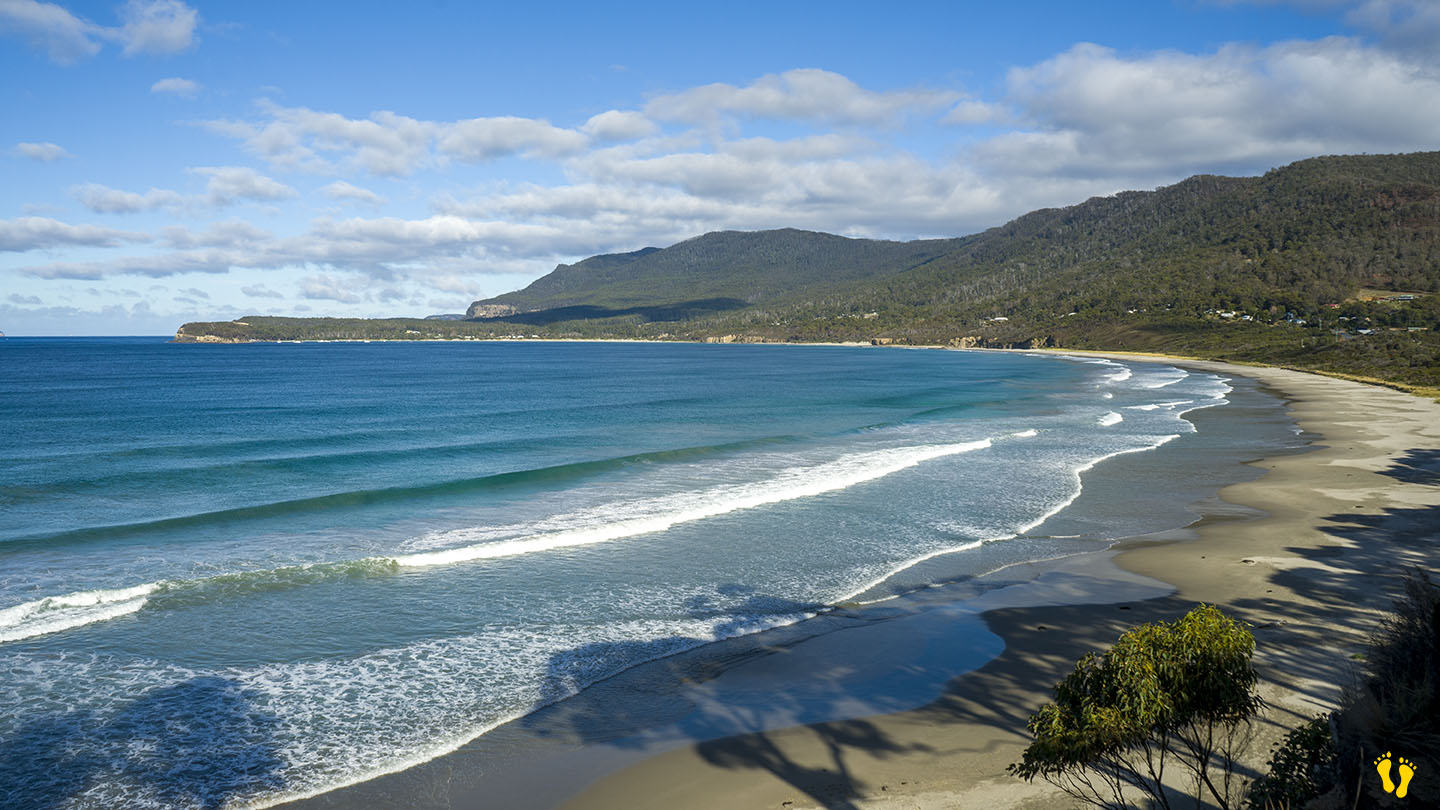
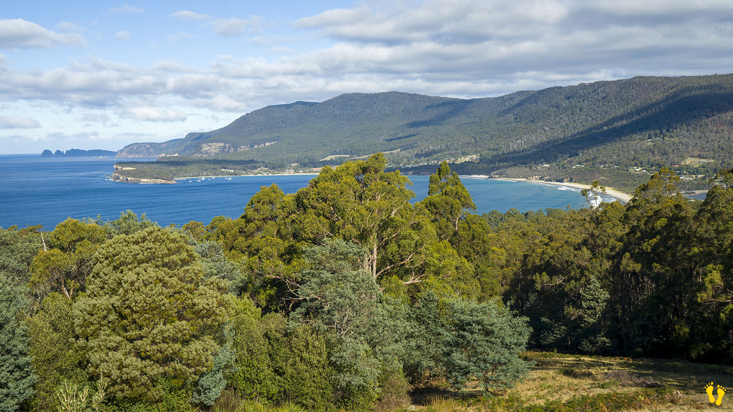
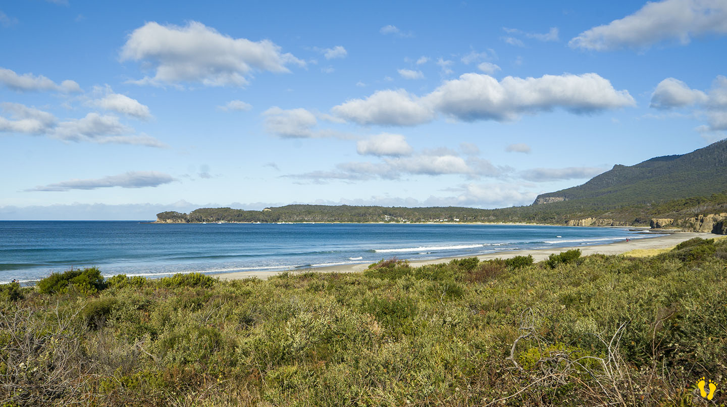
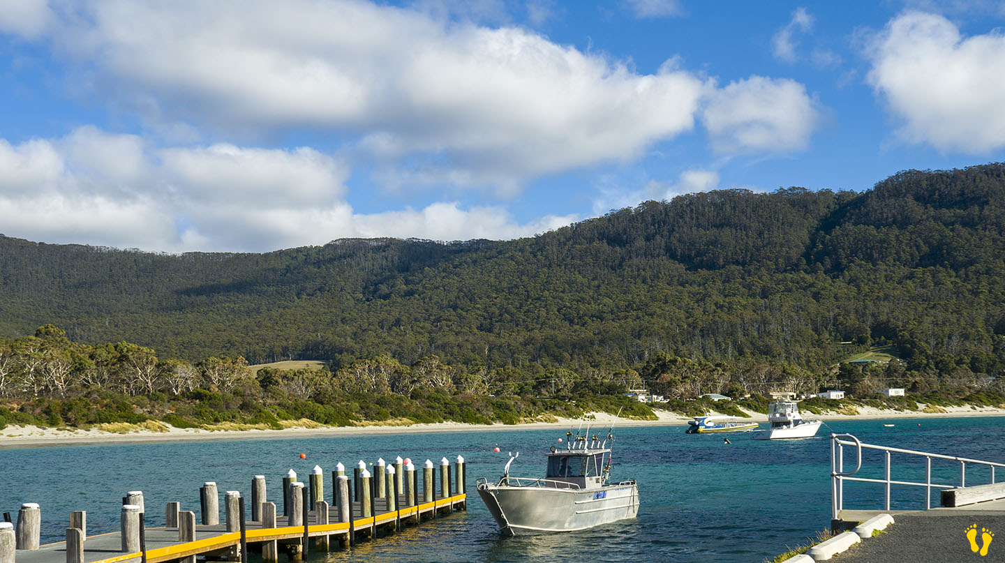
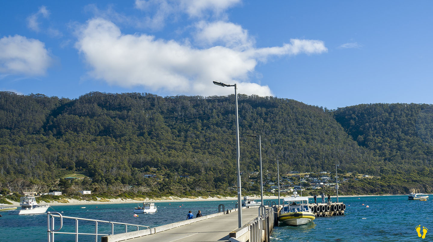
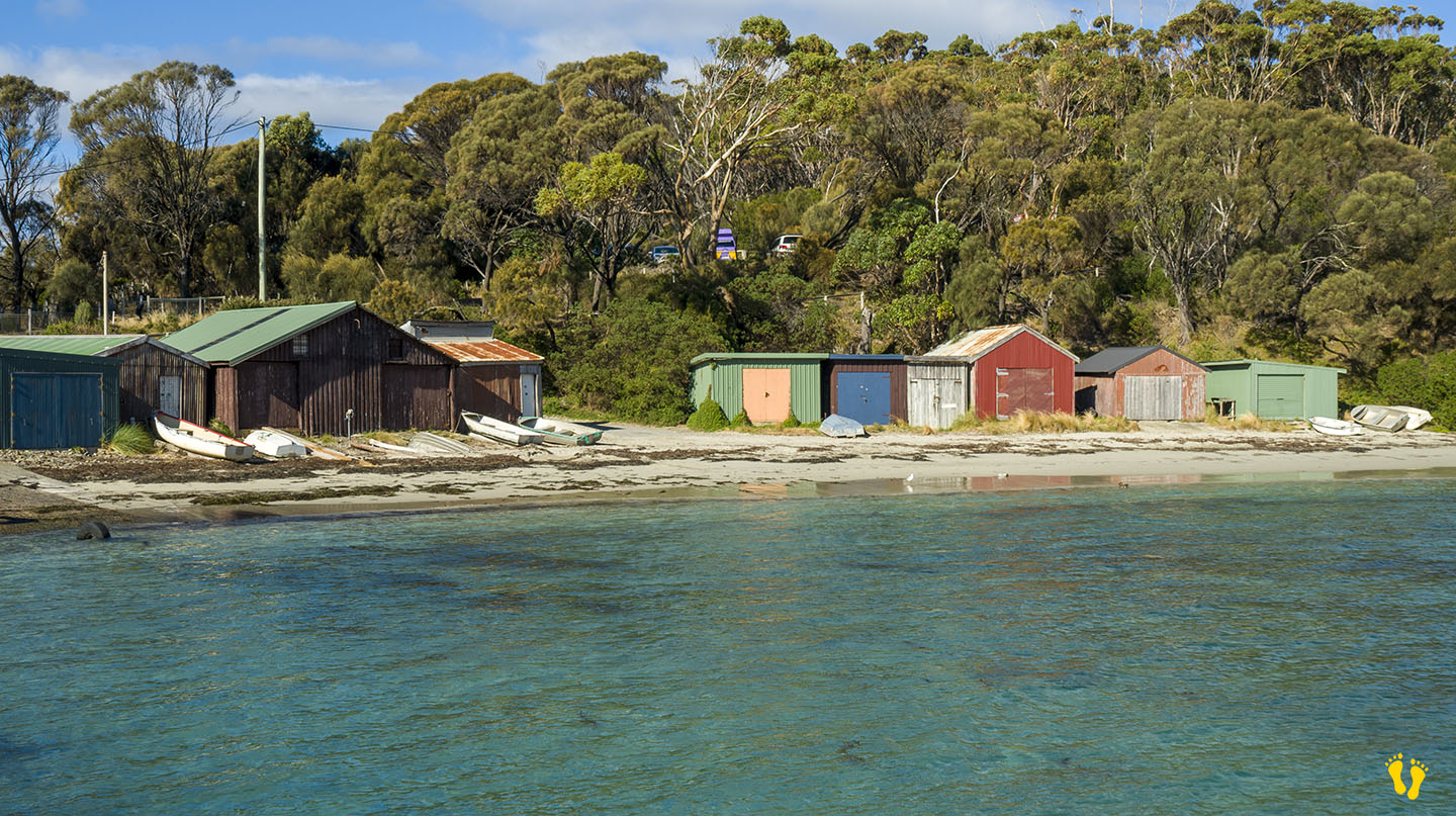
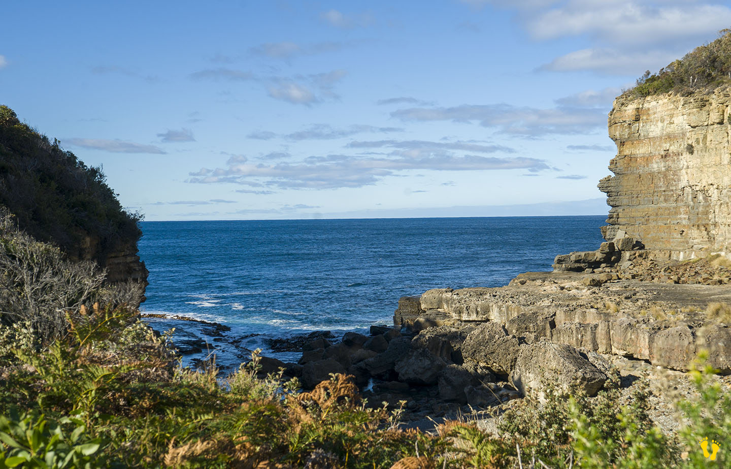
by Mickey Jarvis | Mar 31, 2024 | South East, Surf, Tasman Peninsula
Hazard Rating: 6/10 | Parking: Varied | from Hobart: 75 km | Faces: East into Pirates Bay | Length: ~ 4 km
Original name: Teralina | Original people: Nuenonne |
Eaglehawk Neck is an isthmus (neck) on the way to Port Arthur. Eaglehawk Bay is on the neck’s west side, and Pirates Bay is on the east side.
The east side has a wonderful sweeping beach with white sand facing out into Pirates Bay – the Tasman Sea and the next stop – New Zealand. Various access points and parking along its length. Toilets are at each end and an excellent boat ramp on the south end.
The beach has several headlands creating overlapping beach names, including;
- Eaglehawk Neck Beach | Pirates Bay Beach | Egg Beach | Quarry Beach | Descent Beach
The beach often has surf, generally better on the north end and more protected on the south end near the Blowhole. The north end has the Tesselated Pavement area, a geographical marvel worth a look. Views of Fossil Island on the south end, a whole new mystery!
The name Eaglehawk Neck combines Eaglehawks (Wedge-tailed Eagles) found in the area and its geographical Neck. ‘Teralina’ was the aboriginal name for Eaglehawk Neck. Pirates Bay was originally named Monge Bay by French explorer Baudin but was later renamed around 1822 when escaped convicts took possession of a transport ship called the Seaflower and thus became pirates!
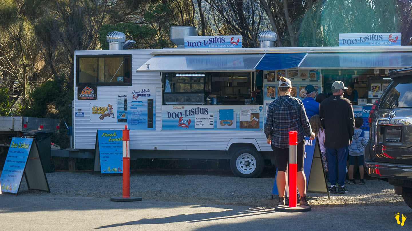
The south end has a quirky town named Doo Town after properties each with a name called Doo-Something. In 1935, Hobart architect Eric Round started a tradition when he named his shack Doo I. The idea soon caught on with most of the town’s shacks now having “Doo” names – the likes of Doo Nix, Make Doo, Much-a-Doo, Doo-Me, Doo-Us, Just Doo It, Doo Drop Inn, Dr Doolittle, Make Doo, Gunnadoo, etc… you get the drift!
Great seafood takeaways at Doo-lishus near the blowhole on the south end (closed in winter). Food and accommodation can be found at the Lufra Hotel.
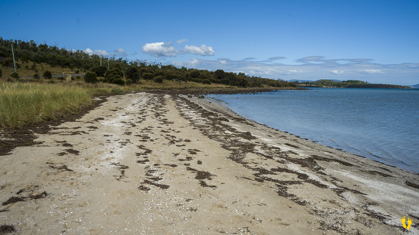
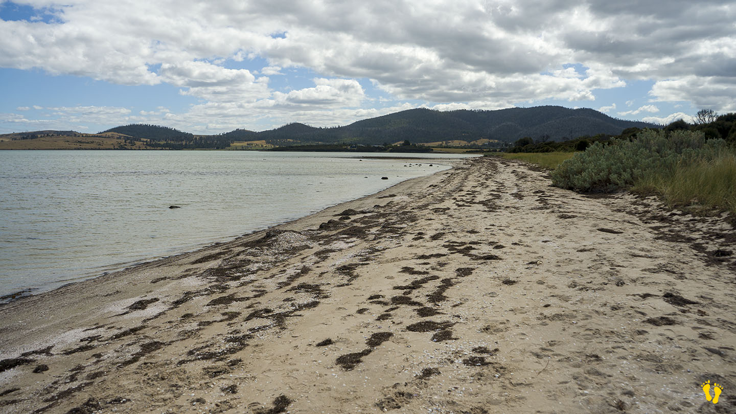
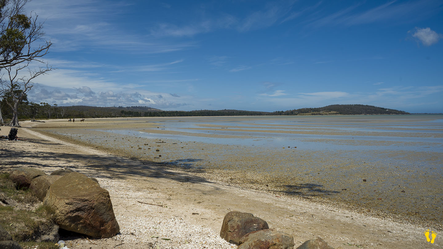
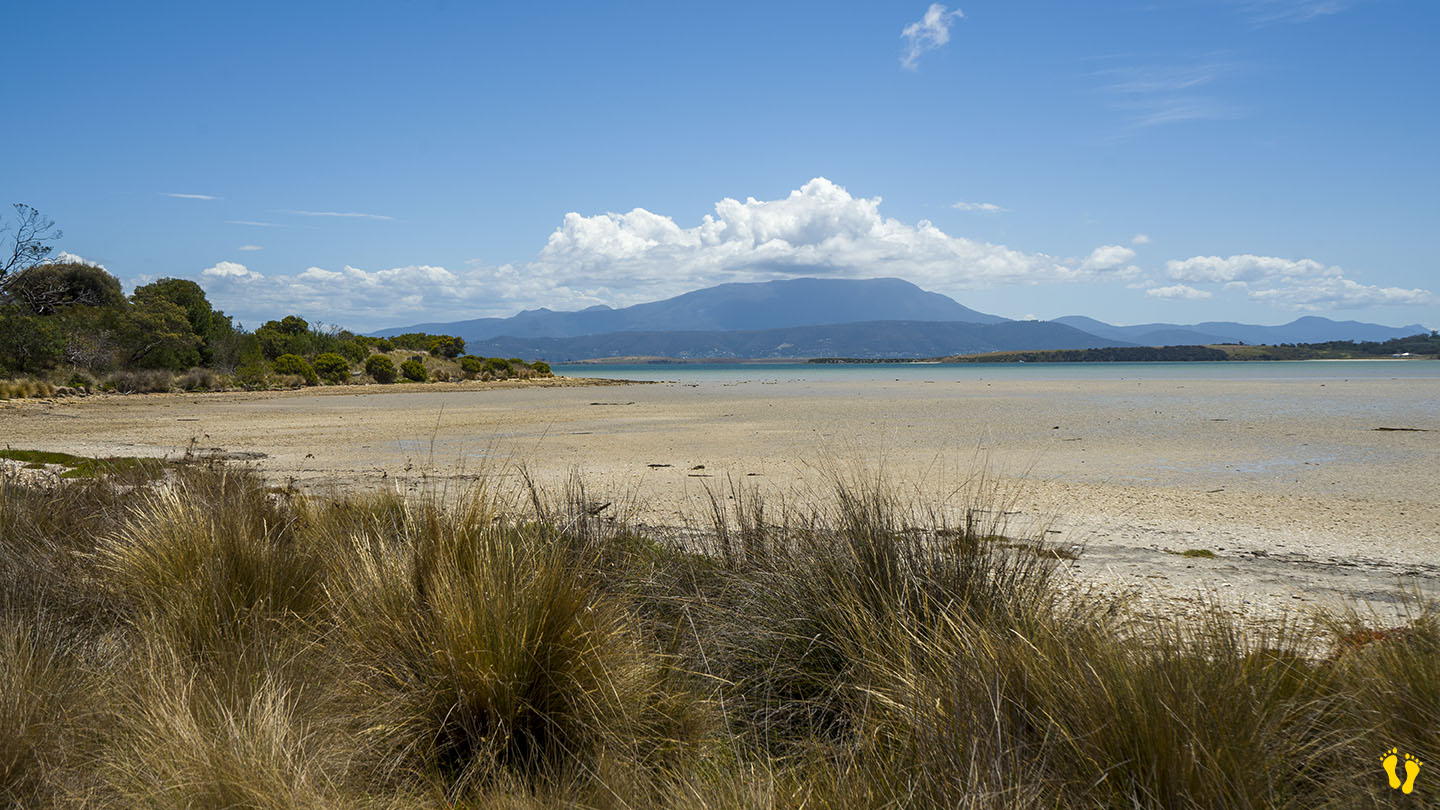
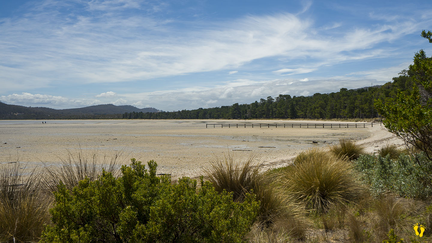
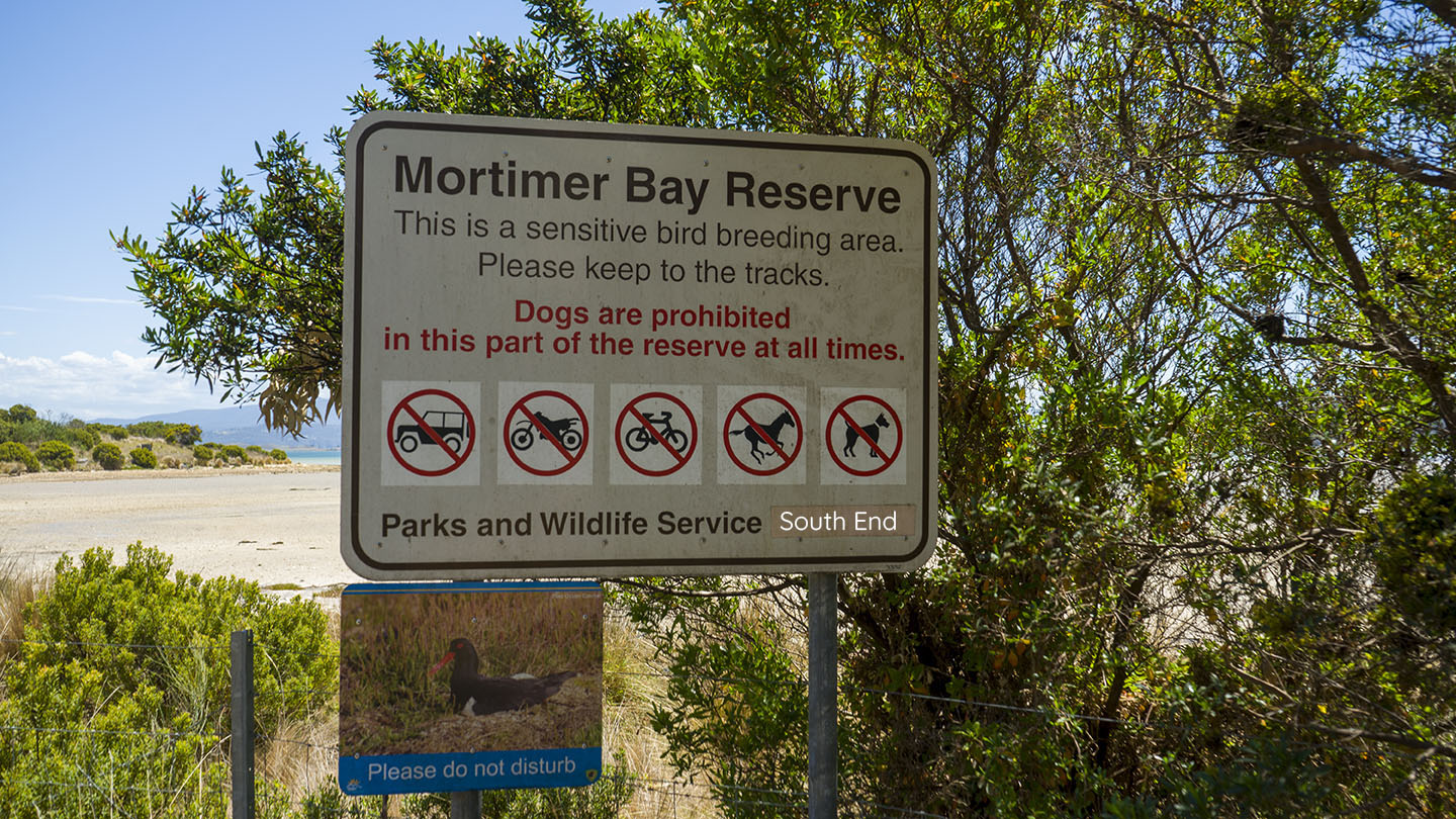
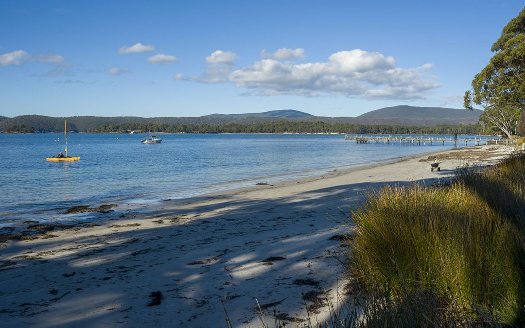
by Mickey Jarvis | Dec 28, 2023 | Low Hazard, South Arm Road, South East
Hazard Rating: 1/10 | Parking: Good + close | from Hobart: 26 km | Faces: West into Mortimer Bay | Length: 2.7 km
Gorringes Beach is part of the Mortimer Bay reserve in a protected area of South Arm. Access via Rifle Range Road just past Lauderdale. The north end is at the end of Rifle Range Road and the south end is further down Gellibrand Drive which forks off Rifle Range Road. No dogs on the south end.
A gradual tidal beach that is more suited for wading than swimming. Interesting birdlife and other things to explore and a wonderful beach to walk and explore with views of the east side of South Arm.
Gorringes Beach was named after Charles Francis Gorringe Senior (born 1809) who occupied the area in 1867. Mortimer Bay was named after landowner and whaler Henry William Mortimer who lived there between 1825-39.
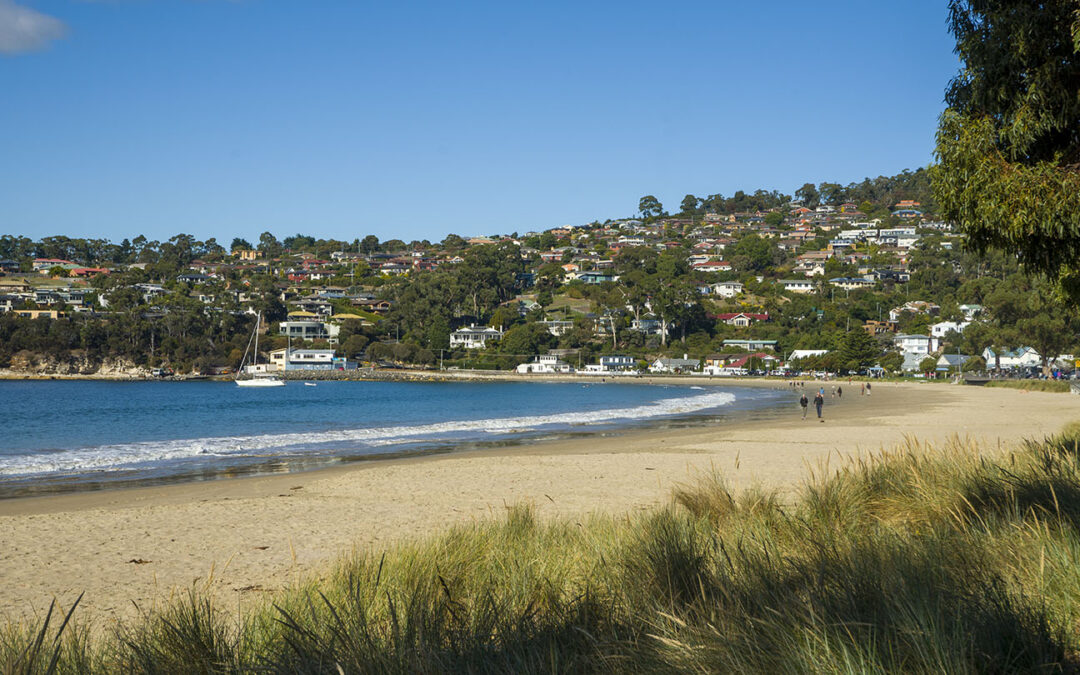
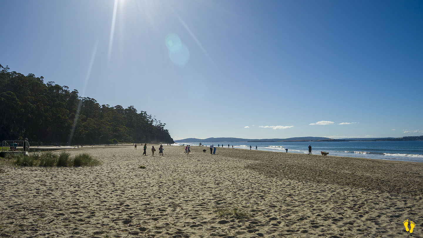
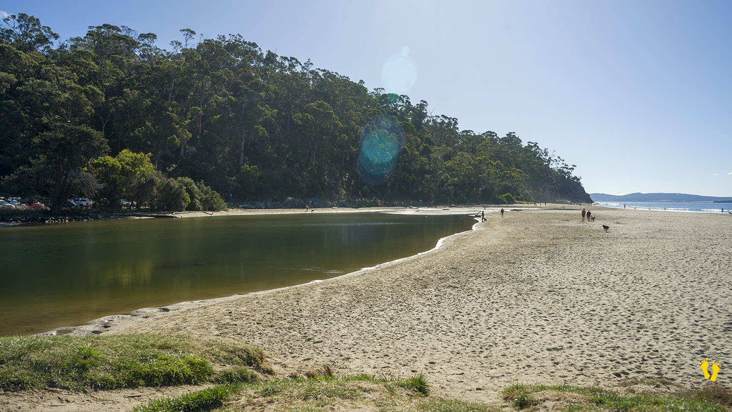
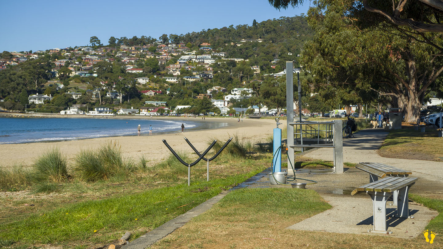
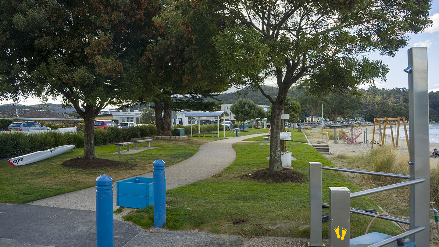
by Mickey Jarvis | Mar 26, 2023 | Greater Hobart, South East
Hazard Rating: 3/10 | Parking: Good + close | from Hobart: 15 km | Faces: South East into the Derwent River | Length: 1 km
Original people: Bunurong people of the Kulin Nation.
A popular beach south of Hobart. Toilets mid beach (opposite beach road) and a basic playground towards the south end. Many tables and grassy areas.
The south-ish end is close many restaurents and cafes.
Dogs are not allowed on the beach but can access the beach walkway and the north end at Browns River has a dedicated dog beach area.